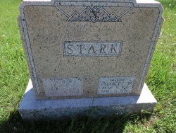
| Birth | : | 25 Apr 1853 Delaware County, Ohio, USA |
| Death | : | 22 Apr 1931 Corydon, Wayne County, Iowa, USA |
| Burial | : | Newton Road Cemetery, Rushden, East Northamptonshire Borough, England |
| Coordinate | : | 52.2882140, -0.5859750 |
| Description | : | Husband of Ema Amanda (Samuelson) Stark (1874-1960). Casper's first wife was Nora (Brown) Stark (1860-1906). Casper was the son of Thomas Stark and Sarah (Richards) Stark. He was the father of eight children with Nora including: Ida May, Otis Edgar, Rollie B., Maud I., William, Bernice and Stella Stark. Casper also had five children with his second wife, Ema. His children with Ema were: a son, Emo Barton Stark, and daughters Loe Esther, Elo, Ole Leota and Olie(later changed to Lourie) Stark. Casper married his first wife, Nora, on December 24, 1878... Read More |
frequently asked questions (FAQ):
-
Where is Casper Barton Stark's memorial?
Casper Barton Stark's memorial is located at: Newton Road Cemetery, Rushden, East Northamptonshire Borough, England.
-
When did Casper Barton Stark death?
Casper Barton Stark death on 22 Apr 1931 in Corydon, Wayne County, Iowa, USA
-
Where are the coordinates of the Casper Barton Stark's memorial?
Latitude: 52.2882140
Longitude: -0.5859750
Family Members:
Parent
Spouse
Siblings
Children
Flowers:
Nearby Cemetories:
1. Newton Road Cemetery
Rushden, East Northamptonshire Borough, England
Coordinate: 52.2882140, -0.5859750
2. St Mary Churchyard
Rushden, East Northamptonshire Borough, England
Coordinate: 52.2885570, -0.5973860
3. St. Mary the Virgin Churchyard
Higham Ferrers, East Northamptonshire Borough, England
Coordinate: 52.3065500, -0.5915240
4. Higham Ferrers Cemetery
Higham Ferrers, East Northamptonshire Borough, England
Coordinate: 52.3084850, -0.5945270
5. St Lawrence Churchyard
Wymington, Bedford Borough, England
Coordinate: 52.2694310, -0.6017230
6. St. Peter Churchyard
Newton Bromswold, East Northamptonshire Borough, England
Coordinate: 52.2815200, -0.5376600
7. St. John the Baptist Churchyard
Chelveston, East Northamptonshire Borough, England
Coordinate: 52.3112800, -0.5501200
8. Irchester Saint Katherine Churchyard
Irchester, Wellingborough Borough, England
Coordinate: 52.2843900, -0.6446900
9. Irchester Cemetery
Irchester, Wellingborough Borough, England
Coordinate: 52.2848000, -0.6456000
10. New Irthlingborough Cemetery
Irthlingborough, East Northamptonshire Borough, England
Coordinate: 52.3178531, -0.6294229
11. St Peter's Churchyard
Irthlingborough, East Northamptonshire Borough, England
Coordinate: 52.3251642, -0.6101925
12. St Mary the Virgin Churchyard
Podington, Bedford Borough, England
Coordinate: 52.2539100, -0.6220900
13. St. Mary the Virgin Churchyard
Yelden, Bedford Borough, England
Coordinate: 52.2930600, -0.5182700
14. St. Michael's Church
Farndish, Bedford Borough, England
Coordinate: 52.2638108, -0.6416839
15. St. Margaret of Antioch Churchyard
Knotting, Bedford Borough, England
Coordinate: 52.2599172, -0.5323686
16. Stanwick Cemetery
Stanwick, East Northamptonshire Borough, England
Coordinate: 52.3298800, -0.5531500
17. St. Laurence Churchyard Stanwick
Stanwick, East Northamptonshire Borough, England
Coordinate: 52.3324970, -0.5628585
18. All Saints Churchyard
Souldrop, Bedford Borough, England
Coordinate: 52.2433000, -0.5584000
19. St. Mary Magdalene Churchyard
Melchbourne, Bedford Borough, England
Coordinate: 52.2770600, -0.4935690
20. Wollaston
Wollaston, Wellingborough Borough, England
Coordinate: 52.2581088, -0.6726313
21. London Road Cemetery
Wellingborough, Wellingborough Borough, England
Coordinate: 52.2986000, -0.6878000
22. All Saints Churchyard
Wellingborough, Wellingborough Borough, England
Coordinate: 52.3010890, -0.6879730
23. St Mary the Virgin Churchyard
Shelton, Bedford Borough, England
Coordinate: 52.3076000, -0.4852000
24. Raunds Cemetery
Raunds, East Northamptonshire Borough, England
Coordinate: 52.3494100, -0.5467400


