
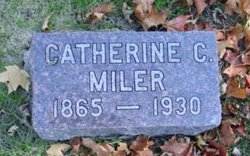
Catherine Cornelia Palmer Miler
| Birth | : | 1865 Ohio, USA |
| Death | : | 30 Mar 1930 Osceola, Clarke County, Iowa, USA |
| Burial | : | Waterlooville Cemetery, Waterlooville, Havant Borough, England |
| Coordinate | : | 50.8802800, -1.0246400 |
frequently asked questions (FAQ):
-
Where is Catherine Cornelia Palmer Miler's memorial?
Catherine Cornelia Palmer Miler's memorial is located at: Waterlooville Cemetery, Waterlooville, Havant Borough, England.
-
When did Catherine Cornelia Palmer Miler death?
Catherine Cornelia Palmer Miler death on 30 Mar 1930 in Osceola, Clarke County, Iowa, USA
-
Where are the coordinates of the Catherine Cornelia Palmer Miler's memorial?
Latitude: 50.8802800
Longitude: -1.0246400
Family Members:
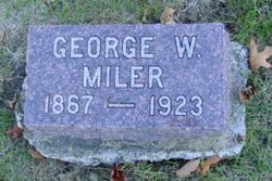
Spouse
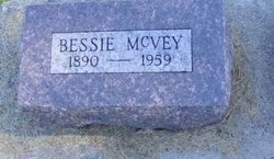
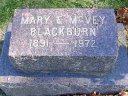
Children

Flowers:


Nearby Cemetories:
1. Waterlooville Cemetery
Waterlooville, Havant Borough, England
Coordinate: 50.8802800, -1.0246400
2. St. George the Martyr Churchyard
Waterlooville, Havant Borough, England
Coordinate: 50.8804060, -1.0328690
3. St John the Baptist Churchyard
Purbrook, Havant Borough, England
Coordinate: 50.8678210, -1.0447060
4. Christ Church Portsdown Churchyard
Widley, City of Winchester, England
Coordinate: 50.8547300, -1.0507540
5. St. Thomas Churchyard
Bedhampton, Havant Borough, England
Coordinate: 50.8529400, -1.0032960
6. St Mary Magdalene Churchyard
Widley, City of Winchester, England
Coordinate: 50.8623650, -1.0642640
7. St. Andrew's Churchyard
Farlington, Portsmouth Unitary Authority, England
Coordinate: 50.8477200, -1.0274510
8. St John the Baptist Churchyard
Rowlands Castle, East Hampshire District, England
Coordinate: 50.8848500, -0.9695200
9. Denmead Burial Ground
Denmead, City of Winchester, England
Coordinate: 50.9057570, -1.0662400
10. St. Faith's Churchyard
Havant, Havant Borough, England
Coordinate: 50.8513550, -0.9819910
11. New Lane Cemetery
Havant, Havant Borough, England
Coordinate: 50.8550670, -0.9753490
12. Holy Trinity Churchyard
Blendworth, East Hampshire District, England
Coordinate: 50.9170620, -0.9895780
13. Catherington Cemetery
Catherington, East Hampshire District, England
Coordinate: 50.9254800, -1.0121200
14. All Saints Churchyard
Catherington, East Hampshire District, England
Coordinate: 50.9259170, -1.0103890
15. St Peter and St Paul Churchyard
Wymering, Portsmouth Unitary Authority, England
Coordinate: 50.8457490, -1.0777170
16. St Thomas A Becket Churchyard
Warblington, Havant Borough, England
Coordinate: 50.8436920, -0.9660980
17. Warblington Cemetery
Warblington, Havant Borough, England
Coordinate: 50.8431290, -0.9669690
18. St. James' Churchyard
Southwick, City of Winchester, England
Coordinate: 50.8739800, -1.1113800
19. St. James Churchyard
Emsworth, Havant Borough, England
Coordinate: 50.8489600, -0.9385900
20. St Peter and St Paul Churchyard
Hambledon, City of Winchester, England
Coordinate: 50.9326480, -1.0810220
21. St Hubert Churchyard
Finchdean, East Hampshire District, England
Coordinate: 50.9213100, -0.9445500
22. St James Churchyard
Clanfield, East Hampshire District, England
Coordinate: 50.9466520, -1.0087900
23. St Peter Churchyard
North Hayling, Havant Borough, England
Coordinate: 50.8237250, -0.9637940
24. St. Mary's Churchyard
Portchester, Fareham Borough, England
Coordinate: 50.8366280, -1.1134270