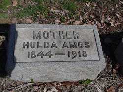
| Birth | : | 29 Jul 1846 Carroll County, Ohio, USA |
| Death | : | 16 Jun 1870 Carroll County, Ohio, USA |
| Burial | : | Arabia Cemetery, Perrysville, Carroll County, USA |
| Coordinate | : | 40.4803009, -81.0678024 |
| Plot | : | Row 14, grave 4 |
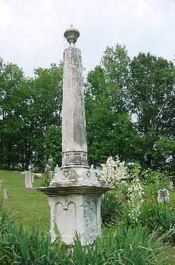
| Inscription | : | CATHERINE daughter of G. & N. J. Sell Died June 16, 1870 Aged 23y 10m 17d |
frequently asked questions (FAQ):
-
Where is Catherine Sell's memorial?
Catherine Sell's memorial is located at: Arabia Cemetery, Perrysville, Carroll County, USA.
-
When did Catherine Sell death?
Catherine Sell death on 16 Jun 1870 in Carroll County, Ohio, USA
-
Where are the coordinates of the Catherine Sell's memorial?
Latitude: 40.4803009
Longitude: -81.0678024
Family Members:
Parent
Siblings
Flowers:
Nearby Cemetories:
1. Arabia Cemetery
Perrysville, Carroll County, USA
Coordinate: 40.4803009, -81.0678024
2. Perrysville Methodist Episcopal Church Cemetery
Perrysville, Carroll County, USA
Coordinate: 40.4655991, -81.0982971
3. Perrysville United Methodist Cemetery
Perrysville, Carroll County, USA
Coordinate: 40.4625510, -81.0973610
4. New Perrysville Cemetery
Perrysville, Carroll County, USA
Coordinate: 40.4569016, -81.1016998
5. Hagey Family Cemetery
Perrysville, Carroll County, USA
Coordinate: 40.4525980, -81.0996160
6. Allen Memorial Cemetery
Carroll County, USA
Coordinate: 40.4364014, -81.0511017
7. Abel Cemetery
Carroll County, USA
Coordinate: 40.4578018, -81.0113983
8. Mount Pleasant Cemetery
Carrollton, Carroll County, USA
Coordinate: 40.5238991, -81.1003036
9. Kilgore Cemetery
Kilgore, Carroll County, USA
Coordinate: 40.4632988, -81.0014038
10. Kilgore Presbyterian Cemetery
Carroll County, USA
Coordinate: 40.4603004, -81.0002975
11. Green Hill Cemetery
Carroll County, USA
Coordinate: 40.5303001, -81.0246964
12. Wood Cemetery
Scio, Harrison County, USA
Coordinate: 40.4193500, -81.0707690
13. Mount Tabor Cemetery
Carroll County, USA
Coordinate: 40.4817009, -81.1483002
14. Mount Olive Cemetery
Carroll County, USA
Coordinate: 40.4488983, -81.1382980
15. Harlem Springs Cemetery
Harlem Springs, Carroll County, USA
Coordinate: 40.5219002, -81.0053024
16. Palermo Cemetery
Carroll County, USA
Coordinate: 40.4894444, -81.1522220
17. Lee Cemetery
Carroll County, USA
Coordinate: 40.5391998, -81.0314026
18. Simmons Cemetery
Carroll County, USA
Coordinate: 40.4622002, -80.9783020
19. Denver George Haddock Family Cemetery
Carrollton, Carroll County, USA
Coordinate: 40.5443880, -81.0227370
20. Seceders Cemetery
Carroll County, USA
Coordinate: 40.5332985, -81.1446991
21. United Brethren Cemetery
Harrison County, USA
Coordinate: 40.4043999, -81.0353012
22. Simmons Ridge Cemetery
Carroll County, USA
Coordinate: 40.4757996, -80.9621964
23. Moorehead Cemetery
Carroll County, USA
Coordinate: 40.5449982, -81.0033035
24. New Rumley Methodist Cemetery
New Rumley, Harrison County, USA
Coordinate: 40.4028015, -81.0346985

