
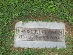
| Birth | : | 13 Aug 1896 Milton, Cabell County, West Virginia, USA |
| Death | : | Jun 1984 USA |
| Burial | : | St. Helen's Churchyard, Escrick, Selby District, England |
| Coordinate | : | 53.8805200, -1.0460990 |
| Description | : | West Virginia, Marriages Index, 1785-1971 Name: Linvil Chapman Gender: Male Birth Date: abt 1896 Birth Place: Cabell County, West Virginia Age: 22 Spouse's name: Miss Irene Collins Spouse Gender: Female Spouse Age: 21 Spouse Birth Place: Cabell County, West Virginia Marriage Date: 21 Dec 1918 Marriage Place: Huntington, Cabell, West Virginia |
frequently asked questions (FAQ):
-
Where is Charles Linvel Chapman's memorial?
Charles Linvel Chapman's memorial is located at: St. Helen's Churchyard, Escrick, Selby District, England.
-
When did Charles Linvel Chapman death?
Charles Linvel Chapman death on Jun 1984 in USA
-
Where are the coordinates of the Charles Linvel Chapman's memorial?
Latitude: 53.8805200
Longitude: -1.0460990
Family Members:
Parent
Spouse

Siblings
Children
Flowers:


Nearby Cemetories:
1. St. Helen's Churchyard
Escrick, Selby District, England
Coordinate: 53.8805200, -1.0460990
2. St Matthew Churchyard
Naburn, York Unitary Authority, England
Coordinate: 53.9009520, -1.0899200
3. St Helen Churchyard
Stillingfleet, Selby District, England
Coordinate: 53.8618710, -1.0994760
4. Holy Trinity Churchyard
Acaster Malbis, York Unitary Authority, England
Coordinate: 53.9052480, -1.0975170
5. St. Mary's Churchyard
Riccall, Selby District, England
Coordinate: 53.8330620, -1.0601630
6. St. Helen's Churchyard
Skipwith, Selby District, England
Coordinate: 53.8386300, -1.0022900
7. St. Andrew's Old Churchyard
Bishopthorpe, York Unitary Authority, England
Coordinate: 53.9221490, -1.0929640
8. Fulford Cemetery
Fulford, York Unitary Authority, England
Coordinate: 53.9304450, -1.0683670
9. St Helen Churchyard
Wheldrake, York Unitary Authority, England
Coordinate: 53.8965340, -0.9626520
10. St Andrew Churchyard
Bishopthorpe, York Unitary Authority, England
Coordinate: 53.9236690, -1.0955320
11. St John Churchyard
Acaster Selby, Selby District, England
Coordinate: 53.8614750, -1.1283740
12. York Crematorium
York, York Unitary Authority, England
Coordinate: 53.9264970, -1.0936130
13. St Helen Churchyard
Thorganby, Selby District, England
Coordinate: 53.8666100, -0.9530300
14. St Oswald's Old Churchyard
Fulford, York Unitary Authority, England
Coordinate: 53.9391350, -1.0809020
15. Dringhouses Cemetery
York, York Unitary Authority, England
Coordinate: 53.9297740, -1.1156780
16. Moor Lane Burial Ground
Copmanthorpe, York Unitary Authority, England
Coordinate: 53.9096890, -1.1449400
17. St Giles Churchyard
Copmanthorpe, York Unitary Authority, England
Coordinate: 53.9149240, -1.1410420
18. All Saints Churchyard
Cawood, Selby District, England
Coordinate: 53.8331970, -1.1235660
19. All Saints Churchyard
Appleton Roebuck, Selby District, England
Coordinate: 53.8734600, -1.1580870
20. St Paul Churchyard
Heslington, York Unitary Authority, England
Coordinate: 53.9471780, -1.0445150
21. Quaker Cemetery
East Cottingwith, East Riding of Yorkshire Unitary Authority, England
Coordinate: 53.8746050, -0.9327040
22. St Mary Churchyard
East Cottingwith, East Riding of Yorkshire Unitary Authority, England
Coordinate: 53.8738030, -0.9317490
23. Friends Burial Ground
York, York Unitary Authority, England
Coordinate: 53.9478920, -1.0618450
24. Rythergate Cemetery
Cawood, Selby District, England
Coordinate: 53.8356000, -1.1347700