
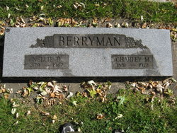
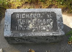
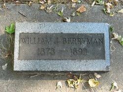
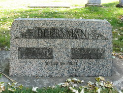
Charles Melbourn Berryman
| Birth | : | 29 Jun 1881 Walla Walla, Walla Walla County, Washington, USA |
| Death | : | 3 Oct 1972 Spokane, Spokane County, Washington, USA |
| Burial | : | St. John the Evangelist Churchyard, Cutcombe, West Somerset District, England |
| Coordinate | : | 51.1424576, -3.5295319 |
| Plot | : | WALLA-MV-52-11-2 |
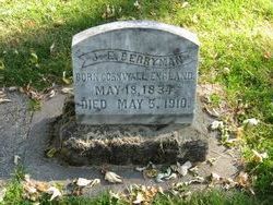
| Description | : | Charles M. Berryman, residing on section 3, township 8 north, range 35 east, devotes his time and energies to the operation of a farm of seven hundred acres and is well known as one of the enterprising and successful young agriculturists of Walla Walla county. He is, moreover, one of its native sons, his birth having occurred in Walla Walla on the 29th of June, 1881. Extended mention of his father, James E. Berryman, is made on another page of this work. Charles M. Berryman obtained his education in the Berryman school and also pursued a commercial course in the Walla... Read More |
frequently asked questions (FAQ):
-
Where is Charles Melbourn Berryman's memorial?
Charles Melbourn Berryman's memorial is located at: St. John the Evangelist Churchyard, Cutcombe, West Somerset District, England.
-
When did Charles Melbourn Berryman death?
Charles Melbourn Berryman death on 3 Oct 1972 in Spokane, Spokane County, Washington, USA
-
Where are the coordinates of the Charles Melbourn Berryman's memorial?
Latitude: 51.1424576
Longitude: -3.5295319
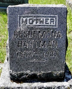
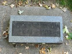
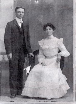
Family Members:
Parent
Spouse

Siblings

Children
Flowers:


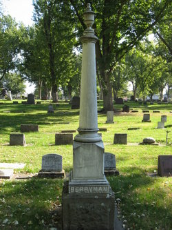
Nearby Cemetories:
1. St. John the Evangelist Churchyard
Cutcombe, West Somerset District, England
Coordinate: 51.1424576, -3.5295319
2. St. Petrock's Churchyard
Timberscombe, West Somerset District, England
Coordinate: 51.1680950, -3.4948210
3. All Saints Churchyard
Wootton Courtenay, West Somerset District, England
Coordinate: 51.1801840, -3.5203550
4. Blesssed Virgin Mary Churchyard
Luxborough, West Somerset District, England
Coordinate: 51.1321490, -3.4680500
5. Winsford Churchyard
Winsford, West Somerset District, England
Coordinate: 51.1038000, -3.5665000
6. St Peter's Church Exton
Exton, West Somerset District, England
Coordinate: 51.0925840, -3.5352300
7. St. Mary's Churchyard
Luccombe, West Somerset District, England
Coordinate: 51.1895770, -3.5596880
8. Luccombe Extension Cemetery
Luccombe, West Somerset District, England
Coordinate: 51.1897360, -3.5609100
9. Stoke Pero Churchyard
Porlock, West Somerset District, England
Coordinate: 51.1796510, -3.6060674
10. Grabbist Hill Cemetery
Dunster, West Somerset District, England
Coordinate: 51.1820510, -3.4492540
11. George Street Cemetery
Dunster, West Somerset District, England
Coordinate: 51.1833740, -3.4483046
12. Minehead Cemetery
Minehead, West Somerset District, England
Coordinate: 51.2050650, -3.4982030
13. St. Mary Magdalene Churchyard
Exford, West Somerset District, England
Coordinate: 51.1341450, -3.6342160
14. Priory Churchyard of St. George
Dunster, West Somerset District, England
Coordinate: 51.1832000, -3.4459000
15. Selworthy Extension Cemeteries
Selworthy, West Somerset District, England
Coordinate: 51.2098330, -3.5481240
16. All Saints Churchyard
Selworthy, West Somerset District, England
Coordinate: 51.2101800, -3.5475440
17. The Blessed Virgin Mary Churchyard
Brompton Regis, West Somerset District, England
Coordinate: 51.0731500, -3.4987200
18. St Mary Magdalene Churchyard
Withiel Florey, West Somerset District, England
Coordinate: 51.0906773, -3.4478871
19. Porlock Cemetery
Porlock, West Somerset District, England
Coordinate: 51.2033790, -3.5954070
20. St. Michael's Anglican Church Cemetery
Minehead, West Somerset District, England
Coordinate: 51.2110390, -3.4808250
21. Treborough Parish Churchyard
Treborough, West Somerset District, England
Coordinate: 51.1180220, -3.4147610
22. Saint John the Baptist Churchyard
Carhampton, West Somerset District, England
Coordinate: 51.1746000, -3.4186000
23. St Dubricius Churchyard
Porlock, West Somerset District, England
Coordinate: 51.2083000, -3.5955000
24. St Nicholas Churchyard
Withycombe, West Somerset District, England
Coordinate: 51.1624530, -3.4096990