
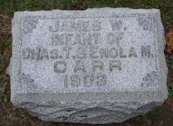
Charles T. Carr
| Birth | : | 8 Sep 1863 Wabash County, Indiana, USA |
| Death | : | 12 May 1923 Huntington, Huntington County, Indiana, USA |
| Burial | : | Saint John's Cemetery, Lancaster, Worcester County, USA |
| Coordinate | : | 42.4328003, -71.6977997 |
| Plot | : | Sec E, lot 113, sp 4 UNMARKED |
frequently asked questions (FAQ):
-
Where is Charles T. Carr's memorial?
Charles T. Carr's memorial is located at: Saint John's Cemetery, Lancaster, Worcester County, USA.
-
When did Charles T. Carr death?
Charles T. Carr death on 12 May 1923 in Huntington, Huntington County, Indiana, USA
-
Where are the coordinates of the Charles T. Carr's memorial?
Latitude: 42.4328003
Longitude: -71.6977997
Family Members:
Parent

Spouse

Siblings
Children
Flowers:


Nearby Cemetories:
1. Saint John's Cemetery
Lancaster, Worcester County, USA
Coordinate: 42.4328003, -71.6977997
2. Woodlawn Cemetery
Clinton, Worcester County, USA
Coordinate: 42.4185982, -71.6889038
3. Middle Cemetery
Lancaster, Worcester County, USA
Coordinate: 42.4491997, -71.6757965
4. Old Settlers Burial Yard
Lancaster, Worcester County, USA
Coordinate: 42.4488754, -71.6742706
5. Thayer Cemetery
Lancaster, Worcester County, USA
Coordinate: 42.4578500, -71.7024400
6. Reservoir Pines Cemetery
Clinton, Worcester County, USA
Coordinate: 42.4084900, -71.7109700
7. Old Common Burial Ground
Lancaster, Worcester County, USA
Coordinate: 42.4426700, -71.6645300
8. Fairbank Burial Ground
Sterling, Worcester County, USA
Coordinate: 42.4152600, -71.7320000
9. Eastwood Cemetery
Lancaster, Worcester County, USA
Coordinate: 42.4417000, -71.6528015
10. Hillside Cemetery
Sterling, Worcester County, USA
Coordinate: 42.4410000, -71.7492570
11. Oak Hill Cemetery
Sterling, Worcester County, USA
Coordinate: 42.4417000, -71.7493973
12. North Village Cemetery
Lancaster, Worcester County, USA
Coordinate: 42.4724998, -71.6778030
13. Chocksett Burial Ground
Sterling, Worcester County, USA
Coordinate: 42.4377000, -71.7555400
14. West Burying Ground
Bolton, Worcester County, USA
Coordinate: 42.4488983, -71.6300964
15. West Cemetery
Sterling, Worcester County, USA
Coordinate: 42.4514100, -71.7651400
16. Cookshire Cemetery
Sterling, Worcester County, USA
Coordinate: 42.4108500, -71.7734800
17. Old Fry Burying Ground
Bolton, Worcester County, USA
Coordinate: 42.4077300, -71.6209900
18. Friends Burial Ground
Bolton, Worcester County, USA
Coordinate: 42.4133620, -71.6176710
19. North Cemetery
Berlin, Worcester County, USA
Coordinate: 42.4037000, -71.6225100
20. Old South Burying Ground
Bolton, Worcester County, USA
Coordinate: 42.4231000, -71.6096500
21. Saint Lukes Cemetery
West Boylston, Worcester County, USA
Coordinate: 42.3833008, -71.7568970
22. Old Burying Ground
Berlin, Worcester County, USA
Coordinate: 42.3811646, -71.6375351
23. Saint Benedict Center Cemetery
Harvard, Worcester County, USA
Coordinate: 42.4827900, -71.6231900
24. Legg Cemetery
Sterling, Worcester County, USA
Coordinate: 42.4070020, -71.7986150