

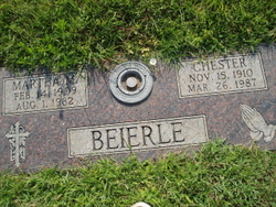
Chester Beierle
| Birth | : | 15 Nov 1910 Butler County, Nebraska, USA |
| Death | : | 26 Mar 1987 Columbus, Platte County, Nebraska, USA |
| Burial | : | Sagamore Cemetery, Bourne, Barnstable County, USA |
| Coordinate | : | 41.7714005, -70.5339966 |
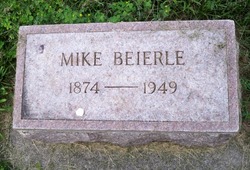
| Description | : | Thanks to Find A Grave contributor #47552612; Chester Beierle, 76, of 73 Schreiber Plaza, Columbus, died Thursday at his home. Services are at 10 a.m. Monday at St. Bonaventure Church in Columbus, with Rev. Deacon Art Spenner officiating. Burial is in Roselawn Cemetery. Visitation is 2-9 p.m. Sunday at the Gass-Haney Chapel in Columbus. Mr. Beierle was born Nov. 15, 1910, near Surprise, the son of Mike and Caroline Bock Beierle. He Received his education in Surprise. He married Martha Brandt in Council Bluffs, Iowa, in 1929. She died Aug. 1, 1982. He married Elsie Kiuntke Mazuch on... Read More |
frequently asked questions (FAQ):
-
Where is Chester Beierle's memorial?
Chester Beierle's memorial is located at: Sagamore Cemetery, Bourne, Barnstable County, USA.
-
When did Chester Beierle death?
Chester Beierle death on 26 Mar 1987 in Columbus, Platte County, Nebraska, USA
-
Where are the coordinates of the Chester Beierle's memorial?
Latitude: 41.7714005
Longitude: -70.5339966
Family Members:
Parent
Spouse

Siblings
Children
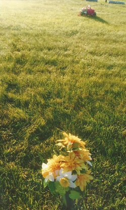
Flowers:


Nearby Cemetories:
1. Sagamore Cemetery
Bourne, Barnstable County, USA
Coordinate: 41.7714005, -70.5339966
2. Saddle and Pillion Cemetery
Sagamore, Barnstable County, USA
Coordinate: 41.7672005, -70.5192032
3. Bournedale Burying Hill
Bourne, Barnstable County, USA
Coordinate: 41.7741520, -70.5611730
4. Bay View Cemetery
Sandwich, Barnstable County, USA
Coordinate: 41.7583008, -70.5102997
5. Freeman Cemetery
Sandwich, Barnstable County, USA
Coordinate: 41.7573013, -70.5083008
6. Bournedale Herring Pond Indian Cemetery
Bourne, Barnstable County, USA
Coordinate: 41.7861900, -70.5658722
7. Herring Pond Wampanoag Indian Cemetery
Plymouth, Plymouth County, USA
Coordinate: 41.7867290, -70.5658940
8. Saint Peters Cemetery
Sandwich, Barnstable County, USA
Coordinate: 41.7502480, -70.5079346
9. Old Town Cemetery
Sandwich, Barnstable County, USA
Coordinate: 41.7556992, -70.5011978
10. Herring Pond Cemetery
Plymouth, Plymouth County, USA
Coordinate: 41.7971700, -70.5588800
11. Cedarville Cemetery
Plymouth, Plymouth County, USA
Coordinate: 41.8049736, -70.5560837
12. Mount Hope Cemetery
Sandwich, Barnstable County, USA
Coordinate: 41.7518997, -70.4850006
13. Almshouse Burial Ground
Sandwich, Barnstable County, USA
Coordinate: 41.7501000, -70.4847000
14. Nightingale Cemetery
Plymouth, Plymouth County, USA
Coordinate: 41.8113400, -70.5588260
15. Lakewood Cemetery
Plymouth, Plymouth County, USA
Coordinate: 41.8141260, -70.5567690
16. Spring Hill Cemetery
Sandwich, Barnstable County, USA
Coordinate: 41.7487984, -70.4775009
17. Bourne Family Cemetery #02
Bourne, Barnstable County, USA
Coordinate: 41.7577230, -70.6001190
18. Bourne Village Cemetery
Bourne, Barnstable County, USA
Coordinate: 41.7425117, -70.5938110
19. Bourne Family Cemetery
Bourne, Barnstable County, USA
Coordinate: 41.7501602, -70.6032104
20. Old Bourne Cemetery
Bourne, Barnstable County, USA
Coordinate: 41.7386017, -70.5986023
21. Old Quaker Meeting House Cemetery at Spring Hill
Sandwich, Barnstable County, USA
Coordinate: 41.7463100, -70.4613060
22. Oakland Grove Cemetery
Bourne, Barnstable County, USA
Coordinate: 41.7402992, -70.6042023
23. Quaker Meeting House Cemetery
East Sandwich, Barnstable County, USA
Coordinate: 41.7469673, -70.4591064
24. Sandwich Town Cemetery
Sandwich, Barnstable County, USA
Coordinate: 41.7125300, -70.4909000