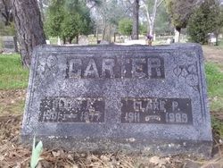
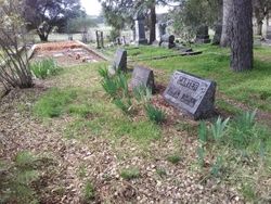
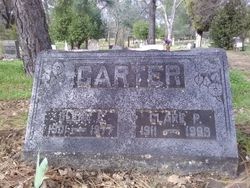
Clare Davenport Palmer Carter
| Birth | : | 25 Mar 1911 |
| Death | : | 24 Apr 1998 Huntsville, Madison County, Alabama, USA |
| Burial | : | El Dorado Cemetery, El Dorado, El Dorado County, USA |
| Coordinate | : | 38.6804085, -120.8490067 |
| Plot | : | Sec 2 Row 5 Plot 3 (2006) |
| Description | : | The Sacramento Bee, Sacramento, California, Sunday 10 May 1998 page 29 col A (Newspapers.com) Carter, Clare Davenport Palmer (Photo) Of El Dorado, CA, passed away April 24, 1998, in Huntsville, AL, aged 87. Many people will remember her as the Principle of Golden Oak Union School in Pleasant Valley before becoming Superintendent of Gold Oak Union School Disrict, comprising the old Ringgold, Oak Hill, Summit and Pleasant Valley districts. She was very active within the church, serving as vestryman, organist and choir director at the Episcopal Church of Our Savior, and was president of the local Episcopal Women and also... Read More |
frequently asked questions (FAQ):
-
Where is Clare Davenport Palmer Carter's memorial?
Clare Davenport Palmer Carter's memorial is located at: El Dorado Cemetery, El Dorado, El Dorado County, USA.
-
When did Clare Davenport Palmer Carter death?
Clare Davenport Palmer Carter death on 24 Apr 1998 in Huntsville, Madison County, Alabama, USA
-
Where are the coordinates of the Clare Davenport Palmer Carter's memorial?
Latitude: 38.6804085
Longitude: -120.8490067
Family Members:
Flowers:
Nearby Cemetories:
1. El Dorado Cemetery
El Dorado, El Dorado County, USA
Coordinate: 38.6804085, -120.8490067
2. Kingsville Cemetery
El Dorado, El Dorado County, USA
Coordinate: 38.6993870, -120.8516060
3. Carpenter Family Residence Burial Plot
Diamond Springs, El Dorado County, USA
Coordinate: 38.6941590, -120.8187750
4. Diamond Springs Cemetery
Diamond Springs, El Dorado County, USA
Coordinate: 38.6940960, -120.8186620
5. Greenstone Cemetery
Shingle Springs, El Dorado County, USA
Coordinate: 38.6749020, -120.8869240
6. Odd Fellows Cemetery
Diamond Springs, El Dorado County, USA
Coordinate: 38.6963882, -120.8151932
7. Missouri Flat Cemetery
Placerville, El Dorado County, USA
Coordinate: 38.7157360, -120.8403400
8. Weberville Cemetery
Placerville, El Dorado County, USA
Coordinate: 38.7024170, -120.7901000
9. Heusner Ranch Family Cemetery
Buckeye, El Dorado County, USA
Coordinate: 38.6675770, -120.9135260
10. Meyer-Zentgraf Cemetery
Shingle Springs, El Dorado County, USA
Coordinate: 38.6710620, -120.9158490
11. Old Placerville City Cemetery
Placerville, El Dorado County, USA
Coordinate: 38.7258987, -120.8059464
12. Middletown Cemetery
Placerville, El Dorado County, USA
Coordinate: 38.7358704, -120.8301010
13. Old Saint Patricks Cemetery
Placerville, El Dorado County, USA
Coordinate: 38.7249107, -120.8024673
14. Westwood Hills Memorial Park Pet Cemetery
Placerville, El Dorado County, USA
Coordinate: 38.7365210, -120.8323130
15. Westwood Hills Memorial Park
Placerville, El Dorado County, USA
Coordinate: 38.7367363, -120.8326035
16. Jewish Pioneer Cemetery
Placerville, El Dorado County, USA
Coordinate: 38.7299500, -120.8091965
17. Boles Family Cemetery
Placerville, El Dorado County, USA
Coordinate: 38.7309860, -120.8069580
18. Placerville Union Cemetery
Placerville, El Dorado County, USA
Coordinate: 38.7317390, -120.8084106
19. Saint Patrick Cemetery
Placerville, El Dorado County, USA
Coordinate: 38.7327995, -120.8047638
20. Shingle Springs Cemetery
Shingle Springs, El Dorado County, USA
Coordinate: 38.6648903, -120.9270325
21. Frenchtown Cemetery
Frenchtown, El Dorado County, USA
Coordinate: 38.6421585, -120.9132309
22. Methodist Episcopal Federated Cemetery
Placerville, El Dorado County, USA
Coordinate: 38.7283287, -120.7942200
23. County Hospital Cemetery
Placerville, El Dorado County, USA
Coordinate: 38.7342796, -120.8028488
24. Cold Springs Cemetery
Cold Springs, El Dorado County, USA
Coordinate: 38.7441444, -120.8721619


