
Daisie Nora Oster Taylor
| Birth | : | 2 Nov 1877 Grape Grove Township, Ray County, Missouri, USA |
| Death | : | 16 Jul 1973 Springfield, Greene County, Missouri, USA |
| Burial | : | New Hope United Methodist Church Cemetery, Millville, Ray County, USA |
| Coordinate | : | 39.4236259, -93.8416061 |
| Plot | : | Sect NW Blk 141 Lot 2 |
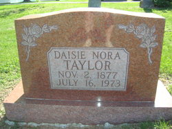
| Inscription | : | Daisie Nora Taylor Nov. 2, 1877 July 16, 1973 |
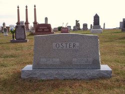
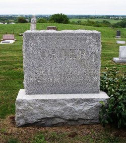
| Description | : | Dau. of Leonard George Oster & Rebecca Ann Phillips Oster; Wife of Benjamin Isaac Taylor 1880-1930, m. 1902; Mother of Rose A. Taylor b. 1904 & Willa L. Taylor b. 1906-1973. |
frequently asked questions (FAQ):
-
Where is Daisie Nora Oster Taylor's memorial?
Daisie Nora Oster Taylor's memorial is located at: New Hope United Methodist Church Cemetery, Millville, Ray County, USA.
-
When did Daisie Nora Oster Taylor death?
Daisie Nora Oster Taylor death on 16 Jul 1973 in Springfield, Greene County, Missouri, USA
-
Where are the coordinates of the Daisie Nora Oster Taylor's memorial?
Latitude: 39.4236259
Longitude: -93.8416061
Family Members:
Parent
Spouse
Siblings
Flowers:


Nearby Cemetories:
1. New Hope United Methodist Church Cemetery
Millville, Ray County, USA
Coordinate: 39.4236259, -93.8416061
2. Old New Hope Cemetery
Millville, Ray County, USA
Coordinate: 39.4327200, -93.8435900
3. McCuistion Cemetery
Richmond, Ray County, USA
Coordinate: 39.4387300, -93.8550900
4. Silas Keith Cemetery
Regal, Ray County, USA
Coordinate: 39.4387800, -93.8262100
5. Mansur Cemetery
Grape Grove Township, Ray County, USA
Coordinate: 39.4230003, -93.8804016
6. Carleton Cemetery
Ray County, USA
Coordinate: 39.4014200, -93.8712700
7. Smith Cemetery
Ray County, USA
Coordinate: 39.4028015, -93.8799973
8. Berry Cemetery
Hardin, Ray County, USA
Coordinate: 39.3913800, -93.8710800
9. Nuckles Cemetery
Richmond, Ray County, USA
Coordinate: 39.4143700, -93.8950300
10. Bethany Church Cemetery
Stet, Ray County, USA
Coordinate: 39.4230995, -93.7838974
11. Woolard Cemetery
Hardin, Ray County, USA
Coordinate: 39.3769300, -93.8351500
12. Felix Wild Cemetery
Ray County, USA
Coordinate: 39.4398200, -93.9110700
13. Antioch Cemetery
Millville, Ray County, USA
Coordinate: 39.4563040, -93.9077420
14. Van Wall Cemetery
Grape Grove Township, Ray County, USA
Coordinate: 39.4513800, -93.9116700
15. Moyer Cemetery
Ray County, USA
Coordinate: 39.4244100, -93.9224100
16. Graff Cemetery
Grape Grove Township, Ray County, USA
Coordinate: 39.4909286, -93.8144836
17. Wakenda Cemetery
Hardin, Ray County, USA
Coordinate: 39.3519300, -93.8456900
18. Meinking-Wilson Cemetery
Ray County, USA
Coordinate: 39.3576200, -93.7995600
19. Millville Community Cemetery
Millville, Ray County, USA
Coordinate: 39.4041100, -93.9351600
20. Little Union Cemetery
Stet, Ray County, USA
Coordinate: 39.4972343, -93.8660507
21. Bethel Mennonite Church Cemetery
Richmond, Ray County, USA
Coordinate: 39.3936900, -93.9330400
22. Basham Cemetery
Ray County, USA
Coordinate: 39.4963400, -93.8810700
23. Mount Olivet Cemetery
Stet, Carroll County, USA
Coordinate: 39.4366000, -93.7403000
24. Elder Cemetery
Grape Grove Township, Ray County, USA
Coordinate: 39.5015259, -93.8108826