
| Memorials | : | 21 |
| Location | : | Hardin, Ray County, USA |
| Coordinate | : | 39.3519300, -93.8456900 |
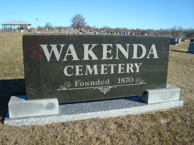
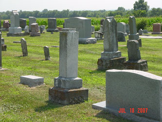
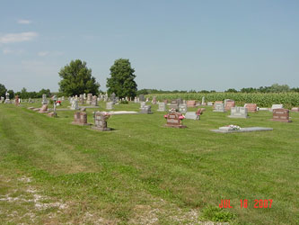
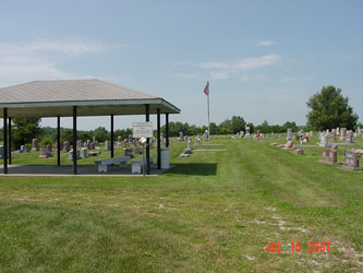
| Description | : | The Wakenda Cemetery is located on 144th Street approximately 7 miles north of the City of Hardin. The Wakenda Cemetery traces its beginning to 1895 when David B. Bowman donated land for a church and cemetery. Directions: 3 miles west of Rockingham or 4 miles north of Hardin on 'A' to junction 'E'. At junction go north on county road 267 1.7 miles to county road 266; west 0.5 miles to cemetery on north side of road; established 1870; a well kept cemetery; once called Bowman or Dundard Cemetery; about 1018 marked graves and 11 unmarked (1994). |
frequently asked questions (FAQ):
-
Where is Wakenda Cemetery?
Wakenda Cemetery is located at Hardin, Ray County ,Missouri ,USA.
-
Wakenda Cemetery cemetery's updated grave count on graveviews.com?
19 memorials
-
Where are the coordinates of the Wakenda Cemetery?
Latitude: 39.3519300
Longitude: -93.8456900
Nearby Cemetories:
1. Bohannon Cemetery
Hardin, Ray County, USA
Coordinate: 39.3291600, -93.8580600
2. Woolard Cemetery
Hardin, Ray County, USA
Coordinate: 39.3769300, -93.8351500
3. Meinking-Wilson Cemetery
Ray County, USA
Coordinate: 39.3576200, -93.7995600
4. Clark Cemetery
Hardin, Ray County, USA
Coordinate: 39.3499985, -93.7956009
5. Berry Cemetery
Hardin, Ray County, USA
Coordinate: 39.3913800, -93.8710800
6. Lavelock Cemetery
Hardin, Ray County, USA
Coordinate: 39.3078003, -93.8394012
7. Hickory Grove Cemetery
Richmond, Ray County, USA
Coordinate: 39.3288120, -93.9006293
8. Forester Cemetery
Hardin, Ray County, USA
Coordinate: 39.3125700, -93.8079100
9. Carleton Cemetery
Ray County, USA
Coordinate: 39.4014200, -93.8712700
10. Pugh Cemetery
Richmond, Ray County, USA
Coordinate: 39.3124800, -93.8968700
11. Smith Cemetery
Ray County, USA
Coordinate: 39.4028015, -93.8799973
12. Liberty Cemetery
Hardin, Ray County, USA
Coordinate: 39.3331800, -93.7667800
13. Oliphant Cemetery
Richmond, Ray County, USA
Coordinate: 39.3573300, -93.9362200
14. New Hope United Methodist Church Cemetery
Millville, Ray County, USA
Coordinate: 39.4236259, -93.8416061
15. Nuckles Cemetery
Richmond, Ray County, USA
Coordinate: 39.4143700, -93.8950300
16. Ray County Poor Farm Cemetery
Richmond, Ray County, USA
Coordinate: 39.3377110, -93.9391770
17. Mansur Cemetery
Grape Grove Township, Ray County, USA
Coordinate: 39.4230003, -93.8804016
18. Wall Cemetery
Ray County, USA
Coordinate: 39.3671989, -93.9458008
19. Bethel Mennonite Church Cemetery
Richmond, Ray County, USA
Coordinate: 39.3936900, -93.9330400
20. Old New Hope Cemetery
Millville, Ray County, USA
Coordinate: 39.4327200, -93.8435900
21. Bethany Church Cemetery
Stet, Ray County, USA
Coordinate: 39.4230995, -93.7838974
22. Millville Community Cemetery
Millville, Ray County, USA
Coordinate: 39.4041100, -93.9351600
23. McCuistion Cemetery
Richmond, Ray County, USA
Coordinate: 39.4387300, -93.8550900
24. Nutter Cemetery
Richmond, Ray County, USA
Coordinate: 39.2966995, -93.9344025