
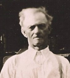
| Birth | : | 7 Nov 1934 Silver Creek Township, Mills County, Iowa, USA |
| Death | : | 17 Nov 2009 Iowa, USA |
| Burial | : | Downsville Cemetery, Pottawattamie County, USA |
| Coordinate | : | 41.3502998, -95.7039032 |
| Description | : | Dolly "Dollie" L. Darnold, 75, passed away November 17, 2009. Dolly was born November 7, 1934 in Malvern, Iowa to the late Arthur and Mary (Logan) Darnold. She was preceded in death by her eight brothers; eight sisters; nephews Jeff McSorley and David Shere. Dolly will be sadly missed by her sister, Doris Jones; sisters-in-law, Naomi, Kathy and Bernice; a host of nieces, nephews, family and friends. The funeral will be at Maher-Livingston Funeal Home. Services will be held 2 p.m, Saturday. Interment to follow at Downsville Cemetery. From the Council Bluffs Iowa Nonpareil November 20,... Read More |
frequently asked questions (FAQ):
-
Where is Dolly Lucille “Dollie” Darnold's memorial?
Dolly Lucille “Dollie” Darnold's memorial is located at: Downsville Cemetery, Pottawattamie County, USA.
-
When did Dolly Lucille “Dollie” Darnold death?
Dolly Lucille “Dollie” Darnold death on 17 Nov 2009 in Iowa, USA
-
Where are the coordinates of the Dolly Lucille “Dollie” Darnold's memorial?
Latitude: 41.3502998
Longitude: -95.7039032
Family Members:
Parent
Siblings

Flowers:


Nearby Cemetories:
1. Downsville Cemetery
Pottawattamie County, USA
Coordinate: 41.3502998, -95.7039032
2. Saint Columbanus Cemetery
Weston, Pottawattamie County, USA
Coordinate: 41.3429440, -95.7435260
3. Pottawattamie County Home Cemetery
McClelland, Pottawattamie County, USA
Coordinate: 41.3269400, -95.6691738
4. H G Fisher Cemetery
Underwood, Pottawattamie County, USA
Coordinate: 41.3838997, -95.6889038
5. Castor Cemetery
Underwood, Pottawattamie County, USA
Coordinate: 41.4127040, -95.6887490
6. Hazel Dell Cemetery
Council Bluffs, Pottawattamie County, USA
Coordinate: 41.3489723, -95.7939911
7. Hardin Township Cemetery
McClelland, Pottawattamie County, USA
Coordinate: 41.2949982, -95.6513977
8. Gregg Cemetery
Weston, Pottawattamie County, USA
Coordinate: 41.3330000, -95.7931000
9. Garner Cemetery
Council Bluffs, Pottawattamie County, USA
Coordinate: 41.2956161, -95.8001709
10. Jones - Williams Cemetery
Pottawattamie County, USA
Coordinate: 41.3761000, -95.5846000
11. Saint Pauls Lutheran Cemetery
Neola, Pottawattamie County, USA
Coordinate: 41.4337000, -95.7607000
12. Evans Cemetery
Crescent, Pottawattamie County, USA
Coordinate: 41.3255997, -95.8368988
13. Stoker-Graybill Cemetery
Council Bluffs, Pottawattamie County, USA
Coordinate: 41.2532620, -95.7751770
14. Crescent Cemetery
Crescent, Pottawattamie County, USA
Coordinate: 41.3664894, -95.8566208
15. Green Valley Cemetery
Council Bluffs, Pottawattamie County, USA
Coordinate: 41.2743988, -95.8225021
16. Saint Joseph Cemetery
Council Bluffs, Pottawattamie County, USA
Coordinate: 41.2722015, -95.8208008
17. Cedar Lawn Cemetery
Council Bluffs, Pottawattamie County, USA
Coordinate: 41.2694016, -95.8182983
18. Bikhor Cholim Cemetery
Council Bluffs, Pottawattamie County, USA
Coordinate: 41.2703670, -95.8229350
19. Oak Hill Cemetery
Council Bluffs, Pottawattamie County, USA
Coordinate: 41.2700900, -95.8226400
20. Grange Cemetery
Honey Creek, Pottawattamie County, USA
Coordinate: 41.4446678, -95.8034668
21. Walnut Hill Cemetery
Council Bluffs, Pottawattamie County, USA
Coordinate: 41.2719002, -95.8255997
22. Reels Cemetery
Crescent, Pottawattamie County, USA
Coordinate: 41.4234100, -95.8321700
23. William C McIntosh Cemetery
Crescent, Pottawattamie County, USA
Coordinate: 41.4088745, -95.8477097
24. Ridgewood Cemetery
Council Bluffs, Pottawattamie County, USA
Coordinate: 41.2694016, -95.8272018