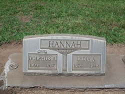
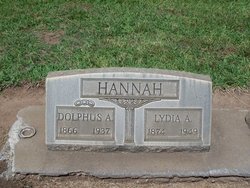
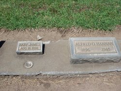
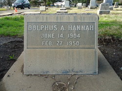
Dolphus Adolph “Doe” Hannah
| Birth | : | 7 Jul 1866 Hopedale, Tazewell County, Illinois, USA |
| Death | : | 2 Jan 1937 Butte County, California, USA |
| Burial | : | Castroville Public Cemetery, Moss Landing, Monterey County, USA |
| Coordinate | : | 36.7930145, -121.7851410 |
| Plot | : | Sec 7 Row 7 gr 388 |
| Description | : | Son of James P Hannah (1830 IL-1872 IL) and his wife Margaret Phillips (1844-1872) M) Lydia Albine Overton Sep 14, 1891 Butte Co, Calif. 1920 census Chico, Butte, CA: Dolphus A. Hannah, aged 54, grocery merchant, bp IL, both parents IL; Lydia aged 45, grocery clerk, bp MO, both parents IL; Alfred O. aged 23, laborer; Dolphs A. aged 15; Mildred A. aged 11 -- all born CA. They are residing 12th Avenue, Chico Vecino. 1930 census Chico, Butte, CA: Dolphus A. Hannah, aged 63, merchant fruits & vegetables, bp IL, both parents IL; Lydia A. aged... Read More |
frequently asked questions (FAQ):
-
Where is Dolphus Adolph “Doe” Hannah's memorial?
Dolphus Adolph “Doe” Hannah's memorial is located at: Castroville Public Cemetery, Moss Landing, Monterey County, USA.
-
When did Dolphus Adolph “Doe” Hannah death?
Dolphus Adolph “Doe” Hannah death on 2 Jan 1937 in Butte County, California, USA
-
Where are the coordinates of the Dolphus Adolph “Doe” Hannah's memorial?
Latitude: 36.7930145
Longitude: -121.7851410
Family Members:
Spouse
Children
Flowers:
Nearby Cemetories:
1. Castroville Public Cemetery
Moss Landing, Monterey County, USA
Coordinate: 36.7930145, -121.7851410
2. Stephen Norriss Gravesite
Monterey County, USA
Coordinate: 36.8214110, -121.7601080
3. Monterey Bay Loved Pet Cemetery
Monterey County, USA
Coordinate: 36.8326160, -121.6812820
4. Hambey Cemetery
Monterey County, USA
Coordinate: 36.8372002, -121.6793976
5. Queen of Heaven Cemetery
Prunedale, Monterey County, USA
Coordinate: 36.7602425, -121.6611252
6. All Saints Episcopal Church Memorial Garden
Watsonville, Santa Cruz County, USA
Coordinate: 36.9102310, -121.7568950
7. Santa Rita Chapel and Cemetery
Salinas, Monterey County, USA
Coordinate: 36.7281303, -121.6565475
8. Calvary Catholic Cemetery
Salinas, Monterey County, USA
Coordinate: 36.6880341, -121.6818085
9. Pioneer Cemetery
Watsonville, Santa Cruz County, USA
Coordinate: 36.9258560, -121.7642790
10. Watsonville Catholic Cemetery
Watsonville, Santa Cruz County, USA
Coordinate: 36.9278564, -121.7658463
11. Saint Georges Episcopal Church Columbarium
Salinas, Monterey County, USA
Coordinate: 36.7062580, -121.6440980
12. Whitcher Cemetery
East Garrison, Monterey County, USA
Coordinate: 36.6501730, -121.7305270
13. Monterey County Potters Field Cemetery
Salinas, Monterey County, USA
Coordinate: 36.6960900, -121.6381950
14. Chinese Cemetery
Salinas, Monterey County, USA
Coordinate: 36.6952057, -121.6390381
15. Valley Catholic Cemetery
Watsonville, Santa Cruz County, USA
Coordinate: 36.9415932, -121.7405777
16. Valley Public Cemetery
Watsonville, Santa Cruz County, USA
Coordinate: 36.9418983, -121.7400513
17. California Central Coast Veterans Cemetery
Seaside, Monterey County, USA
Coordinate: 36.6371900, -121.7963600
18. Saint Pauls Episcopal Church Columbarium
Salinas, Monterey County, USA
Coordinate: 36.6588430, -121.6558850
19. Mission Memorial Park
Seaside, Monterey County, USA
Coordinate: 36.6191635, -121.8217926
20. Pajaro Valley Memorial Park
Watsonville, Santa Cruz County, USA
Coordinate: 36.9629669, -121.7219391
21. Garden of Memories
Salinas, Monterey County, USA
Coordinate: 36.6565247, -121.6384125
22. Yamato Cemetery
Salinas, Monterey County, USA
Coordinate: 36.6552811, -121.6307297
23. Christ Lutheran Church Columbarium
Aptos, Santa Cruz County, USA
Coordinate: 36.9700550, -121.8704370
24. El Carmelo Cemetery
Pacific Grove, Monterey County, USA
Coordinate: 36.6325836, -121.9319763


