Donald Charles “Donnie” Lower
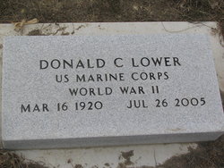
| Birth | : | 16 Mar 1920 Ashton, Spink County, South Dakota, USA |
| Death | : | 26 Jul 2005 Redfield, Spink County, South Dakota, USA |
| Burial | : | Bakersfield National Cemetery, Arvin, Kern County, USA |
| Coordinate | : | 35.2559600, -118.6693480 |
| Inscription | : | US MARINE CORPS WORLD WAR 11 |
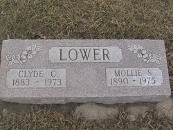
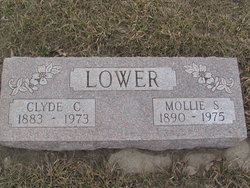
| Description | : | Redfield - Donald C. "Donnie" Lower, 85, of Redfield, died July 26, at the Eastern Star Home in Redfield. His funeral will be Friday, July 29, at 2 p.m. at Thelen Funeral Home in Redfield. The Rev. Stephen Perry will officiate. Burial will be in the Ashton Cemetery with full military rites. Visitation will be Thursday from 1 to 8 p.m. with the family present from 5 to 7 p.m. at Thelen Funeral Home. Donnie was born March 16, 1920 near Ashton to Clyde and Mollie (Lunney) Lower. He graduated from Ashton High School and entered the United States Marine... Read More |
frequently asked questions (FAQ):
-
Where is Donald Charles “Donnie” Lower's memorial?
Donald Charles “Donnie” Lower's memorial is located at: Bakersfield National Cemetery, Arvin, Kern County, USA.
-
When did Donald Charles “Donnie” Lower death?
Donald Charles “Donnie” Lower death on 26 Jul 2005 in Redfield, Spink County, South Dakota, USA
-
Where are the coordinates of the Donald Charles “Donnie” Lower's memorial?
Latitude: 35.2559600
Longitude: -118.6693480
Family Members:
Parent
Spouse
Siblings
Flowers:
Nearby Cemetories:
1. Bakersfield National Cemetery
Arvin, Kern County, USA
Coordinate: 35.2559600, -118.6693480
2. Fickert Family Cemetery
Bear Valley Springs, Kern County, USA
Coordinate: 35.1697260, -118.6443350
3. Cesar E. Chavez National Monument
Keene, Kern County, USA
Coordinate: 35.2236000, -118.5592400
4. Tehachapi Cove Cemetery
Tehachapi, Kern County, USA
Coordinate: 35.1190000, -118.5724600
5. Rankin Cemetery
Walker Basin, Kern County, USA
Coordinate: 35.3844560, -118.5388890
6. Brite Family Cemetery
Tehachapi, Kern County, USA
Coordinate: 35.1085350, -118.5473470
7. Arvin Cemetery
Arvin, Kern County, USA
Coordinate: 35.2132300, -118.8952700
8. Old Tehachapi Cemetery
Tehachapi, Kern County, USA
Coordinate: 35.1400990, -118.4795570
9. Paris-Loraine Cemetery
Loraine, Kern County, USA
Coordinate: 35.3059000, -118.4355000
10. Tehachapi Westside Cemetery
Tehachapi, Kern County, USA
Coordinate: 35.1387400, -118.4633600
11. Tejon Indian Settlement Cemetery
Kern County, USA
Coordinate: 35.0422000, -118.6553900
12. Hillcrest Memorial Park
Bakersfield, Kern County, USA
Coordinate: 35.3814316, -118.9012527
13. Buhn Ranch Cemetery
Tehachapi, Kern County, USA
Coordinate: 35.1352210, -118.4319290
14. Williams Burial Site
Walker Basin, Kern County, USA
Coordinate: 35.4320950, -118.4815680
15. Tehachapi Eastside Cemetery
Tehachapi, Kern County, USA
Coordinate: 35.1329000, -118.4153200
16. Kuntz Ranch Cemetery
Bakersfield, Kern County, USA
Coordinate: 35.4373560, -118.9390180
17. Saint Joseph Cemetery
Havilah, Kern County, USA
Coordinate: 35.5147500, -118.5177700
18. Union Cemetery
Bakersfield, Kern County, USA
Coordinate: 35.3646500, -118.9948700
19. Home of Peace Jewish Cemetery
Bakersfield, Kern County, USA
Coordinate: 35.3631500, -118.9987400
20. Greenlawn Cemetery and Mortuary
Bakersfield, Kern County, USA
Coordinate: 35.4067001, -118.9856033
21. Greenlawn Southwest Mortuary and Cemetery
Bakersfield, Kern County, USA
Coordinate: 35.2948990, -119.0330810
22. Chinese Cemetery
Bakersfield, Kern County, USA
Coordinate: 35.3510550, -119.0273380
23. Sand Canyon Cemetery
Tehachapi, Kern County, USA
Coordinate: 35.1331320, -118.3150210
24. Saint Pauls Episcopal Church Columbarium
Bakersfield, Kern County, USA
Coordinate: 35.3746120, -119.0277940

