
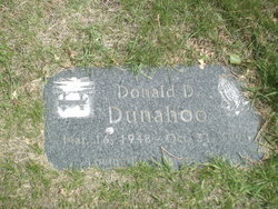
Donald Dennis Dunahoo
| Birth | : | 16 Mar 1948 Mason City, Cerro Gordo County, Iowa, USA |
| Death | : | 31 Oct 1998 Mason City, Cerro Gordo County, Iowa, USA |
| Burial | : | Eden Mennonite Church Cemetery, Moundridge, McPherson County, USA |
| Coordinate | : | 38.2329890, -97.5940630 |
| Description | : | Mason City (Iowa) Globe Gazette obituaries MASON CITY — Donald Dennis Dunahoo, 50, of 24 16th St. N.E., died Saturday (Oct. 31, 1998) at his home. Funeral services will be held at 1 p.m. Thursday, Nov. 5, 1998, at the Fullerton Funeral Home, 123 Second St. S.E., with the Lt. Jon Augenstein, of the Salvation Army, officiating. Interment will follow in Memorial Park Cemetery. Visitation will be held from 4 to 8 p.m. today at the funeral home and will continue from 9 a.m. on Thursday until time of services. Those planning an expression of sympathy may wish to direct memorials to the Donald... Read More |
frequently asked questions (FAQ):
-
Where is Donald Dennis Dunahoo's memorial?
Donald Dennis Dunahoo's memorial is located at: Eden Mennonite Church Cemetery, Moundridge, McPherson County, USA.
-
When did Donald Dennis Dunahoo death?
Donald Dennis Dunahoo death on 31 Oct 1998 in Mason City, Cerro Gordo County, Iowa, USA
-
Where are the coordinates of the Donald Dennis Dunahoo's memorial?
Latitude: 38.2329890
Longitude: -97.5940630
Family Members:
Parent
Siblings
Flowers:


Nearby Cemetories:
1. Eden Mennonite Church Cemetery
Moundridge, McPherson County, USA
Coordinate: 38.2329890, -97.5940630
2. Hopefield Church Cemetery
Moundridge, McPherson County, USA
Coordinate: 38.2105180, -97.5858040
3. Mound Township Cemetery
Moundridge, McPherson County, USA
Coordinate: 38.2028008, -97.5378036
4. West Zion Cemetery
Moundridge, McPherson County, USA
Coordinate: 38.2028008, -97.5372009
5. Emmanuel Bible Church Cemetery
Moundridge, McPherson County, USA
Coordinate: 38.2868200, -97.5264200
6. Schlender Cemetery
Harvey County, USA
Coordinate: 38.1669006, -97.5374985
7. First Mennonite Cemetery
Moundridge, McPherson County, USA
Coordinate: 38.1885090, -97.5094070
8. Lohrentz Cemetery
Harvey County, USA
Coordinate: 38.1518374, -97.5843430
9. Hoffnungsau Mennonite Church Cemetery
Inman, McPherson County, USA
Coordinate: 38.1807370, -97.6830270
10. Lone Tree Cemetery
Moundridge, McPherson County, USA
Coordinate: 38.2846985, -97.5002975
11. Hebron Cemetery
Burrton, Harvey County, USA
Coordinate: 38.1432991, -97.6883011
12. Schroeder Family Cemetery
Buhler, Reno County, USA
Coordinate: 38.1664700, -97.7211600
13. Empire Cemetery
Galva, McPherson County, USA
Coordinate: 38.3403015, -97.5192032
14. Immanuel Lutheran Church Cemetery
Canton, McPherson County, USA
Coordinate: 38.2755330, -97.4473030
15. Buhler East Cemetery
Reno County, USA
Coordinate: 38.1453018, -97.7071991
16. Garden Community Church Cemetery
Halstead, Harvey County, USA
Coordinate: 38.1225900, -97.5188600
17. Freedom Baptist Church Cemetery
McPherson County, USA
Coordinate: 38.2027400, -97.4362500
18. Garden Valley Cemetery
Harvey County, USA
Coordinate: 38.1232147, -97.4998856
19. Farnsworth-Cook Cemetery
Halstead, Harvey County, USA
Coordinate: 38.1233600, -97.4992200
20. German Evangelical Lutheran Cemetery
Meridian Township, McPherson County, USA
Coordinate: 38.2567150, -97.4267420
21. McPherson Cemetery
McPherson, McPherson County, USA
Coordinate: 38.3630981, -97.6430969
22. Martens Family Cemetery
Buhler, Reno County, USA
Coordinate: 38.1472400, -97.7292700
23. Dunkard Church Cemetery
Galva, McPherson County, USA
Coordinate: 38.3497009, -97.5006027
24. Little River Township Cemetery
Buhler, Reno County, USA
Coordinate: 38.1369019, -97.7205963