
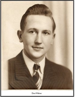
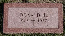
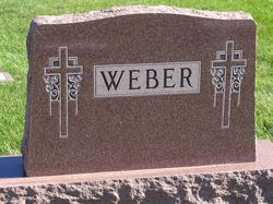
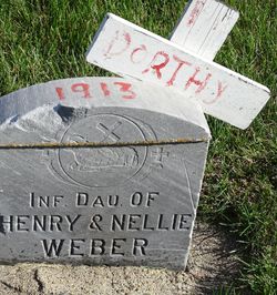
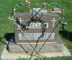
Donald Henry Weber
| Birth | : | 24 Jul 1927 Dunlap, Harrison County, Iowa, USA |
| Death | : | 27 Aug 1957 Council Bluffs, Pottawattamie County, Iowa, USA |
| Burial | : | Saint John the Baptist Churchyard, North Cheriton, South Somerset District, England |
| Coordinate | : | 51.0309000, -2.4474000 |
| Plot | : | Block 19 |
| Description | : | THE DUNLAP (IOWA) REPORTER Thursday September 5, 1957 Funeral services were held Friday morning, Aug. 30, at St. Patrick's Church at 9:00 o'clock for Donald Weber, 30. Mr. Weber died Tuesday evening, Aug. 27, at Jennie Edmundson hospital in Council Bluffs following a highway crash. Rev. E. Leo Ford officated at the Requiem Mass. Burial was made in Pleasant Hill Cemetery, Dunlap, under the direction of the Barrett Funeral Home. Pallbearers were David Houston, Robert Quirk, Richard Olmstead, Dale Rosenberger, Gerald Mulligan and Edward Herrernan. Donald Henry Weber, son of Mr. and Mrs. Henry Weber, was born July 24, 1927 at... Read More |
frequently asked questions (FAQ):
-
Where is Donald Henry Weber's memorial?
Donald Henry Weber's memorial is located at: Saint John the Baptist Churchyard, North Cheriton, South Somerset District, England.
-
When did Donald Henry Weber death?
Donald Henry Weber death on 27 Aug 1957 in Council Bluffs, Pottawattamie County, Iowa, USA
-
Where are the coordinates of the Donald Henry Weber's memorial?
Latitude: 51.0309000
Longitude: -2.4474000
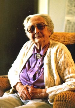
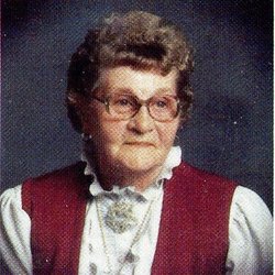
Family Members:
Parent
Siblings


Flowers:


Nearby Cemetories:
1. Saint John the Baptist Churchyard
North Cheriton, South Somerset District, England
Coordinate: 51.0309000, -2.4474000
2. North Cheriton Cemetery
North Cheriton, South Somerset District, England
Coordinate: 51.0284840, -2.4389150
3. Saint Nicholas Churchyard
Holton, South Somerset District, England
Coordinate: 51.0401280, -2.4502641
4. St. Peter & St. Paul Churchyard
Maperton, South Somerset District, England
Coordinate: 51.0335993, -2.4686628
5. Saint John's Churchyard
Horsington, South Somerset District, England
Coordinate: 51.0126300, -2.4238400
6. St. Michael's Churchyard
Blackford, South Somerset District, England
Coordinate: 51.0336960, -2.4892290
7. Saint Peter & Saint Paul Churchyard
Charlton Horethorne, South Somerset District, England
Coordinate: 51.0060200, -2.4790100
8. St. Nicholas' Churchyard
Bratton Seymour, South Somerset District, England
Coordinate: 51.0679406, -2.4625400
9. Blessed Virgin Mary Churchyard
Compton Pauncefoot, South Somerset District, England
Coordinate: 51.0336770, -2.5089430
10. Saint Stephen Churchyard
Charlton Musgrove, South Somerset District, England
Coordinate: 51.0678630, -2.4008550
11. St Michael Churchyard
North Cadbury, South Somerset District, England
Coordinate: 51.0416670, -2.5213610
12. Corton Denham Cemetery
Corton Denham, South Somerset District, England
Coordinate: 51.0015810, -2.5202380
13. Saint Andrew Churchyard
Corton Denham, South Somerset District, England
Coordinate: 51.0015790, -2.5203100
14. All Saints Churchyard
Poyntington, West Dorset District, England
Coordinate: 50.9782070, -2.4997530
15. Civic Cemetery
Buckhorn Weston, North Dorset District, England
Coordinate: 51.0212440, -2.3484600
16. St Leonard Churchyard and Extension
Pitcombe, South Somerset District, England
Coordinate: 51.0925600, -2.4684600
17. St John The Baptist Churchyard
Buckhorn Weston, North Dorset District, England
Coordinate: 51.0212870, -2.3481780
18. St Lawrence Churchyard
Cucklington, South Somerset District, England
Coordinate: 51.0487190, -2.3507950
19. St Nicholas Churchyard
Henstridge, South Somerset District, England
Coordinate: 50.9762610, -2.3957980
20. Milborne Port Cemetery
Milborne Port, South Somerset District, England
Coordinate: 50.9662940, -2.4605880
21. Saint John's Churchyard
Charlton Musgrove, South Somerset District, England
Coordinate: 51.0840723, -2.3869787
22. Milborne Port Churchyard
Milborne Port, South Somerset District, England
Coordinate: 50.9653900, -2.4621550
23. St Peter Churchyard
Redlynch, South Somerset District, England
Coordinate: 51.0983279, -2.4299457
24. Castle Cary Cemetery
Castle Cary, South Somerset District, England
Coordinate: 51.0803800, -2.5223600