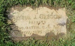
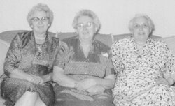
| Birth | : | 4 Feb 1898 |
| Death | : | 12 Mar 1978 |
| Burial | : | Chorley Cemetery, Chorley, Chorley Borough, England |
| Coordinate | : | 53.6549770, -2.6447530 |
| Description | : | Doris was born in Portland Oregan and moved with her family to Vancouver at the age of about 2. She grew up there and met Bamford Miller during World War 1. They married March 3, 1916 and moved to Granville Ferry Nova Scotia after the war where they raised their 12 children. |
frequently asked questions (FAQ):
-
Where is Doris May Gregory Miller's memorial?
Doris May Gregory Miller's memorial is located at: Chorley Cemetery, Chorley, Chorley Borough, England.
-
When did Doris May Gregory Miller death?
Doris May Gregory Miller death on 12 Mar 1978 in
-
Where are the coordinates of the Doris May Gregory Miller's memorial?
Latitude: 53.6549770
Longitude: -2.6447530
Family Members:
Parent
Spouse
Siblings
Children
Flowers:
Nearby Cemetories:
1. Chorley Cemetery
Chorley, Chorley Borough, England
Coordinate: 53.6549770, -2.6447530
2. St Laurence's Church
Chorley, Chorley Borough, England
Coordinate: 53.6546880, -2.6327020
3. St George's Churchyard
Chorley, Chorley Borough, England
Coordinate: 53.6521460, -2.6295520
4. St Peters Churchyard
Chorley, Chorley Borough, England
Coordinate: 53.6607430, -2.6232100
5. St Gregory Weld Bank Church Cemetery
Chorley, Chorley Borough, England
Coordinate: 53.6390300, -2.6307480
6. Charnock Richard Crematorium
Chorley, Chorley Borough, England
Coordinate: 53.6518550, -2.6763080
7. Euxton Parish Churchyard
Euxton, Chorley Borough, England
Coordinate: 53.6650950, -2.6743630
8. St. Mary's Churchyard
Euxton, Chorley Borough, England
Coordinate: 53.6669580, -2.6768350
9. Christ Church
Charnock Richard, Chorley Borough, England
Coordinate: 53.6367200, -2.6773400
10. St John the Evangelist Churchyard
Whittle-le-Woods, Chorley Borough, England
Coordinate: 53.6883280, -2.6400320
11. St. Chad's South Hill Churchyard
Wheelton, Chorley Borough, England
Coordinate: 53.6826040, -2.6125010
12. St Barnabas Churchyard
Heapey, Chorley Borough, England
Coordinate: 53.6792520, -2.6043310
13. St Oswald’s Churchyard
Coppull, Chorley Borough, England
Coordinate: 53.6217176, -2.6714738
14. Coppull Parish Churchyard Extension
Coppull, Chorley Borough, England
Coordinate: 53.6170200, -2.6555420
15. Coppull Parish Churchyard
Coppull, Chorley Borough, England
Coordinate: 53.6168000, -2.6549710
16. Saint Andrews Churchyard
Leyland, South Ribble Borough, England
Coordinate: 53.6881270, -2.6957880
17. St Mary's Roman Catholic Churchyard
Leyland, South Ribble Borough, England
Coordinate: 53.6880510, -2.6983240
18. Christ Church Churchyard
Adlington, Chorley Borough, England
Coordinate: 53.6136590, -2.6042260
19. St. Joseph's Churchyard, Anderton
Adlington, Chorley Borough, England
Coordinate: 53.6165600, -2.5953600
20. Adlington Cemetery
Adlington, Chorley Borough, England
Coordinate: 53.6100510, -2.6089100
21. St Mary the Virgin Churchyard
Eccleston, Chorley Borough, England
Coordinate: 53.6528800, -2.7331920
22. St. Bedes Churchyard
Clayton-le-Woods, Chorley Borough, England
Coordinate: 53.7079260, -2.6390320
23. Rivington Churchyard
Rivington, Chorley Borough, England
Coordinate: 53.6251690, -2.5684490
24. Unitarian Chapelyard
Rivington, Chorley Borough, England
Coordinate: 53.6254549, -2.5660662


