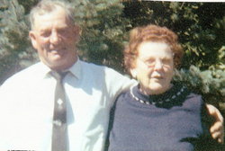
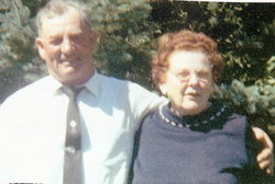
Dorthy Jannette Pitch Belden
| Birth | : | 14 Aug 1931 Havre, Hill County, Montana, USA |
| Death | : | 13 Nov 2014 Harlem, Blaine County, Montana, USA |
| Burial | : | Harlem Cemetery, Harlem, Blaine County, USA |
| Coordinate | : | 48.5444700, -108.7817200 |
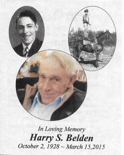
| Description | : | Dorthy Jannette (Pitch) Belden, 83, passed away on November 13, 2014. Dorthy was born in Havre, MT to John George and Ethel (Sherrod) Pitch on August 14, 1931. She grew up in the Harlem area and attended the Harlem schools. She attended Montana State University in Bozeman where she met Harry. They were married in Chinook on May 12, 1951. Dorthy's family was the center of her life. She was a homemaker and shared her talents, teaching many young ladies to sew throug her work with 4-H. She loved doing crafts, quilting and... Read More |
frequently asked questions (FAQ):
-
Where is Dorthy Jannette Pitch Belden's memorial?
Dorthy Jannette Pitch Belden's memorial is located at: Harlem Cemetery, Harlem, Blaine County, USA.
-
When did Dorthy Jannette Pitch Belden death?
Dorthy Jannette Pitch Belden death on 13 Nov 2014 in Harlem, Blaine County, Montana, USA
-
Where are the coordinates of the Dorthy Jannette Pitch Belden's memorial?
Latitude: 48.5444700
Longitude: -108.7817200
Family Members:
Parent
Spouse
Siblings
Children
Flowers:
Nearby Cemetories:
1. Harlem Cemetery
Harlem, Blaine County, USA
Coordinate: 48.5444700, -108.7817200
2. North Harlem Colony Cemetery
North Harlem Colony, Blaine County, USA
Coordinate: 48.5855560, -108.7558330
3. Agency Cemetery
Fort Belknap Agency, Blaine County, USA
Coordinate: 48.4767000, -108.7702000
4. Sacred Heart Catholic Cemetery
Fort Belknap Agency, Blaine County, USA
Coordinate: 48.4489000, -108.6582000
5. Zurich Cemetery
Zurich, Blaine County, USA
Coordinate: 48.5900000, -109.0459000
6. Fort Belknap Cemetery
Harlem, Blaine County, USA
Coordinate: 48.4347210, -108.5595860
7. Hollandville Cemetery
Chinook, Blaine County, USA
Coordinate: 48.6960310, -109.1557200
8. Wing Cemetery
Hogeland, Blaine County, USA
Coordinate: 48.8125000, -108.5860000
9. Turner Colony Cemetery
Turner Colony, Blaine County, USA
Coordinate: 48.7595000, -108.4369000
10. Bethel Bruderthaler Mennonite Church Cemetery
Chinook, Blaine County, USA
Coordinate: 48.7552000, -109.1345000
11. Saint Gabriel Cemetery
Chinook, Blaine County, USA
Coordinate: 48.6065200, -109.2531200
12. Kuper Memorial Cemetery
Chinook, Blaine County, USA
Coordinate: 48.6083100, -109.2531200
13. Graveyard Hill Cemetery
Phillips County, USA
Coordinate: 48.3847008, -108.3638992
14. Bear Paw Battlefield
Chinook, Blaine County, USA
Coordinate: 48.3780070, -109.2121290
15. Silver Bow Cemetery
Hogeland, Blaine County, USA
Coordinate: 48.8870000, -108.7160000
16. Cleveland Cemetery
Cleveland, Blaine County, USA
Coordinate: 48.2714500, -109.1517000
17. Mennonite Brethren Cemetery
Chinook, Blaine County, USA
Coordinate: 48.8012560, -109.1980620
18. Hillside Cemetery
Dodson, Phillips County, USA
Coordinate: 48.4122009, -108.2352982
19. Turner Cemetery
Turner, Blaine County, USA
Coordinate: 48.8610001, -108.4120026
20. Andrew S. Lohman Grave Site
Lohman, Blaine County, USA
Coordinate: 48.5903520, -109.4073350
21. Prairie Chapel United Brethren Cemetery
Chinook, Blaine County, USA
Coordinate: 48.8860000, -109.3414000
22. Messerly Cemetery
Blaine County, USA
Coordinate: 48.0630989, -108.4385986
23. Lodge Pole Cemetery
Lodge Pole, Blaine County, USA
Coordinate: 48.0371430, -108.5260870
24. East End Colony Cemetery
East End Colony, Hill County, USA
Coordinate: 48.7485000, -109.5474000


