
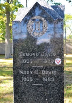


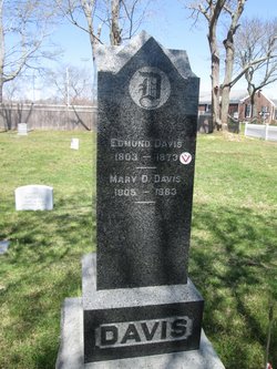
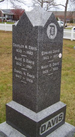
Edmund Davis
| Birth | : | 31 Jan 1803 Falmouth, Barnstable County, Massachusetts, USA |
| Death | : | 1873 |
| Burial | : | St Margaret Churchyard, Harwood Dale, Scarborough Borough, England |
| Coordinate | : | 54.3470030, -0.5238540 |
| Inscription | : | age 70 |
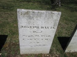
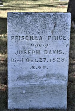
| Description | : | father: Joseph Davis mother: Priscilla |
frequently asked questions (FAQ):
-
Where is Edmund Davis's memorial?
Edmund Davis's memorial is located at: St Margaret Churchyard, Harwood Dale, Scarborough Borough, England.
-
When did Edmund Davis death?
Edmund Davis death on 1873 in
-
Where are the coordinates of the Edmund Davis's memorial?
Latitude: 54.3470030
Longitude: -0.5238540
Family Members:
Parent
Spouse
Siblings

Children


Flowers:


Nearby Cemetories:
1. St Margaret Churchyard
Harwood Dale, Scarborough Borough, England
Coordinate: 54.3470030, -0.5238540
2. St Margaret Churchyard (Ruins)
Harwood Dale, Scarborough Borough, England
Coordinate: 54.3558170, -0.5365790
3. Staintondale Churchyard
Staintondale, Scarborough Borough, England
Coordinate: 54.3752645, -0.4795295
4. St Peter Churchyard
Langdale End, Scarborough Borough, England
Coordinate: 54.3065050, -0.5557030
5. Cloughton Church Cemetery
Cloughton, Scarborough Borough, England
Coordinate: 54.3322500, -0.4511900
6. St Peter Churchyard
Hackness, Scarborough Borough, England
Coordinate: 54.3012880, -0.5127850
7. St Hilda Churchyard
Ravenscar, Scarborough Borough, England
Coordinate: 54.3973500, -0.4925300
8. St Laurence Churchyard
Scalby, Scarborough Borough, England
Coordinate: 54.2988160, -0.4507520
9. Ebenezers Baptist Church
Scarborough Borough, England
Coordinate: 54.3744655, -0.6557164
10. Woodlands Cemetery and Crematorium
Scarborough, Scarborough Borough, England
Coordinate: 54.2766640, -0.4428030
11. St. Stephen's New Churchyard
Robin Hoods Bay, Scarborough Borough, England
Coordinate: 54.4341460, -0.5394280
12. Dean Road and Manor Road Cemetery
Scarborough, Scarborough Borough, England
Coordinate: 54.2843690, -0.4184140
13. St. Stephen Old Churchyard
Fylingdales, Scarborough Borough, England
Coordinate: 54.4400890, -0.5496350
14. St. Mary's Churchyard
Scarborough, Scarborough Borough, England
Coordinate: 54.2864850, -0.3936260
15. Greyfriars Abbey
Scarborough, Scarborough Borough, England
Coordinate: 54.2850360, -0.3950300
16. Quaker House Church
Scarborough Borough, England
Coordinate: 54.2844280, -0.3941730
17. Scarborough Castle
Scarborough, Scarborough Borough, England
Coordinate: 54.2875810, -0.3895485
18. St. John the Baptist Churchyard
East Ayton, Scarborough Borough, England
Coordinate: 54.2508900, -0.4792900
19. St Matthew Churchyard
Hutton Buscel, Scarborough Borough, England
Coordinate: 54.2426410, -0.5071200
20. St. Helen’s & All Saints Churchyard
Wykeham, Scarborough Borough, England
Coordinate: 54.2372000, -0.5212000
21. Lockton Cemetery
Lockton, Ryedale District, England
Coordinate: 54.2977400, -0.7003200
22. St Giles Churchyard
Lockton, Ryedale District, England
Coordinate: 54.2987100, -0.7057700
23. All Saints Churchyard
High Hawsker, Scarborough Borough, England
Coordinate: 54.4624580, -0.5785000
24. St Martin Churchyard
Seamer, Scarborough Borough, England
Coordinate: 54.2361500, -0.4437100