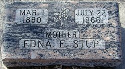
Edna Eulah Finch Stup
| Birth | : | 1 Mar 1890 Farlinville, Linn County, Kansas, USA |
| Death | : | 22 Jul 1966 Billings, Yellowstone County, Montana, USA |
| Burial | : | General Cemetery, Nottingham, Nottingham Unitary Authority, England |
| Coordinate | : | 52.9561430, -1.1615420 |
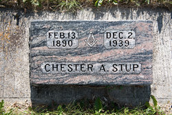
| Description | : | Billings Gazette (MT), 22 Jul 1966 Mrs. Edna Stup, 76, of Billings, died in a Billings hospital Friday morning. Born 1 March 1890, in Farlinville, Kan., daughter of Mr. and Mrs. David Finch, she was married to Ralph Hebron Foster, who died a short time later. In 1919 she was married to Chester Stup in Kansas City, Mo. They lived in Snowy Mountain district near Lavina from 1919 to 1934, then in Bozeman and Absarokee. After Mr. Stup's death she moved to Billings in 1940 to live with her son, Charles Foster. Other survivors are a brother, Chester Finch of Nampa,... Read More |
frequently asked questions (FAQ):
-
Where is Edna Eulah Finch Stup's memorial?
Edna Eulah Finch Stup's memorial is located at: General Cemetery, Nottingham, Nottingham Unitary Authority, England.
-
When did Edna Eulah Finch Stup death?
Edna Eulah Finch Stup death on 22 Jul 1966 in Billings, Yellowstone County, Montana, USA
-
Where are the coordinates of the Edna Eulah Finch Stup's memorial?
Latitude: 52.9561430
Longitude: -1.1615420
Family Members:
Flowers:
Nearby Cemetories:
1. General Cemetery
Nottingham, Nottingham Unitary Authority, England
Coordinate: 52.9561430, -1.1615420
2. Nottingham General Cemetery
Nottingham, Nottingham Unitary Authority, England
Coordinate: 52.9575370, -1.1594236
3. Cathedral Church of St. Barnabas
Nottingham, Nottingham Unitary Authority, England
Coordinate: 52.9546750, -1.1570460
4. Hardy Street Jewish Cemetery
Nottingham, Nottingham Unitary Authority, England
Coordinate: 52.9619500, -1.1665900
5. St Nicholas Churchyard
Nottingham, Nottingham Unitary Authority, England
Coordinate: 52.9504780, -1.1509220
6. St Peters Church Yard
Nottingham, Nottingham Unitary Authority, England
Coordinate: 52.9522800, -1.1486940
7. Nottingham Church Cemetery
Nottingham, Nottingham Unitary Authority, England
Coordinate: 52.9649830, -1.1558070
8. Holy Trinity Churchyard
Lenton, Nottingham Unitary Authority, England
Coordinate: 52.9485630, -1.1753148
9. St. Peter Churchyard Old Radford
Nottingham, Nottingham Unitary Authority, England
Coordinate: 52.9601830, -1.1789620
10. National Justice Museum High Pavement Nottingham
Nottingham Unitary Authority, England
Coordinate: 52.9510680, -1.1443050
11. St Mary's Burial Grounds
Nottingham, Nottingham Unitary Authority, England
Coordinate: 52.9527860, -1.1419160
12. St. Mary Rest Ground
Nottingham, Nottingham Unitary Authority, England
Coordinate: 52.9568310, -1.1406580
13. National Ice Centre
Nottingham, Nottingham Unitary Authority, England
Coordinate: 52.9527790, -1.1394460
14. St. John's Carrington Churchyard
Nottingham, Nottingham Unitary Authority, England
Coordinate: 52.9755350, -1.1506790
15. St. Wilfrid Churchyard
Wilford, Nottingham Unitary Authority, England
Coordinate: 52.9346290, -1.1587770
16. Wilford Village Cemetery
Wilford, Nottingham Unitary Authority, England
Coordinate: 52.9338540, -1.1591170
17. Basford Cemetery
Old Basford, Nottingham Unitary Authority, England
Coordinate: 52.9799700, -1.1725900
18. St. Leodegarius Churchyard
Old Basford, Nottingham Unitary Authority, England
Coordinate: 52.9794240, -1.1778650
19. St. Paul's Churchyard
Nottingham Unitary Authority, England
Coordinate: 52.9667590, -1.1172140
20. St. Giles's Church & Churchyard
West Bridgford, Rushcliffe Borough, England
Coordinate: 52.9316460, -1.1288450
21. St. Leonard's Churchyard
Wollaton, Nottingham Unitary Authority, England
Coordinate: 52.9529790, -1.2200830
22. Wollaton Cemetery
Wollaton, Nottingham Unitary Authority, England
Coordinate: 52.9503000, -1.2260800
23. Beeston Baptist Chapel
Beeston, Broxtowe Borough, England
Coordinate: 52.9246600, -1.2122000
24. Carlton Cemetery
Nottingham, Nottingham Unitary Authority, England
Coordinate: 52.9682820, -1.0900230


