
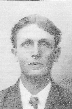
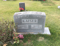
Edward Kaiser
| Birth | : | 31 Jan 1888 Moniteau County, Missouri, USA |
| Death | : | 20 Oct 1945 |
| Burial | : | St. Peter's Churchyard, Burnley, Burnley Borough, England |
| Coordinate | : | 53.7924450, -2.2394890 |
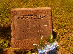
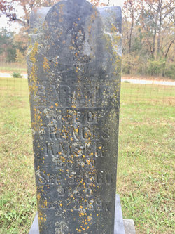
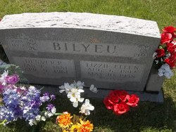
| Description | : | Obituary: Edward Kaiser, son of Frances and Sarah Edwards Kaiser, was born in Moniteau County, January 31, 1888, and departed this life, Oct. 20,1945, his age being 57 years, 8 months, and 20 days at the date of his death. At the age of seven, he moved with his parents to Miller County where he resided on a farm, the remainder of his life. On September 22, 1907, he was united in matrimony to Nettie Jeffries, and to this union four children were born, namely, Virgie Miller of Olean, Edrie Roberts of Sunflower, Kansas, Oscar Kaiser of Kaiser and Louie Kaiser... Read More |
frequently asked questions (FAQ):
-
Where is Edward Kaiser's memorial?
Edward Kaiser's memorial is located at: St. Peter's Churchyard, Burnley, Burnley Borough, England.
-
When did Edward Kaiser death?
Edward Kaiser death on 20 Oct 1945 in
-
Where are the coordinates of the Edward Kaiser's memorial?
Latitude: 53.7924450
Longitude: -2.2394890
Family Members:
Parent
Spouse

Siblings

Flowers:


Nearby Cemetories:
1. St. Peter's Churchyard
Burnley, Burnley Borough, England
Coordinate: 53.7924450, -2.2394890
2. St. James' Churchyard
Burnley, Burnley Borough, England
Coordinate: 53.7905590, -2.2458280
3. Ebenezer Baptist Chapel Chapelyard
Burnley, Burnley Borough, England
Coordinate: 53.7975120, -2.2397260
4. Holy Trinity Churchyard
Burnley, Burnley Borough, England
Coordinate: 53.7898290, -2.2574200
5. Burnley Cemetery
Burnley, Burnley Borough, England
Coordinate: 53.7821730, -2.2795070
6. Burnley Crematorium
Burnley, Burnley Borough, England
Coordinate: 53.7821730, -2.2795070
7. St. James' Churchyard
Briercliffe, Burnley Borough, England
Coordinate: 53.8107700, -2.2031800
8. St. John the Evangelist Churchyard
Worsthorne, Burnley Borough, England
Coordinate: 53.7877640, -2.1887420
9. All Saints Churchyard
Habergham Eaves, Burnley Borough, England
Coordinate: 53.7971060, -2.2913770
10. Marsden Friends Burial Ground
Marsden, Metropolitan Borough of Kirklees, England
Coordinate: 53.8241910, -2.2197410
11. Haggate Baptist Church Burial Ground
Burnley Borough, England
Coordinate: 53.8145048, -2.1960725
12. Hill Lane Baptist Church Churchyard
Briercliffe, Burnley Borough, England
Coordinate: 53.8161467, -2.1875368
13. St. Paul's Churchyard
Nelson, Pendle Borough, England
Coordinate: 53.8289250, -2.2157520
14. St. Anne Churchyard
Fence, Pendle Borough, England
Coordinate: 53.8304372, -2.2679552
15. Wheatley Lane Methodist Churchyard
Fence, Pendle Borough, England
Coordinate: 53.8341457, -2.2596202
16. St John Churchyard
Higham, Pendle Borough, England
Coordinate: 53.8251420, -2.2898120
17. St. John's Cemetery
Padiham, Burnley Borough, England
Coordinate: 53.7948720, -2.3145290
18. St. Leonard's Churchyard
Padiham, Burnley Borough, England
Coordinate: 53.8022600, -2.3164300
19. St Margaret Churchyard
Hapton, Burnley Borough, England
Coordinate: 53.7802400, -2.3169230
20. Wesleyan Methodist Chapel Chapelyard
Padiham, Burnley Borough, England
Coordinate: 53.8018980, -2.3181730
21. Wheatley Lane Inghamite Church Churchyard
Wheatley Lane, Pendle Borough, England
Coordinate: 53.8412800, -2.2457100
22. St. John the Divine Churchyard
Cliviger, Burnley Borough, England
Coordinate: 53.7533610, -2.1895090
23. St Leonard Churchyard Extension
Padiham, Burnley Borough, England
Coordinate: 53.7991800, -2.3222000
24. John Ecroyd's Orchard
Lancaster, City of Lancaster, England
Coordinate: 53.8201990, -2.1697920