
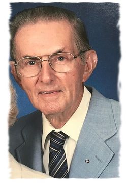
| Birth | : | 19 Jul 1894 Benton County, Tennessee, USA |
| Death | : | 8 Sep 1983 Benton County, Tennessee, USA |
| Burial | : | McIllwain Cemetery, McIllwain, Benton County, USA |
| Coordinate | : | 35.8634900, -88.0819700 |
| Description | : | Ed and Nora were members of McIllwain Presbyterian Church. They lived on his fathers farm.He was also Magistrate in the second district following his dad. They wre known for their sorghum molasses and thoroughbred hogs. They had one son Troy C.Cain |
frequently asked questions (FAQ):
-
Where is Edward Woodson Cain's memorial?
Edward Woodson Cain's memorial is located at: McIllwain Cemetery, McIllwain, Benton County, USA.
-
When did Edward Woodson Cain death?
Edward Woodson Cain death on 8 Sep 1983 in Benton County, Tennessee, USA
-
Where are the coordinates of the Edward Woodson Cain's memorial?
Latitude: 35.8634900
Longitude: -88.0819700
Family Members:
Parent

Spouse
Siblings
Children
Flowers:


Nearby Cemetories:
1. McIllwain Cemetery
McIllwain, Benton County, USA
Coordinate: 35.8634900, -88.0819700
2. Thornton Cemetery
Holladay, Benton County, USA
Coordinate: 35.8634810, -88.0791180
3. Flatwoods Baptist Cemetery
Benton County, USA
Coordinate: 35.8486450, -88.0877350
4. Friendship Church Cemetery
McIllwain, Benton County, USA
Coordinate: 35.8682710, -88.0551560
5. Manley Chapel Cemetery
McIllwain, Benton County, USA
Coordinate: 35.8690750, -88.0543250
6. Moore's Chapel Cemetery
McIllwain, Benton County, USA
Coordinate: 35.8690750, -88.0543250
7. Ezekiel Tippitt Cemetery
Holladay, Benton County, USA
Coordinate: 35.8875750, -88.0739270
8. Tippitt Cemetery
Benton County, USA
Coordinate: 35.8877983, -88.0736008
9. Caney Fork Cemetery
Benton County, USA
Coordinate: 35.8885994, -88.0919037
10. Cox Family Cemetery
Holladay, Benton County, USA
Coordinate: 35.8888100, -88.0700310
11. Mathews Cemetery
Chaseville, Benton County, USA
Coordinate: 35.8783000, -88.1178750
12. Cox-Wilson Cemetery
Decatur County, USA
Coordinate: 35.8299300, -88.0791600
13. Spence Cemetery
Yellow Springs, Decatur County, USA
Coordinate: 35.8249340, -88.0892620
14. Gossett Cemetery
Holladay, Benton County, USA
Coordinate: 35.9057020, -88.0969140
15. Capps Cemetery
Holladay, Benton County, USA
Coordinate: 35.8997002, -88.0444031
16. Wesson Cemetery
Decatur County, USA
Coordinate: 35.8325005, -88.0357971
17. Smith Cemetery
Yellow Springs, Decatur County, USA
Coordinate: 35.8425780, -88.1406500
18. Morgan Creek Primitive Baptist Cemetery
Holladay, Benton County, USA
Coordinate: 35.8409840, -88.0211680
19. Liberty Cemetery
Benton County, USA
Coordinate: 35.9082985, -88.1211014
20. Holladay Community Cemetery
Holladay, Benton County, USA
Coordinate: 35.8688950, -88.1513880
21. Fry Cemetery
Holladay, Benton County, USA
Coordinate: 35.8966530, -88.0252880
22. Flowers Family Cemetery
Holladay, Benton County, USA
Coordinate: 35.8689100, -88.1517430
23. Kelly Family Cemetery
Holladay, Benton County, USA
Coordinate: 35.9196200, -88.0985400
24. Palestine Cemetery
Holladay, Benton County, USA
Coordinate: 35.9048410, -88.1335320