
| Memorials | : | 0 |
| Location | : | Holladay, Benton County, USA |
| Coordinate | : | 35.8997002, -88.0444031 |
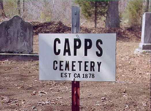
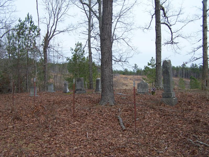
| Description | : | Located near the old Coxburg Community on Coxburg Road approximately 2 miles east of the McIllwain-Rockport Road intersection. The cemetery is on the north side of the road behind a house on the hill. The cemetery is not very well cared for. The last burial was in 1945. Approximately 600' north from the road, along the property line/fence line. |
frequently asked questions (FAQ):
-
Where is Capps Cemetery?
Capps Cemetery is located at 740 Coxburg Road West Holladay, Benton County ,Tennessee , 38341USA.
-
Capps Cemetery cemetery's updated grave count on graveviews.com?
0 memorials
-
Where are the coordinates of the Capps Cemetery?
Latitude: 35.8997002
Longitude: -88.0444031
Nearby Cemetories:
1. Fry Cemetery
Holladay, Benton County, USA
Coordinate: 35.8966530, -88.0252880
2. Malin Cemetery
Holladay, Benton County, USA
Coordinate: 35.8955430, -88.0161442
3. Cox Family Cemetery
Holladay, Benton County, USA
Coordinate: 35.8888100, -88.0700310
4. Tippitt Cemetery
Benton County, USA
Coordinate: 35.8877983, -88.0736008
5. Ezekiel Tippitt Cemetery
Holladay, Benton County, USA
Coordinate: 35.8875750, -88.0739270
6. Manley Chapel Cemetery
McIllwain, Benton County, USA
Coordinate: 35.8690750, -88.0543250
7. Moore's Chapel Cemetery
McIllwain, Benton County, USA
Coordinate: 35.8690750, -88.0543250
8. Friendship Church Cemetery
McIllwain, Benton County, USA
Coordinate: 35.8682710, -88.0551560
9. Peebles Sims Cemetery
Benton County, USA
Coordinate: 35.9236650, -88.0101830
10. Caney Fork Cemetery
Benton County, USA
Coordinate: 35.8885994, -88.0919037
11. Arthur Hatley Cemetery
Rockport, Benton County, USA
Coordinate: 35.9358430, -88.0661280
12. Hatley Cemetery
Mount Moriah, Benton County, USA
Coordinate: 35.9358430, -88.0661280
13. Hatley Cemetery
Benton County, USA
Coordinate: 35.9361000, -88.0661011
14. Matlock Cemetery
Benton County, USA
Coordinate: 35.9030991, -87.9944000
15. Dry Branch Cemetery
Holladay, Benton County, USA
Coordinate: 35.8985190, -87.9915550
16. Gossett Cemetery
Holladay, Benton County, USA
Coordinate: 35.9057020, -88.0969140
17. Wilbanks Cemetery
Holladay, Benton County, USA
Coordinate: 35.8831960, -87.9942490
18. Thornton Cemetery
Holladay, Benton County, USA
Coordinate: 35.8634810, -88.0791180
19. McIllwain Cemetery
McIllwain, Benton County, USA
Coordinate: 35.8634900, -88.0819700
20. Kelly Family Cemetery
Holladay, Benton County, USA
Coordinate: 35.9196200, -88.0985400
21. Eagle Creek Church Cemetery
Rockport, Benton County, USA
Coordinate: 35.9163200, -87.9833700
22. Luper Cemetery
Holladay, Benton County, USA
Coordinate: 35.9522370, -88.0372720
23. Dalton Cemetery
Mount Moriah, Benton County, USA
Coordinate: 35.9566680, -88.0498480
24. Baker McAuley Cemetery
Benton County, USA
Coordinate: 35.9556007, -88.0274963