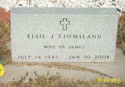
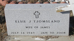
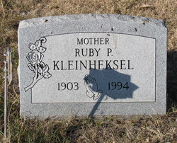
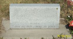
Elsie J Kleinheksel Tjomsland
| Birth | : | 14 Jul 1943 Pierre, Hughes County, South Dakota, USA |
| Death | : | 30 Jan 2008 Blunt, Hughes County, South Dakota, USA |
| Burial | : | Mad River Cemetery, Thornton, Grafton County, USA |
| Coordinate | : | 43.8833670, -71.6077500 |
| Plot | : | Section 2 Lot 142 Grave 6 |
| Description | : | Elsie Tjomsland, 64, Blunt, died Wednesday, Jan. 30, 2008, at her home in Blunt. Graveside service will be today at Scotty Philip Cemetery, Fort Pierre with Rev. Howard Grinager officiating. Elsie was born July 14, 1943 at St. Mary's Hospital in Pierre. In 1960, she married John Garner and they had two children, Robert and Brenda. In 1983, Elsie married Jim Tjomsland of Blunt. While in Blunt she owned TJ's Crafts for several years. Elsie enjoyed working with the kids on craft projects. She also worked at Blunt's landfill. Elsie... Read More |
frequently asked questions (FAQ):
-
Where is Elsie J Kleinheksel Tjomsland's memorial?
Elsie J Kleinheksel Tjomsland's memorial is located at: Mad River Cemetery, Thornton, Grafton County, USA.
-
When did Elsie J Kleinheksel Tjomsland death?
Elsie J Kleinheksel Tjomsland death on 30 Jan 2008 in Blunt, Hughes County, South Dakota, USA
-
Where are the coordinates of the Elsie J Kleinheksel Tjomsland's memorial?
Latitude: 43.8833670
Longitude: -71.6077500
Family Members:
Parent
Spouse
Siblings
Flowers:
Nearby Cemetories:
1. Mad River Cemetery
Thornton, Grafton County, USA
Coordinate: 43.8833670, -71.6077500
2. Packard Graveyard
Thornton, Grafton County, USA
Coordinate: 43.8971540, -71.5845930
3. Campton Village Cemetery
Campton, Grafton County, USA
Coordinate: 43.8654440, -71.6364380
4. Burbank Foss Cemetery
Campton Lower Village, Grafton County, USA
Coordinate: 43.8955730, -71.5667000
5. Town Line Cemetery
Campton, Grafton County, USA
Coordinate: 43.8614570, -71.6678870
6. Pine Grove Cemetery
Thornton, Grafton County, USA
Coordinate: 43.9060100, -71.6689000
7. Blake Mountain Cemetery
Thornton, Grafton County, USA
Coordinate: 43.8963600, -71.6794200
8. Yeaton Cemetery
Thornton, Grafton County, USA
Coordinate: 43.8963800, -71.6794500
9. West Thornton Cemetery
Thornton, Grafton County, USA
Coordinate: 43.8997200, -71.6805600
10. Campton Hollow Cemetery
Campton Hollow, Grafton County, USA
Coordinate: 43.8238150, -71.6409440
11. Eastern Corner Road Cemetery
Campton, Grafton County, USA
Coordinate: 43.8177540, -71.6045920
12. West Campton Cemetery
Grafton County, USA
Coordinate: 43.8622220, -71.7052780
13. Blaisdell Cemetery
Campton, Grafton County, USA
Coordinate: 43.8169440, -71.6555560
14. Mount Delight Burying Ground
North Sandwich, Carroll County, USA
Coordinate: 43.8385671, -71.5158940
15. Bog Road Cemetery
Campton, Grafton County, USA
Coordinate: 43.8152149, -71.6666793
16. Partridge Hill Cemetery
West Campton, Grafton County, USA
Coordinate: 43.8428700, -71.7046900
17. Blair Cemetery
Campton, Grafton County, USA
Coordinate: 43.8111000, -71.6603012
18. Pease Cemetery
Ellsworth, Grafton County, USA
Coordinate: 43.8741100, -71.7382000
19. Old Baptist Church Cemetery
Ellsworth, Grafton County, USA
Coordinate: 43.8738890, -71.7430560
20. Avery Cemetery
Ellsworth, Grafton County, USA
Coordinate: 43.8805600, -71.7511200
21. Ladd Cemetery
Holderness, Grafton County, USA
Coordinate: 43.7873700, -71.5506400
22. Waterville Valley Cemetery
Waterville Valley, Grafton County, USA
Coordinate: 43.9634670, -71.5087000
23. Eastman Cemetery
Sandwich, Carroll County, USA
Coordinate: 43.7930300, -71.5263500
24. True Cemetery
Holderness, Grafton County, USA
Coordinate: 43.7819440, -71.5538890

