
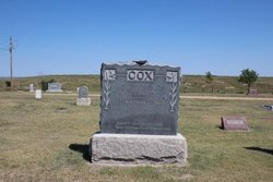
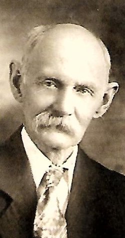
Elvira Hickerson Cox
| Birth | : | 2 Aug 1848 Lexington, Fayette County, Kentucky, USA |
| Death | : | 10 Apr 1925 Wray, Yuma County, Colorado, USA |
| Burial | : | St James Churchyard, Skillington, South Kesteven District, England |
| Coordinate | : | 52.8231750, -0.6724600 |
frequently asked questions (FAQ):
-
Where is Elvira Hickerson Cox's memorial?
Elvira Hickerson Cox's memorial is located at: St James Churchyard, Skillington, South Kesteven District, England.
-
When did Elvira Hickerson Cox death?
Elvira Hickerson Cox death on 10 Apr 1925 in Wray, Yuma County, Colorado, USA
-
Where are the coordinates of the Elvira Hickerson Cox's memorial?
Latitude: 52.8231750
Longitude: -0.6724600
Family Members:
Parent
Spouse

Siblings
Children

Flowers:


Nearby Cemetories:
1. St James Churchyard
Skillington, South Kesteven District, England
Coordinate: 52.8231750, -0.6724600
2. St Peter Churchyard
Stainby, South Kesteven District, England
Coordinate: 52.7953390, -0.6587990
3. St John the Baptist Churchyard
Buckminster, Melton Borough, England
Coordinate: 52.7981500, -0.6974900
4. St. John the Baptist Churchyard
Colsterworth, South Kesteven District, England
Coordinate: 52.8069090, -0.6214400
5. St Bartholomew's Churchyard
Sproxton, Melton Borough, England
Coordinate: 52.8150500, -0.7307100
6. St Peter's Churchyard
Saltby, Melton Borough, England
Coordinate: 52.8298400, -0.7378900
7. St. Peter's Churchyard
Gunby, East Lindsey District, England
Coordinate: 52.7840600, -0.6483000
8. St Nicholas Churchyard
Gunby, South Kesteven District, England
Coordinate: 52.7838800, -0.6481500
9. St Mary's Churchyard
North Witham, South Kesteven District, England
Coordinate: 52.7864400, -0.6252800
10. All Saints Churchyard
Stroxton, South Kesteven District, England
Coordinate: 52.8695300, -0.6609700
11. Holy Cross Churchyard
Great Ponton, South Kesteven District, England
Coordinate: 52.8638270, -0.6275570
12. St Andrew Churchyard
Coston, Melton Borough, England
Coordinate: 52.7905590, -0.7439280
13. St Mary and St Peter Churchyard
Harlaxton, South Kesteven District, England
Coordinate: 52.8836860, -0.6895640
14. Stonesby Saltby/Sproxton Road Cemetery
Sproxton, Melton Borough, England
Coordinate: 52.8143880, -0.7731270
15. St. Guthlac Churchyard
Little Ponton, South Kesteven District, England
Coordinate: 52.8796100, -0.6271200
16. St Botolph & St John Baptist Churchyard
Croxton Kerrial, Melton Borough, England
Coordinate: 52.8565120, -0.7608620
17. St Andrew Churchyard
Denton, South Kesteven District, England
Coordinate: 52.8828830, -0.7151840
18. St Peter's Churchyard
Stonesby, Melton Borough, England
Coordinate: 52.8140000, -0.7805100
19. Croxton Abbey
Croxton Kerrial, Melton Borough, England
Coordinate: 52.8398910, -0.7786310
20. St Thomas a Beckett Churchyard
Bassingthorpe, South Kesteven District, England
Coordinate: 52.8457500, -0.5669900
21. St Mary Churchyard
Garthorpe, Melton Borough, England
Coordinate: 52.7795740, -0.7685920
22. St Nicholas Churchyard
Thistleton, Rutland Unitary Authority, England
Coordinate: 52.7516900, -0.6483100
23. St Michael & All Angels Churchyard
Harston, Melton Borough, England
Coordinate: 52.8769700, -0.7556000
24. St Peter Churchyard
Wymondham, Melton Borough, England
Coordinate: 52.7585970, -0.7395410