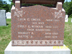
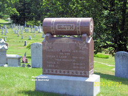
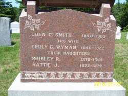
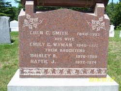
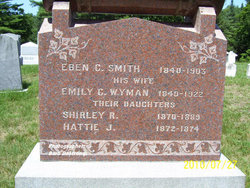
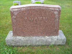
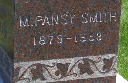
Emily Cornelia Wyman Smith
| Birth | : | 27 Jan 1840 Stockbridge, Windsor County, Vermont, USA |
| Death | : | 9 May 1922 Cabot, Washington County, Vermont, USA |
| Burial | : | Mountain View Funeral Home and Cemetery, Mesa, Maricopa County, USA |
| Coordinate | : | 33.4160995, -111.6603012 |
| Description | : | wife of Eben Smith |
frequently asked questions (FAQ):
-
Where is Emily Cornelia Wyman Smith's memorial?
Emily Cornelia Wyman Smith's memorial is located at: Mountain View Funeral Home and Cemetery, Mesa, Maricopa County, USA.
-
When did Emily Cornelia Wyman Smith death?
Emily Cornelia Wyman Smith death on 9 May 1922 in Cabot, Washington County, Vermont, USA
-
Where are the coordinates of the Emily Cornelia Wyman Smith's memorial?
Latitude: 33.4160995
Longitude: -111.6603012
Family Members:
Parent
Spouse
Siblings
Children
Flowers:
Nearby Cemetories:
1. Mountain View Funeral Home and Cemetery
Mesa, Maricopa County, USA
Coordinate: 33.4160995, -111.6603012
2. Mariposa Gardens Memorial Park
Mesa, Maricopa County, USA
Coordinate: 33.4081760, -111.6860250
3. Presbyterian Church of the Master Columbarium
Mesa, Maricopa County, USA
Coordinate: 33.4220990, -111.6879280
4. Love of Christ Lutheran Church Columbarium
Mesa, Maricopa County, USA
Coordinate: 33.4443000, -111.6834000
5. Victory Lutheran Church Memorial Garden
Mesa, Maricopa County, USA
Coordinate: 33.4238470, -111.7024970
6. Velda Rose Garden
Mesa, Maricopa County, USA
Coordinate: 33.4160000, -111.7110000
7. Apache Wells Community Church Columbarium
Mesa, Maricopa County, USA
Coordinate: 33.4545260, -111.7087900
8. Desert Haven Columbarium
Mesa, Maricopa County, USA
Coordinate: 33.4691300, -111.6850800
9. Church of the Transfiguration Columbarium
Mesa, Maricopa County, USA
Coordinate: 33.4061240, -111.5898330
10. Queen of Heaven Catholic Cemetery
Mesa, Maricopa County, USA
Coordinate: 33.3800011, -111.8000031
11. Mountain View Lutheran Church Columbarium
Apache Junction, Pinal County, USA
Coordinate: 33.3952940, -111.5119390
12. Saint Marks Episcopal Church Columbarium
Mesa, Maricopa County, USA
Coordinate: 33.4215140, -111.8147770
13. First Presbyterian Church of Mesa Columbarium
Mesa, Maricopa County, USA
Coordinate: 33.4190950, -111.8225900
14. Lehi Cemetery
Maricopa County, USA
Coordinate: 33.4811740, -111.8103000
15. First United Methodist Church Columbarium
Gilbert, Maricopa County, USA
Coordinate: 33.3435440, -111.8057160
16. First United Methodist Church of Mesa Columbarium
Mesa, Maricopa County, USA
Coordinate: 33.4127690, -111.8307530
17. City of Mesa Cemetery
Mesa, Maricopa County, USA
Coordinate: 33.4383774, -111.8329163
18. Goldfield Ghost Town Cemetery
Apache Junction, Pinal County, USA
Coordinate: 33.4560700, -111.4922390
19. First Evangelical Lutheran Church Memorial Garden
Mesa, Maricopa County, USA
Coordinate: 33.4182770, -111.8448890
20. Salt River Pima-Maricopa Indian Cemetery
Maricopa County, USA
Coordinate: 33.4687000, -111.8502000
21. Gilbert Memorial Park
Gilbert, Maricopa County, USA
Coordinate: 33.2633783, -111.7456097
22. Gold Canyon UMC Columbarium and Memorial Garden
Gold Canyon, Pinal County, USA
Coordinate: 33.3543840, -111.4559350
23. Catholic Church Cemetery
Salt River, Maricopa County, USA
Coordinate: 33.4853210, -111.8686880
24. Holy Trinity Lutheran Church Memory Gardens
Chandler, Maricopa County, USA
Coordinate: 33.3094100, -111.8532100

