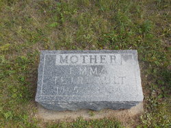
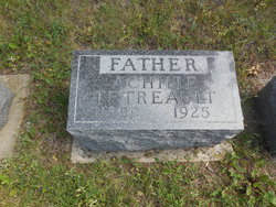
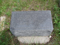
Emma Tetreault
| Birth | : | Jan 1865 Quebec, Canada |
| Death | : | 18 Apr 1954 Lawrence County, South Dakota, USA |
| Burial | : | Kowai Pass Cemetery, Springfield, Selwyn District, New Zealand |
| Coordinate | : | -43.3399830, 171.9334560 |
| Description | : | from ground reading in the 1970's, exact date and county from SD deaths on Ancestry. Emma Tetreault United States Census, 1900 Name Emma Tetreault Event Type Census Event Year 1900 Event Place Ashbury, Boulder, Centennial, Lower Centennial, Lower Whitewood, Lower False Bottom, St. Onge, Lawrence, South Dakota, United States Gender Female Age 35 Marital Status Married Race White Race (Original) W Relationship to Head of Household Wife Relationship to Head of Household (Original) Wife Number of Living Children 8 Years Married 17 Birth Date Jan 1865 Birthplace Canada Fr Marriage Year (Estimated) 1883 Immigration Year 1866 Father's Birthplace Canada Fr Mother's Birthplace Canada Fr Mother of how many children 8 Achille Tetreault Head M 41 Canada Fr Emma Tetreault Wife F 35 Canada Fr Elmena... Read More |
frequently asked questions (FAQ):
-
Where is Emma Tetreault's memorial?
Emma Tetreault's memorial is located at: Kowai Pass Cemetery, Springfield, Selwyn District, New Zealand.
-
When did Emma Tetreault death?
Emma Tetreault death on 18 Apr 1954 in Lawrence County, South Dakota, USA
-
Where are the coordinates of the Emma Tetreault's memorial?
Latitude: -43.3399830
Longitude: 171.9334560
Family Members:
Spouse
Children
Flowers:
Nearby Cemetories:
1. Kowai Pass Cemetery
Springfield, Selwyn District, New Zealand
Coordinate: -43.3399830, 171.9334560
2. Waddington Cemetery
Waddington, Selwyn District, New Zealand
Coordinate: -43.4001830, 172.0424870
3. South Malvern Cemetery
Glentunnel, Selwyn District, New Zealand
Coordinate: -43.4807300, 171.9475200
4. Kimberley Cemetery
Darfield, Selwyn District, New Zealand
Coordinate: -43.4485800, 172.1208100
5. St Johns Churchyard
Hororata, Selwyn District, New Zealand
Coordinate: -43.5189100, 171.9457550
6. Hororata Cemetery
Hororata, Selwyn District, New Zealand
Coordinate: -43.5196600, 171.9461100
7. Rockwood Station Cemetery
Windwhistle, Selwyn District, New Zealand
Coordinate: -43.4928406, 171.7730184
8. Glenroy War Memorial
Glenroy, Selwyn District, New Zealand
Coordinate: -43.5199750, 171.8345040
9. Trinity Church Columbarium
Darfield, Selwyn District, New Zealand
Coordinate: -43.4888350, 172.1052750
10. St Joseph's Catholic Cemetery
Darfield, Selwyn District, New Zealand
Coordinate: -43.4918030, 172.1081060
11. Oxford Cemetery
Oxford, Waimakariri District, New Zealand
Coordinate: -43.2976980, 172.2000500
12. Greendale Cemetery
Greendale, Selwyn District, New Zealand
Coordinate: -43.5447560, 172.0772460
13. Kirwee Cemetery
Kirwee, Selwyn District, New Zealand
Coordinate: -43.4935800, 172.2118100
14. St George's Anglican Churchyard
Kirwee, Selwyn District, New Zealand
Coordinate: -43.4940826, 172.2182446
15. St Matthew's Churchyard
Courtenay, Selwyn District, New Zealand
Coordinate: -43.4819060, 172.2792350
16. Lake Coleridge Cemetery
Lake Coleridge, Selwyn District, New Zealand
Coordinate: -43.3695530, 171.5264300
17. Cust Anglican Cemetery
Cust, Waimakariri District, New Zealand
Coordinate: -43.3103410, 172.3545810
18. Birch Hill Cemetery
Waimakariri District, New Zealand
Coordinate: -43.2144910, 172.3319440
19. Highbank Cemetery
Highbank, Ashburton District, New Zealand
Coordinate: -43.6228060, 171.7387780
20. Cust War Memorial
Cust, Waimakariri District, New Zealand
Coordinate: -43.3114200, 172.3736700
21. Halkett Presbyterian Churchyard
Halkett, Selwyn District, New Zealand
Coordinate: -43.5011000, 172.3220900
22. Cust-West Eyreton Cemetery
Cust, Waimakariri District, New Zealand
Coordinate: -43.3183330, 172.3877170
23. Barrhill Cemetery
Barrhill, Ashburton District, New Zealand
Coordinate: -43.6756950, 171.8480790
24. Methven Cemetery
Methven, Ashburton District, New Zealand
Coordinate: -43.6346810, 171.6563070

