
| Memorials | : | 18 |
| Location | : | Halkett, Selwyn District, New Zealand |
| Coordinate | : | -43.5011000, 172.3220900 |
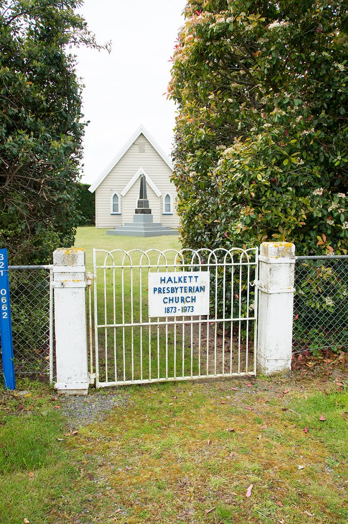
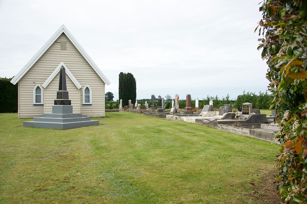
| Description | : | Halkett Presbyterian Church opened it's doors on 26 October 1873. Newspapers of the day said it could seat 100 people. It is situated on Halkett Road almost in the centre of Halkett, a rural area between West Melton and Courtenay that was formerly a large sheep run. Halkett gets it's name from a Captain Halkett who purchased a large chunk of land in the area, and also presented land for a school to be built. The adjoining cemetery is small, and contains the names of some of the area's earliest settlers including McKay, Whyte, Henderson and Ford.... Read More |
frequently asked questions (FAQ):
-
Where is Halkett Presbyterian Churchyard?
Halkett Presbyterian Churchyard is located at Cnr Halkett Rd and McKays Rd Halkett, Selwyn District ,Canterbury , 7671New Zealand.
-
Halkett Presbyterian Churchyard cemetery's updated grave count on graveviews.com?
18 memorials
-
Where are the coordinates of the Halkett Presbyterian Churchyard?
Latitude: -43.5011000
Longitude: 172.3220900
Nearby Cemetories:
1. St Matthew's Churchyard
Courtenay, Selwyn District, New Zealand
Coordinate: -43.4819060, 172.2792350
2. St Paul's Anglican Church Cemetery
West Melton, Selwyn District, New Zealand
Coordinate: -43.5261700, 172.3701800
3. St George's Anglican Churchyard
Kirwee, Selwyn District, New Zealand
Coordinate: -43.4940826, 172.2182446
4. Kirwee Cemetery
Kirwee, Selwyn District, New Zealand
Coordinate: -43.4935800, 172.2118100
5. Weedons Cemetery
Weedons, Selwyn District, New Zealand
Coordinate: -43.5670010, 172.4015870
6. Yaldhurst Cemetery
Yaldhurst, Christchurch City, New Zealand
Coordinate: -43.5109640, 172.4765980
7. St Saviours Churchyard
Templeton, Christchurch City, New Zealand
Coordinate: -43.5501420, 172.4714620
8. Shands Road Cemetery
Prebbleton, Selwyn District, New Zealand
Coordinate: -43.5792540, 172.4888630
9. Kimberley Cemetery
Darfield, Selwyn District, New Zealand
Coordinate: -43.4485800, 172.1208100
10. St Joseph's Catholic Cemetery
Darfield, Selwyn District, New Zealand
Coordinate: -43.4918030, 172.1081060
11. Trinity Church Columbarium
Darfield, Selwyn District, New Zealand
Coordinate: -43.4888350, 172.1052750
12. All Saint's Churchyard
Prebbleton, Selwyn District, New Zealand
Coordinate: -43.5781040, 172.5131430
13. Prebbleton Cemetery
Prebbleton, Selwyn District, New Zealand
Coordinate: -43.5887200, 172.5053500
14. St Mary's Churchyard
Springston, Selwyn District, New Zealand
Coordinate: -43.6446560, 172.4263590
15. Avonhead Memorial Cemetery
Avonhead, Christchurch City, New Zealand
Coordinate: -43.5095390, 172.5503920
16. Springston Cemetery
Lincoln, Selwyn District, New Zealand
Coordinate: -43.6404360, 172.4509420
17. St James Anglican Church
Harewood, Christchurch City, New Zealand
Coordinate: -43.4788400, 172.5579800
18. Lincoln Cemetery
Lincoln, Selwyn District, New Zealand
Coordinate: -43.6311790, 172.4862570
19. Brookside Cemetery
Brookside, Selwyn District, New Zealand
Coordinate: -43.6751800, 172.2683700
20. St Peter's Anglican Churchyard
Upper Riccarton, Christchurch City, New Zealand
Coordinate: -43.5317570, 172.5701330
21. Swannanoa Community Churchyard
Swannanoa, Waimakariri District, New Zealand
Coordinate: -43.3701500, 172.4975000
22. Greendale Cemetery
Greendale, Selwyn District, New Zealand
Coordinate: -43.5447560, 172.0772460
23. Waimairi Cemetery
Burnside, Christchurch City, New Zealand
Coordinate: -43.4997760, 172.5773860
24. Eyreton St Thomas' Anglican Cemetery
Swannanoa, Waimakariri District, New Zealand
Coordinate: -43.4153900, 172.5508800