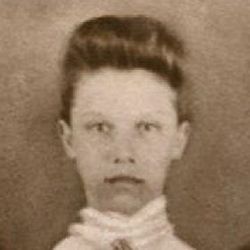
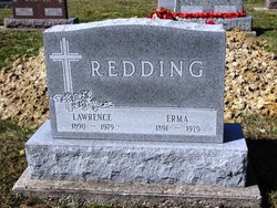
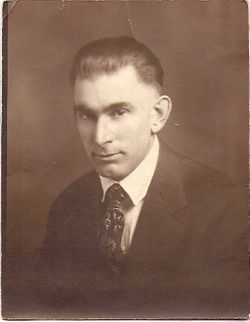
Erma Bell Hughes Redding
| Birth | : | 20 Jun 1891 Huntington County, Indiana, USA |
| Death | : | 18 Jul 1979 Fort Wayne, Allen County, Indiana, USA |
| Burial | : | St. Hilda's Churchyard, Chop Gate, Hambleton District, England |
| Coordinate | : | 54.3988950, -1.1299120 |
| Description | : | Obituary found in the Herald-Press, Wednesday, July 18, 1979, huntington, Indiana Erma Redding, 88, Roanoke, died unexpectedly at 3:31 a.m. Wednesday (July 18, 1070) in the Lutheran Hospital, Fort Wayne. She was a member of the Zion United Methodist Church, Roanoke. Mrs Redding was born June 20, 1891 in Huntington County to William V. and Ella Smith Hughes, and her marriage was on Dec. 25, 1913 to Lawrence Redding, who died Jan. 20, 1979. Surviving are four sons, Jack Redding and Joe Redding, both of Roanoke; Bill Redding, Fort Wayne; and Bob Redding, Florida; a brother,... Read More |
frequently asked questions (FAQ):
-
Where is Erma Bell Hughes Redding's memorial?
Erma Bell Hughes Redding's memorial is located at: St. Hilda's Churchyard, Chop Gate, Hambleton District, England.
-
When did Erma Bell Hughes Redding death?
Erma Bell Hughes Redding death on 18 Jul 1979 in Fort Wayne, Allen County, Indiana, USA
-
Where are the coordinates of the Erma Bell Hughes Redding's memorial?
Latitude: 54.3988950
Longitude: -1.1299120
Family Members:
Parent
Spouse
Siblings
Children
Flowers:
Nearby Cemetories:
1. St. Hilda's Churchyard
Chop Gate, Hambleton District, England
Coordinate: 54.3988950, -1.1299120
2. St. Andrew's Churchyard
Ingleby Greenhow, Hambleton District, England
Coordinate: 54.4487300, -1.1051300
3. St. Nicholas' Churchyard
Bransdale, Ryedale District, England
Coordinate: 54.3777000, -1.0464000
4. St. Augustine's Churchyard
Kirkby-in-Cleveland, Hambleton District, England
Coordinate: 54.4470300, -1.1715250
5. Saint John the Evangelist Churchyard
Bilsdale Midcable, Hambleton District, England
Coordinate: 54.3436000, -1.1192000
6. St Botolph Churchyard
Carlton-in-Cleveland, Hambleton District, England
Coordinate: 54.4338200, -1.2199490
7. St Mary Magdalene Churchyard
Faceby, Hambleton District, England
Coordinate: 54.4204090, -1.2377320
8. Emerson Family Mausoleum
Easby, Hambleton District, England
Coordinate: 54.4702280, -1.1098760
9. Holy Cross Old Churchyard
Swainby, Hambleton District, England
Coordinate: 54.4152440, -1.2567640
10. St Peter and St Paul Churchyard Cemetery Extension
Stokesley, Hambleton District, England
Coordinate: 54.4693040, -1.1853160
11. St Peter and St Paul Churchyard
Stokesley, Hambleton District, England
Coordinate: 54.4696430, -1.1902080
12. St Cuthbert Churchyard
Kildale, Hambleton District, England
Coordinate: 54.4779100, -1.0689200
13. Friends Burial Ground
Great Ayton, Hambleton District, England
Coordinate: 54.4880800, -1.1315580
14. All Saints Churchyard
Great Ayton, Hambleton District, England
Coordinate: 54.4897000, -1.1429000
15. Great Ayton Cemetery
Great Ayton, Hambleton District, England
Coordinate: 54.4931360, -1.1390010
16. Christ Church Churchyard Westerdale
Westerdale, Scarborough Borough, England
Coordinate: 54.4450870, -0.9781360
17. All Saints Churchyard
Hutton Rudby, Hambleton District, England
Coordinate: 54.4532040, -1.2737220
18. St Mary Churchyard
Farndale East, Ryedale District, England
Coordinate: 54.3693000, -0.9663000
19. All Saints Churchyard
Ingleby Arncliffe, Hambleton District, England
Coordinate: 54.3959000, -1.3042000
20. All Saints Churchyard
Hawnby, Ryedale District, England
Coordinate: 54.3000380, -1.1770300
21. St Peter Churchyard
Osmotherley, Hambleton District, England
Coordinate: 54.3681190, -1.3001490
22. St Martin Churchyard
Seamer, Hambleton District, England
Coordinate: 54.4856000, -1.2322000
23. Osmotherley Cemetery
Osmotherley, Hambleton District, England
Coordinate: 54.3684200, -1.3046700
24. Mount Grace Priory
East Harlsey, Hambleton District, England
Coordinate: 54.3799590, -1.3109160


