
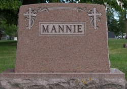

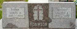
Ermena Agnes Robinson Mannie
| Birth | : | 16 Mar 1896 Frankfort, Spink County, South Dakota, USA |
| Death | : | 5 Aug 1950 Watertown, Codington County, South Dakota, USA |
| Burial | : | St. John the Baptist Churchyard, Little Marlow, Wycombe District, England |
| Coordinate | : | 51.5826450, -0.7398600 |
frequently asked questions (FAQ):
-
Where is Ermena Agnes Robinson Mannie's memorial?
Ermena Agnes Robinson Mannie's memorial is located at: St. John the Baptist Churchyard, Little Marlow, Wycombe District, England.
-
When did Ermena Agnes Robinson Mannie death?
Ermena Agnes Robinson Mannie death on 5 Aug 1950 in Watertown, Codington County, South Dakota, USA
-
Where are the coordinates of the Ermena Agnes Robinson Mannie's memorial?
Latitude: 51.5826450
Longitude: -0.7398600
Family Members:
Parent

Spouse

Siblings
Children


Flowers:


Nearby Cemetories:
1. St. John the Baptist Churchyard
Little Marlow, Wycombe District, England
Coordinate: 51.5826450, -0.7398600
2. Fern Lane Cemetery
Little Marlow, Wycombe District, England
Coordinate: 51.5887390, -0.7273880
3. Marlow Cemetery
Marlow, Wycombe District, England
Coordinate: 51.5773094, -0.7761266
4. St. Peter Roman Catholic Churchyard
Marlow, Wycombe District, England
Coordinate: 51.5695438, -0.7723466
5. Holy Trinity Churchyard
Marlow, Wycombe District, England
Coordinate: 51.5750000, -0.7768000
6. St John the Baptist Churchyard
Cookham Dean, Windsor and Maidenhead Royal Borough, England
Coordinate: 51.5581960, -0.7447210
7. All Saints Churchyard
Marlow, Wycombe District, England
Coordinate: 51.5679730, -0.7732080
8. United Reformed Church Cemetery
Bourne End, Wycombe District, England
Coordinate: 51.5769930, -0.6972670
9. Bethel Chapel Cores End-Independent
Wooburn, Wycombe District, England
Coordinate: 51.5770400, -0.6971420
10. Christ Church
Marlow, Wycombe District, England
Coordinate: 51.5712799, -0.7795249
11. Sir William Borlase's Grammar School Chapel
Marlow, Wycombe District, England
Coordinate: 51.5702500, -0.7811730
12. Holy Trinity Churchyard
Cookham, Windsor and Maidenhead Royal Borough, England
Coordinate: 51.5613910, -0.7074150
13. Wooburn & Bourne End Cemetery
Wooburn, Wycombe District, England
Coordinate: 51.5795260, -0.6919400
14. St. Paul's Churchyard
Wooburn, Wycombe District, England
Coordinate: 51.5816640, -0.6886330
15. All Saints Churchyard
Bisham, Windsor and Maidenhead Royal Borough, England
Coordinate: 51.5611410, -0.7780430
16. St Nicholas Churchyard
Hedsor, Wycombe District, England
Coordinate: 51.5675780, -0.6924980
17. Cookham Parish Cemetery
Cookham, Windsor and Maidenhead Royal Borough, England
Coordinate: 51.5485170, -0.7270770
18. Bisham Priory
Bisham, Windsor and Maidenhead Royal Borough, England
Coordinate: 51.5566350, -0.7796570
19. Cliveden War Memorial Cemetery
Taplow, South Bucks District, England
Coordinate: 51.5578380, -0.6900160
20. Altona Road Cemetery
Chepping Wycombe, Wycombe District, England
Coordinate: 51.6102200, -0.6938200
21. Cliveden House Pet Cemetery
Taplow, South Bucks District, England
Coordinate: 51.5590770, -0.6880610
22. Atlona Road Cemetery
Loudwater, Wycombe District, England
Coordinate: 51.6101490, -0.6932680
23. Cliveden Chapel
Taplow, South Bucks District, England
Coordinate: 51.5571020, -0.6899240
24. High Wycombe Friends Burial Ground
High Wycombe, Wycombe District, England
Coordinate: 51.6282800, -0.7428870