
| Birth | : | 1 Oct 1907 Muscotah, Atchison County, Kansas, USA |
| Death | : | 13 Mar 1998 Hiawatha, Brown County, Kansas, USA |
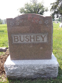
| Burial | : | Mount Hope Cemetery, Hiawatha, Brown County, USA |
| Coordinate | : | 39.8497009, -95.5156021 |
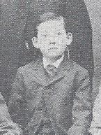
| Description | : | Obit. from Atchison Globe Esther Bushey Shear HIAWATHA- Esther Bushey Shear,90, Hiawatha, died Friday, March 13, 1998, at a Hiawatha Hospital. Mrs. Shear and her husband farmed near Robinson until 1976. She was born Oct. 1, 1907, at Muscotah, the daughter of Chastine Dwight and Mabel Berry Bushey. She was reared at Muscotah. She moved to Robinson from the farm in 1976, and she moved to Hiawatha in 1991. Mrs. Shear was a member of Bethany United Church of Christ at Hiawatha, the Guild at the church and the Manville Sunshine Club. She married Leonard Shear on Jan. 12, 1925, at... Read More |
frequently asked questions (FAQ):
-
Where is Esther Bushey Shear's memorial?
Esther Bushey Shear's memorial is located at: Mount Hope Cemetery, Hiawatha, Brown County, USA.
-
When did Esther Bushey Shear death?
Esther Bushey Shear death on 13 Mar 1998 in Hiawatha, Brown County, Kansas, USA
-
Where are the coordinates of the Esther Bushey Shear's memorial?
Latitude: 39.8497009
Longitude: -95.5156021
Family Members:
Parent
Spouse

Siblings

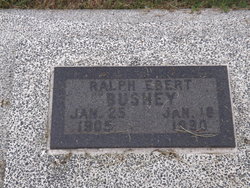
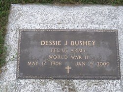
Children
Flowers:


Nearby Cemetories:
1. Mount Hope Cemetery
Hiawatha, Brown County, USA
Coordinate: 39.8497009, -95.5156021
2. Hiawatha Cemetery
Hiawatha, Brown County, USA
Coordinate: 39.8601799, -95.5265198
3. Bemis Cemetery
Hiawatha, Brown County, USA
Coordinate: 39.8194900, -95.5668300
4. Claytonville Cemetery
Horton, Brown County, USA
Coordinate: 39.7766991, -95.5046997
5. Niles Cemetery
Hiawatha, Brown County, USA
Coordinate: 39.8730900, -95.6126300
6. Ununda Cemetery
Robinson, Brown County, USA
Coordinate: 39.8582993, -95.4143982
7. Oakland Cemetery
Padonia, Brown County, USA
Coordinate: 39.9273900, -95.5610900
8. Rose Hill Cemetery
Robinson, Brown County, USA
Coordinate: 39.8097000, -95.4139023
9. Shelton Cemetery
Hamlin, Brown County, USA
Coordinate: 39.8852997, -95.6393967
10. Hart Cemetery
Reserve, Brown County, USA
Coordinate: 39.9519005, -95.5366974
11. Carson Cemetery
Hamlin, Brown County, USA
Coordinate: 39.8810200, -95.6483100
12. Madison Cemetery
Robinson, Brown County, USA
Coordinate: 39.7717700, -95.4201700
13. Kenyon Cemetery
Robinson, Brown County, USA
Coordinate: 39.9122000, -95.3964600
14. Hamlin Cemetery
Hamlin, Brown County, USA
Coordinate: 39.9206009, -95.6292877
15. Pleasant Hill Cemetery
Irving Township, Brown County, USA
Coordinate: 39.9435997, -95.4328232
16. Powhattan Cemetery
Powhattan, Brown County, USA
Coordinate: 39.7681007, -95.6288986
17. Pleasant Hill Cemetery
Fairview, Brown County, USA
Coordinate: 39.8411800, -95.6716400
18. Saint Paul Lutheran Cemetery
Fairview, Brown County, USA
Coordinate: 39.8559700, -95.6779700
19. Upper Wolf Lutheran Cemetery
Robinson, Brown County, USA
Coordinate: 39.7690010, -95.3893509
20. Cornelison Cemetery
Reserve, Brown County, USA
Coordinate: 39.9754105, -95.5485687
21. Pleasant Ridge Cemetery
Brown County, USA
Coordinate: 39.7928009, -95.3654022
22. Laus Creek Cemetery
Reserve, Brown County, USA
Coordinate: 39.9754105, -95.4699936
23. Immanuel Lutheran Cemetery
Fairview, Brown County, USA
Coordinate: 39.8559700, -95.6858500
24. Carr Cemetery
Everest, Brown County, USA
Coordinate: 39.7254600, -95.4521600