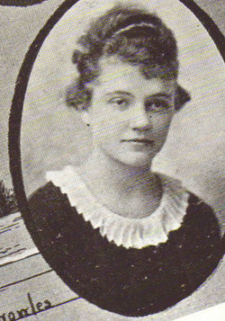
Esther Dorinda “Do” Lamson Johnson
| Birth | : | 20 Sep 1889 Fairfield, Jefferson County, Iowa, USA |
| Death | : | 27 Apr 1967 Ottumwa, Wapello County, Iowa, USA |
| Burial | : | Watervliet Cemetery, Watervliet, Berrien County, USA |
| Coordinate | : | 42.1886110, -86.2536110 |
| Plot | : | Old.P.038 |
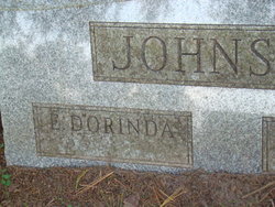
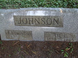
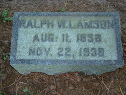
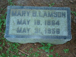
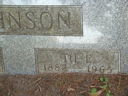
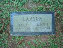
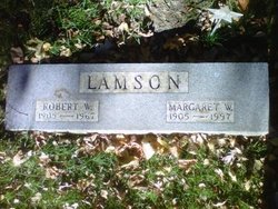
| Description | : | Daughter of Ralph Waldo Lamson and Mary Bowman Lamson. Wife of Til E. Johnson, married October 14, 1912 in Fairfield, Iowa. The birth and death year inscriptons for Esther have not been engraved on her portion of the joint headstone with Til E Johnson. |
frequently asked questions (FAQ):
-
Where is Esther Dorinda “Do” Lamson Johnson's memorial?
Esther Dorinda “Do” Lamson Johnson's memorial is located at: Watervliet Cemetery, Watervliet, Berrien County, USA.
-
When did Esther Dorinda “Do” Lamson Johnson death?
Esther Dorinda “Do” Lamson Johnson death on 27 Apr 1967 in Ottumwa, Wapello County, Iowa, USA
-
Where are the coordinates of the Esther Dorinda “Do” Lamson Johnson's memorial?
Latitude: 42.1886110
Longitude: -86.2536110
Family Members:
Parent
Spouse
Siblings
Flowers:
Nearby Cemetories:
1. Watervliet Cemetery
Watervliet, Berrien County, USA
Coordinate: 42.1886110, -86.2536110
2. Saint Josephs Catholic Cemetery
Watervliet, Berrien County, USA
Coordinate: 42.1852989, -86.2722015
3. Fairview Memorial Cemetery
Watervliet, Berrien County, USA
Coordinate: 42.1969440, -86.2236110
4. Coloma Cemetery
Coloma, Berrien County, USA
Coordinate: 42.1860008, -86.3119965
5. Saint Pauls United Church of Christ Cemetery
Watervliet, Berrien County, USA
Coordinate: 42.1447222, -86.2819444
6. Saint Marys Catholic Church Cemetery
Watervliet, Berrien County, USA
Coordinate: 42.1450000, -86.2916670
7. Baptist Cemetery
Bainbridge Center, Berrien County, USA
Coordinate: 42.1455600, -86.2947300
8. New Hope United Methodist Church Cemetery
Bainbridge Center, Berrien County, USA
Coordinate: 42.1380530, -86.2812620
9. Kniebes Cemetery
Coloma, Berrien County, USA
Coordinate: 42.1511002, -86.3071976
10. Rush Lake Indian Cemetery
Hartford, Van Buren County, USA
Coordinate: 42.2357340, -86.2058600
11. Pioneer Cemetery
Hartford, Van Buren County, USA
Coordinate: 42.2052200, -86.1769400
12. Emmanuel Home Cemetery
Covert, Van Buren County, USA
Coordinate: 42.2508253, -86.2624946
13. Maple Hill Cemetery
Hartford, Van Buren County, USA
Coordinate: 42.1980600, -86.1683300
14. Boyer Cemetery
Bainbridge Center, Berrien County, USA
Coordinate: 42.1572222, -86.3305556
15. Byers Cemetery
Bainbridge Center, Berrien County, USA
Coordinate: 42.1156700, -86.2680820
16. Bainbridge Cemetery
Bainbridge Center, Berrien County, USA
Coordinate: 42.1156006, -86.2694016
17. Harris Cemetery
Lake Michigan Beach, Berrien County, USA
Coordinate: 42.2144012, -86.3482971
18. Curtis Cemetery
Hagar Township, Berrien County, USA
Coordinate: 42.1856003, -86.3544006
19. Main Family Cemetery
Hartford, Van Buren County, USA
Coordinate: 42.2299530, -86.1575240
20. Fish Cemetery
Covert, Van Buren County, USA
Coordinate: 42.2655983, -86.2981033
21. Millburg Cemetery
Millburg, Berrien County, USA
Coordinate: 42.1264000, -86.3486023
22. Van Auken Cemetery
Van Buren County, USA
Coordinate: 42.2586100, -86.1644400
23. Keeler Cemetery
Keeler, Van Buren County, USA
Coordinate: 42.1129875, -86.1657715
24. North Shore Memory Gardens
Coloma, Berrien County, USA
Coordinate: 42.2024994, -86.3908005

