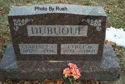
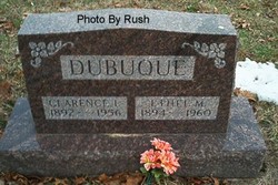
Ethel M. Croutcher Dubuque
| Birth | : | 20 Nov 1894 McLean County, Illinois, USA |
| Death | : | 28 Apr 1960 Cass County, Indiana, USA |
| Burial | : | Scotforth Cemetery, Scotforth, City of Lancaster, England |
| Coordinate | : | 54.0282250, -2.8007170 |
| Description | : | Services will be held at 1:30 p.m. Sunday at the Harrison funeral home in Royal Center for Mrs. Ethel Dubuque, 65, victim of a two-car accident Thursday on State road 17, just north of Logansport. Rev. David St. Clair will officiate and burial will be in Buck cemetery. Meanwhile, state police and sheriffs officers continued an investigation of the crash to determine exact cause. Mrs. Dubuque was born in McCain county, Ill., Nov. 20, 1894, the daughter of Albert Walter and Malissa Belcher Croutcher. Her marriage was to Clarence Dubuque, who is deceased. Surviving are one daughter, Mrs. Dorothy Neff, Logansport; two... Read More |
frequently asked questions (FAQ):
-
Where is Ethel M. Croutcher Dubuque's memorial?
Ethel M. Croutcher Dubuque's memorial is located at: Scotforth Cemetery, Scotforth, City of Lancaster, England.
-
When did Ethel M. Croutcher Dubuque death?
Ethel M. Croutcher Dubuque death on 28 Apr 1960 in Cass County, Indiana, USA
-
Where are the coordinates of the Ethel M. Croutcher Dubuque's memorial?
Latitude: 54.0282250
Longitude: -2.8007170
Family Members:
Parent
Spouse
Siblings
Children
Flowers:
Nearby Cemetories:
1. Scotforth Cemetery
Scotforth, City of Lancaster, England
Coordinate: 54.0282250, -2.8007170
2. Mount Street Congregational Chapel
Lancaster, City of Lancaster, England
Coordinate: 54.0468260, -2.8027430
3. Cathedral Cemetery of Lancaster
Lancaster, City of Lancaster, England
Coordinate: 54.0471170, -2.7942920
4. Friends Meeting House Burial Ground
Lancaster, City of Lancaster, England
Coordinate: 54.0482500, -2.8058025
5. St. Nicholas Street Chapel Churchyard
Lancaster, City of Lancaster, England
Coordinate: 54.0486900, -2.7987900
6. Lancaster Castle Cemetery
Lancaster, City of Lancaster, England
Coordinate: 54.0494330, -2.8047890
7. St. John the Evangelist Churchyard
Lancaster, City of Lancaster, England
Coordinate: 54.0504000, -2.7990000
8. Lancaster Priory
Lancaster, City of Lancaster, England
Coordinate: 54.0507360, -2.8057850
9. Lancaster Cemetery
Lancaster, City of Lancaster, England
Coordinate: 54.0504210, -2.7768760
10. Saint Luke's Parish Churchyard
Skerton, City of Lancaster, England
Coordinate: 54.0564700, -2.7982600
11. St John’s Church Graveyard
Ellel, City of Lancaster, England
Coordinate: 53.9990010, -2.7846660
12. St. Helen's Churchyard
Overton, City of Lancaster, England
Coordinate: 54.0111620, -2.8552950
13. Skerton Cemetery
Lancaster, City of Lancaster, England
Coordinate: 54.0651430, -2.7951140
14. Quernmore Methodist Churchyard
Quernmore, City of Lancaster, England
Coordinate: 54.0259440, -2.7361400
15. St Peter's Churchyard
Quernmore, City of Lancaster, England
Coordinate: 54.0367200, -2.7375400
16. Lancaster and Morecambe Crematorium
Lancaster, City of Lancaster, England
Coordinate: 54.0650890, -2.8198420
17. Christ Church of Glasson Churchyard
Glasson, City of Lancaster, England
Coordinate: 53.9966870, -2.8421460
18. Torrisholme Cemetery
Morecambe, City of Lancaster, England
Coordinate: 54.0638980, -2.8409800
19. St Thomas with Elizabeth Churchyard
Thurnham, City of Lancaster, England
Coordinate: 53.9819990, -2.8159520
20. St Wilfrid's Churchyard
Halton, City of Lancaster, England
Coordinate: 54.0759400, -2.7672600
21. St. Mary's Chapel Ellel Grange
Ellel, City of Lancaster, England
Coordinate: 53.9756944, -2.7918522
22. Hale Carr Lane Cemetery
Morecambe, City of Lancaster, England
Coordinate: 54.0520500, -2.8833940
23. Holy Trinity Church Poulton-le-Sands
Morecambe, City of Lancaster, England
Coordinate: 54.0744769, -2.8569331
24. Morecambe Cemetery
Morecambe, City of Lancaster, England
Coordinate: 54.0759090, -2.8572610


