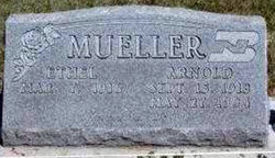
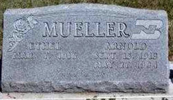
Ethel Mae Bacon Mueller
| Birth | : | 7 Mar 1916 |
| Death | : | 1 May 2007 |
| Burial | : | Malton Cemetery, Malton, Ryedale District, England |
| Coordinate | : | 54.1392670, -0.7980300 |
| Description | : | IMPERIAL -- Ethel Mae Mueller, 91, died Tuesday (May 1, 2007) at Imperial Manor Nursing Home. She was born March 7, 1916, in Richardson County, to Worthy and Nellie (Crouch) Bacon. She attended Pleasant Valley Country School southwest of Dawson. She married Arnold D. Mueller on July 29, 1933, at Oregon, Mo. The couple then settled on a farm in the southeast corner of Richardson County. The family moved to Wauneta in 1943. He preceded her in death 1984 and she soon after moved to Imperial. She was a member of the United Methodist Church of Wauneta and the VFW... Read More |
frequently asked questions (FAQ):
-
Where is Ethel Mae Bacon Mueller's memorial?
Ethel Mae Bacon Mueller's memorial is located at: Malton Cemetery, Malton, Ryedale District, England.
-
When did Ethel Mae Bacon Mueller death?
Ethel Mae Bacon Mueller death on 1 May 2007 in
-
Where are the coordinates of the Ethel Mae Bacon Mueller's memorial?
Latitude: 54.1392670
Longitude: -0.7980300
Family Members:
Parent
Spouse
Siblings
Children
Flowers:
Nearby Cemetories:
1. Malton Cemetery
Malton, Ryedale District, England
Coordinate: 54.1392670, -0.7980300
2. St. Leonard with St. Mary Churchyard
Malton, Ryedale District, England
Coordinate: 54.1348110, -0.7946110
3. Old Malton Cemetery
Malton, Ryedale District, England
Coordinate: 54.1443200, -0.7808900
4. St Mary the Virgin Priory Churchyard
Malton, Ryedale District, England
Coordinate: 54.1427520, -0.7786450
5. Norton Cemetery
Norton, Ryedale District, England
Coordinate: 54.1306400, -0.7834200
6. St Peter Churchyard
Norton, Ryedale District, England
Coordinate: 54.1289040, -0.7861910
7. St Helen Churchyard
Amotherby, Ryedale District, England
Coordinate: 54.1512000, -0.8521000
8. St. Margaret's Churchyard
Huttons Ambo, Ryedale District, England
Coordinate: 54.1066490, -0.8490640
9. Settrington Cemetery
Settrington, Ryedale District, England
Coordinate: 54.1254200, -0.7221700
10. St Andrew Churchyard
Langton, Ryedale District, England
Coordinate: 54.0934510, -0.7834680
11. All Saints Churchyard
Appleton-le-Street, Ryedale District, England
Coordinate: 54.1529500, -0.8766300
12. All Saints Churchyard
Settrington, Ryedale District, England
Coordinate: 54.1212780, -0.7178830
13. Castle Howard Mausoleum
Castle Howard, Ryedale District, England
Coordinate: 54.1173870, -0.8886900
14. St. Mary's Churchyard
Westow, Ryedale District, England
Coordinate: 54.0846190, -0.8406850
15. St Michael Churchyard
Barton-le-Street, Ryedale District, England
Coordinate: 54.1587100, -0.8969600
16. St. Andrew's Churchyard
Rillington, Ryedale District, England
Coordinate: 54.1579700, -0.6959800
17. Coneysthorpe Cemetery
Coneysthorpe, Ryedale District, England
Coordinate: 54.1308750, -0.9042820
18. St. Nicholas Churchyard
North Grimston, Ryedale District, England
Coordinate: 54.0989220, -0.7148680
19. St. Andrew’s Churchyard Extension
Rillington, Ryedale District, England
Coordinate: 54.1558500, -0.6926500
20. Burythorpe Churchyard
Burythorpe, Ryedale District, England
Coordinate: 54.0752951, -0.7955984
21. All Saints' Churchyard
Thorpe Bassett, Ryedale District, England
Coordinate: 54.1496503, -0.6875921
22. St Laurence Churchyard
Kirby Misperton, Ryedale District, England
Coordinate: 54.2057120, -0.8070710
23. St Mary Churchyard
Birdsall, Ryedale District, England
Coordinate: 54.0780000, -0.7508000
24. St John the Evangelist Churchyard
Welburn (Malton), Ryedale District, England
Coordinate: 54.1008850, -0.8985440


