
| Birth | : | 9 Dec 1908 Winneshiek County, Iowa, USA |
| Death | : | 10 Oct 2005 Mabel, Fillmore County, Minnesota, USA |
| Burial | : | Hazel Dell Cemetery, Council Bluffs, Pottawattamie County, USA |
| Coordinate | : | 41.3489723, -95.7939911 |
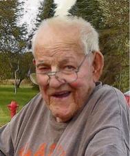
| Description | : | Evelyn M. Underbakke, age 96 of Mabel, Minnesota and formerly of Burr Oak, Iowa, died Monday, October 10, 2005 at Green Lea Manor in Mabel. Funeral services will be held at 11:00 A.M. Saturday, October 15, 2005 at Burr Oak Lutheran Church by Rev. Allen Hermeier, with burial in Burr Oak Cemetery. Friends may call from 5:00-7:00 P.M. Friday, October 14, 2005 at Fjelstul Funeral Home in Decorah and an hour prior to the services on Saturday at the church. Evelyn Marie Underbakke was born December 9, 1908 near Castalia, Iowa, the oldest daughter of John and... Read More |
frequently asked questions (FAQ):
-
Where is Evelyn Marie Decou Underbakke's memorial?
Evelyn Marie Decou Underbakke's memorial is located at: Hazel Dell Cemetery, Council Bluffs, Pottawattamie County, USA.
-
When did Evelyn Marie Decou Underbakke death?
Evelyn Marie Decou Underbakke death on 10 Oct 2005 in Mabel, Fillmore County, Minnesota, USA
-
Where are the coordinates of the Evelyn Marie Decou Underbakke's memorial?
Latitude: 41.3489723
Longitude: -95.7939911
Family Members:
Parent
Spouse

Siblings
Children
Flowers:


Nearby Cemetories:
1. Hazel Dell Cemetery
Council Bluffs, Pottawattamie County, USA
Coordinate: 41.3489723, -95.7939911
2. Gregg Cemetery
Weston, Pottawattamie County, USA
Coordinate: 41.3330000, -95.7931000
3. Saint Columbanus Cemetery
Weston, Pottawattamie County, USA
Coordinate: 41.3429440, -95.7435260
4. Evans Cemetery
Crescent, Pottawattamie County, USA
Coordinate: 41.3255997, -95.8368988
5. Crescent Cemetery
Crescent, Pottawattamie County, USA
Coordinate: 41.3664894, -95.8566208
6. Garner Cemetery
Council Bluffs, Pottawattamie County, USA
Coordinate: 41.2956161, -95.8001709
7. Downsville Cemetery
Pottawattamie County, USA
Coordinate: 41.3502998, -95.7039032
8. William C McIntosh Cemetery
Crescent, Pottawattamie County, USA
Coordinate: 41.4088745, -95.8477097
9. Green Valley Cemetery
Council Bluffs, Pottawattamie County, USA
Coordinate: 41.2743988, -95.8225021
10. Saint Joseph Cemetery
Council Bluffs, Pottawattamie County, USA
Coordinate: 41.2722015, -95.8208008
11. Reels Cemetery
Crescent, Pottawattamie County, USA
Coordinate: 41.4234100, -95.8321700
12. Walnut Hill Cemetery
Council Bluffs, Pottawattamie County, USA
Coordinate: 41.2719002, -95.8255997
13. Bikhor Cholim Cemetery
Council Bluffs, Pottawattamie County, USA
Coordinate: 41.2703670, -95.8229350
14. Cedar Lawn Cemetery
Council Bluffs, Pottawattamie County, USA
Coordinate: 41.2694016, -95.8182983
15. Oak Hill Cemetery
Council Bluffs, Pottawattamie County, USA
Coordinate: 41.2700900, -95.8226400
16. Ridgewood Cemetery
Council Bluffs, Pottawattamie County, USA
Coordinate: 41.2694016, -95.8272018
17. H G Fisher Cemetery
Underwood, Pottawattamie County, USA
Coordinate: 41.3838997, -95.6889038
18. Memorial Park Cemetery
Council Bluffs, Pottawattamie County, USA
Coordinate: 41.2644005, -95.8261032
19. Saint Pauls Lutheran Cemetery
Neola, Pottawattamie County, USA
Coordinate: 41.4337000, -95.7607000
20. Fairview Cemetery
Council Bluffs, Pottawattamie County, USA
Coordinate: 41.2703018, -95.8480988
21. Grange Cemetery
Honey Creek, Pottawattamie County, USA
Coordinate: 41.4446678, -95.8034668
22. Clark Cemetery
Pottawattamie County, USA
Coordinate: 41.2551610, -95.8223390
23. Pottawattamie County Home Cemetery
McClelland, Pottawattamie County, USA
Coordinate: 41.3269400, -95.6691738
24. Stoker-Graybill Cemetery
Council Bluffs, Pottawattamie County, USA
Coordinate: 41.2532620, -95.7751770