
| Birth | : | 8 Sep 1892 Coloma, El Dorado County, California, USA |
| Death | : | 5 Aug 1942 Placerville, El Dorado County, California, USA |
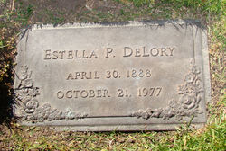
| Burial | : | Pioneer Cemetery, Coloma, El Dorado County, USA |
| Coordinate | : | 38.7943192, -120.8894577 |
| Plot | : | Grave 82 |
| Description | : | The Mountain Democrat, Placerville, CA Thursday, 6 Jul 1942 "The funeral services for Everett Edmund De Lory, of Coloma, will be held at 2:30 o'clock Saturday afternoon at the Methodist Church in his home city and interment will be at Coloma Cemetery. Mr. De Lory passed away Wednesday evening at Placerville Sanatorium, where he had been admitted as a patient on Wednesday morning for the treatment of an apparent throat congestion. The arrangements for the funeral services were announced by Memory Chapel. Officers of Placerville Parlor No. 9, N. S. G. W. will assist the Rev. J. R. Rudkin in the last... Read More |
frequently asked questions (FAQ):
-
Where is Everett Edmund DeLory Jr.'s memorial?
Everett Edmund DeLory Jr.'s memorial is located at: Pioneer Cemetery, Coloma, El Dorado County, USA.
-
When did Everett Edmund DeLory Jr. death?
Everett Edmund DeLory Jr. death on 5 Aug 1942 in Placerville, El Dorado County, California, USA
-
Where are the coordinates of the Everett Edmund DeLory Jr.'s memorial?
Latitude: 38.7943192
Longitude: -120.8894577
Family Members:
Parent

Spouse
Siblings
Flowers:


Nearby Cemetories:
1. Pioneer Cemetery
Coloma, El Dorado County, USA
Coordinate: 38.7943192, -120.8894577
2. Saint John's Catholic Churchyard
Coloma, El Dorado County, USA
Coordinate: 38.7975311, -120.8919678
3. James Marshall Monument and Gravesite
Coloma, El Dorado County, USA
Coordinate: 38.7963104, -120.8953781
4. Indian Creek Cemetery
Coloma, El Dorado County, USA
Coordinate: 38.7974230, -120.9104530
5. Uniontown Cemetery
Lotus, El Dorado County, USA
Coordinate: 38.7994003, -120.9111023
6. Wakamastu Tea and Silk Farm Colony Burial Site
Coloma, El Dorado County, USA
Coordinate: 38.7674100, -120.8858100
7. Gold Hill Cemetery
Gold Hill, El Dorado County, USA
Coordinate: 38.7604010, -120.8849970
8. Alabama Flat Cemetery
Garden Valley, El Dorado County, USA
Coordinate: 38.8413660, -120.8770510
9. Cold Springs Cemetery
Cold Springs, El Dorado County, USA
Coordinate: 38.7441444, -120.8721619
10. Kelsey Cemetery
Kelsey, El Dorado County, USA
Coordinate: 38.7949791, -120.8200073
11. Chili Bar Toll House Cemetery
Placerville, El Dorado County, USA
Coordinate: 38.7700530, -120.8177660
12. Westwood Hills Memorial Park
Placerville, El Dorado County, USA
Coordinate: 38.7367363, -120.8326035
13. Westwood Hills Memorial Park Pet Cemetery
Placerville, El Dorado County, USA
Coordinate: 38.7365210, -120.8323130
14. Middletown Cemetery
Placerville, El Dorado County, USA
Coordinate: 38.7358704, -120.8301010
15. Jayhawk Cemetery
Rescue, El Dorado County, USA
Coordinate: 38.7308006, -120.9627991
16. Missouri Flat Cemetery
Placerville, El Dorado County, USA
Coordinate: 38.7157360, -120.8403400
17. Rose Springs Cemetery
Rescue, El Dorado County, USA
Coordinate: 38.7146150, -120.9398390
18. Placerville Union Cemetery
Placerville, El Dorado County, USA
Coordinate: 38.7317390, -120.8084106
19. Jewish Pioneer Cemetery
Placerville, El Dorado County, USA
Coordinate: 38.7299500, -120.8091965
20. Saint Patrick Cemetery
Placerville, El Dorado County, USA
Coordinate: 38.7327995, -120.8047638
21. Boles Family Cemetery
Placerville, El Dorado County, USA
Coordinate: 38.7309860, -120.8069580
22. County Hospital Cemetery
Placerville, El Dorado County, USA
Coordinate: 38.7342796, -120.8028488
23. Old Placerville City Cemetery
Placerville, El Dorado County, USA
Coordinate: 38.7258987, -120.8059464
24. Old Saint Patricks Cemetery
Placerville, El Dorado County, USA
Coordinate: 38.7249107, -120.8024673