
| Birth | : | 21 May 1782 Uxbridge, Worcester County, Massachusetts, USA |
| Death | : | 24 Apr 1860 Grafton County, New Hampshire, USA |
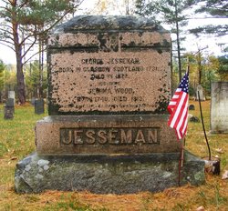
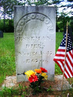
| Burial | : | Mad River Cemetery, Thornton, Grafton County, USA |
| Coordinate | : | 43.8833670, -71.6077500 |
| Description | : | Age: 78 |
frequently asked questions (FAQ):
-
Where is Faithful Jesseman Russell's memorial?
Faithful Jesseman Russell's memorial is located at: Mad River Cemetery, Thornton, Grafton County, USA.
-
When did Faithful Jesseman Russell death?
Faithful Jesseman Russell death on 24 Apr 1860 in Grafton County, New Hampshire, USA
-
Where are the coordinates of the Faithful Jesseman Russell's memorial?
Latitude: 43.8833670
Longitude: -71.6077500
Family Members:
Parent
Siblings

Flowers:


Nearby Cemetories:
1. Mad River Cemetery
Thornton, Grafton County, USA
Coordinate: 43.8833670, -71.6077500
2. Packard Graveyard
Thornton, Grafton County, USA
Coordinate: 43.8971540, -71.5845930
3. Campton Village Cemetery
Campton, Grafton County, USA
Coordinate: 43.8654440, -71.6364380
4. Burbank Foss Cemetery
Campton Lower Village, Grafton County, USA
Coordinate: 43.8955730, -71.5667000
5. Town Line Cemetery
Campton, Grafton County, USA
Coordinate: 43.8614570, -71.6678870
6. Pine Grove Cemetery
Thornton, Grafton County, USA
Coordinate: 43.9060100, -71.6689000
7. Blake Mountain Cemetery
Thornton, Grafton County, USA
Coordinate: 43.8963600, -71.6794200
8. Yeaton Cemetery
Thornton, Grafton County, USA
Coordinate: 43.8963800, -71.6794500
9. West Thornton Cemetery
Thornton, Grafton County, USA
Coordinate: 43.8997200, -71.6805600
10. Campton Hollow Cemetery
Campton Hollow, Grafton County, USA
Coordinate: 43.8238150, -71.6409440
11. Eastern Corner Road Cemetery
Campton, Grafton County, USA
Coordinate: 43.8177540, -71.6045920
12. West Campton Cemetery
Grafton County, USA
Coordinate: 43.8622220, -71.7052780
13. Blaisdell Cemetery
Campton, Grafton County, USA
Coordinate: 43.8169440, -71.6555560
14. Mount Delight Burying Ground
North Sandwich, Carroll County, USA
Coordinate: 43.8385671, -71.5158940
15. Bog Road Cemetery
Campton, Grafton County, USA
Coordinate: 43.8152149, -71.6666793
16. Partridge Hill Cemetery
West Campton, Grafton County, USA
Coordinate: 43.8428700, -71.7046900
17. Blair Cemetery
Campton, Grafton County, USA
Coordinate: 43.8111000, -71.6603012
18. Pease Cemetery
Ellsworth, Grafton County, USA
Coordinate: 43.8741100, -71.7382000
19. Old Baptist Church Cemetery
Ellsworth, Grafton County, USA
Coordinate: 43.8738890, -71.7430560
20. Avery Cemetery
Ellsworth, Grafton County, USA
Coordinate: 43.8805600, -71.7511200
21. Ladd Cemetery
Holderness, Grafton County, USA
Coordinate: 43.7873700, -71.5506400
22. Waterville Valley Cemetery
Waterville Valley, Grafton County, USA
Coordinate: 43.9634670, -71.5087000
23. Eastman Cemetery
Sandwich, Carroll County, USA
Coordinate: 43.7930300, -71.5263500
24. True Cemetery
Holderness, Grafton County, USA
Coordinate: 43.7819440, -71.5538890