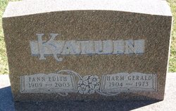
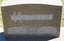
Fann E Baker Katuin
| Birth | : | 10 Oct 1909 Wright County, Iowa, USA |
| Death | : | 5 Dec 2003 Belmond, Wright County, Iowa, USA |
| Burial | : | St. Mary's Churchyard, Stalisfield, Swale Borough, England |
| Coordinate | : | 51.2371410, 0.8169790 |
| Description | : | BELMOND - Fann E. Katuin, 94, of Belmond, passed away Friday (Dec. 5, 2003) at the Belmond Health Care Center. Burial will follow at 3 p.m in Amsterdam Township Cemetery in Kanawha. Fann, the daughter of John and Jennie Abbas Baker was born Oct. 10, 1909, in Wright County south of Kanawha. She grew up in the Twin Lakes area near Kanawha, where she attended country schoolOn February 15, 1928, Fann was united in marriage with Harm Katuin. The couple made their home and farmed in various locations in the North Central Iowa area. In 1955, the family moved to... Read More |
frequently asked questions (FAQ):
-
Where is Fann E Baker Katuin's memorial?
Fann E Baker Katuin's memorial is located at: St. Mary's Churchyard, Stalisfield, Swale Borough, England.
-
When did Fann E Baker Katuin death?
Fann E Baker Katuin death on 5 Dec 2003 in Belmond, Wright County, Iowa, USA
-
Where are the coordinates of the Fann E Baker Katuin's memorial?
Latitude: 51.2371410
Longitude: 0.8169790
Family Members:
Spouse
Flowers:
Nearby Cemetories:
1. St. Mary's Churchyard
Stalisfield, Swale Borough, England
Coordinate: 51.2371410, 0.8169790
2. Charing Cemetery
Charing, Ashford Borough, England
Coordinate: 51.2120247, 0.7922290
3. St. Peter and St. Paul Churchyard
Charing, Ashford Borough, England
Coordinate: 51.2102230, 0.7966500
4. Kent County Crematorium
Charing, Ashford Borough, England
Coordinate: 51.2026560, 0.8006770
5. St. Michael and All Angels Churchyard
Throwley, Swale Borough, England
Coordinate: 51.2651000, 0.8540800
6. St. Mary Churchyard
Eastling, Swale Borough, England
Coordinate: 51.2740700, 0.8155000
7. St. Laurence Churchyard
Leaveland, Swale Borough, England
Coordinate: 51.2501510, 0.8773610
8. Sts Peter & Paul Churchyard Extension
Newnham, Swale Borough, England
Coordinate: 51.2840000, 0.8026500
9. St. Leonard Churchyard
Badlesmere, Swale Borough, England
Coordinate: 51.2590000, 0.8850000
10. St Peter and St Paul Churchyard
Newnham, Swale Borough, England
Coordinate: 51.2842590, 0.8006070
11. Holy Trinity Churchyard
Charing Heath, Ashford Borough, England
Coordinate: 51.2117420, 0.7510860
12. St Cosmas and St Damian Churchyard
Challock, Ashford Borough, England
Coordinate: 51.2065340, 0.8781660
13. St Mary Churchyard
Westwell, Ashford Borough, England
Coordinate: 51.1919020, 0.8473350
14. Westwell Burial Ground
Westwell, Ashford Borough, England
Coordinate: 51.1900100, 0.8434000
15. St Peter Churchyard
Molash, Ashford Borough, England
Coordinate: 51.2328420, 0.8974670
16. The Beheading of St. John the Baptist Churchyard
Doddington, Swale Borough, England
Coordinate: 51.2843350, 0.7805830
17. St. Margaret's Churchyard
Wichling, Maidstone Borough, England
Coordinate: 51.2682226, 0.7455862
18. St James Churchyard
Sheldwich, Swale Borough, England
Coordinate: 51.2753830, 0.8821940
19. Lenham Cemetery
Lenham, Maidstone Borough, England
Coordinate: 51.2389480, 0.7223940
20. St Mary Churchyard
Lenham, Maidstone Borough, England
Coordinate: 51.2366860, 0.7191470
21. St. James Churchyard
Egerton, Ashford Borough, England
Coordinate: 51.1953860, 0.7295170
22. All Saints Churchyard
Boughton Aluph, Ashford Borough, England
Coordinate: 51.1963280, 0.9086490
23. Church of St. Margaret
Hothfield, Ashford Borough, England
Coordinate: 51.1661000, 0.8158000
24. St. Nicholas' Churchyard
Pluckley, Ashford Borough, England
Coordinate: 51.1749440, 0.7548470


