
| Birth | : | 18 Apr 1907 Dallas Center, Dallas County, Iowa, USA |
| Death | : | 15 Aug 1979 Nevada, Story County, Iowa, USA |
| Burial | : | Spalding Cemetery, Spalding, South Holland District, England |
| Coordinate | : | 52.7954960, -0.1519390 |
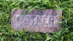
| Plot | : | Same marker as |
| Description | : | Flora Mae Wise Post Flora Mae Wise Post, 72, of 1222 L Ave., Nevada, died Wednesday, Aug. 15 at Story County Hospital in Nevada. Born April 18, 1907 in Dallas Center, Ia., to parents Daniel Wise and Flora Steck, she was educated at Beaver and Fernald schools and graduated from the University of Northern Iowa. She married William Post Dec. 25, 1932 in Omaha, Neb. Mrs. Post taught at Milford schools, and was a member of the United Methodist Church and the Order of Eastern Star. Survivors include one son, Claude W. Post of Belmond, Ia.; one daughter, Floramae Gaard... Read More |
frequently asked questions (FAQ):
-
Where is Flora Mae Wise Post's memorial?
Flora Mae Wise Post's memorial is located at: Spalding Cemetery, Spalding, South Holland District, England.
-
When did Flora Mae Wise Post death?
Flora Mae Wise Post death on 15 Aug 1979 in Nevada, Story County, Iowa, USA
-
Where are the coordinates of the Flora Mae Wise Post's memorial?
Latitude: 52.7954960
Longitude: -0.1519390
Family Members:
Parent

Spouse
Siblings
Children
Flowers:


Nearby Cemetories:
1. Spalding Cemetery
Spalding, South Holland District, England
Coordinate: 52.7954960, -0.1519390
2. St Paul's Churchyard
Spalding, South Holland District, England
Coordinate: 52.7969559, -0.1305557
3. St. Mary's Churchyard
Pinchbeck, South Holland District, England
Coordinate: 52.8135340, -0.1589220
4. St. Laurence Churchyard
Surfleet, South Holland District, England
Coordinate: 52.8369500, -0.1436110
5. St Bartholomew's Church West Pinchbeck
Pinchbeck, South Holland District, England
Coordinate: 52.8080873, -0.2216285
6. Surfleet Cemetery
Surfleet, South Holland District, England
Coordinate: 52.8391670, -0.1383330
7. St. Mary's Cemetery
Weston, South Holland District, England
Coordinate: 52.8078662, -0.0809039
8. South Lincolnshire Crematorium
Surfleet, South Holland District, England
Coordinate: 52.8451100, -0.1475110
9. All Saints Churchyard
Moulton, South Holland District, England
Coordinate: 52.7990056, -0.0629691
10. Moulton Cemetery
Moulton, South Holland District, England
Coordinate: 52.8017000, -0.0632400
11. St Gilbert and St Hugh Churchyard
Gosberton Clough, South Holland District, England
Coordinate: 52.8518081, -0.2166268
12. St. Mary's Churchyard
Whaplode, South Holland District, England
Coordinate: 52.7974840, -0.0385520
13. Gosberton Baptist Church
Gosberton, South Holland District, England
Coordinate: 52.8651820, -0.1533940
14. Gosberton Cemetery
Gosberton, South Holland District, England
Coordinate: 52.8659400, -0.1623000
15. St. Peter and St. Paul Churchyard
Gosberton, South Holland District, England
Coordinate: 52.8690870, -0.1629740
16. Whaplode Cemetery
Whaplode, South Holland District, England
Coordinate: 52.8016190, -0.0281347
17. St. Margaret's Churchyard
Quadring, South Holland District, England
Coordinate: 52.8903400, -0.1819700
18. All Saints Churchyard
Holbeach, South Holland District, England
Coordinate: 52.8036140, 0.0142530
19. Holbeach Cemetery
Holbeach, South Holland District, England
Coordinate: 52.8062100, 0.0171500
20. St. John's Churchyard
Holbeach, South Holland District, England
Coordinate: 52.7457510, -0.0024000
21. All Saints Churchyard
Fosdyke, Boston Borough, England
Coordinate: 52.8811100, -0.0469440
22. Fosdyke Village Cemetery
Fosdyke, Boston Borough, England
Coordinate: 52.8808330, -0.0447220
23. Sutterton Village Cemetery
Sutterton, Boston Borough, England
Coordinate: 52.8994440, -0.0900000
24. St. John the Baptist Churchyard
Whaplode Drove, South Holland District, England
Coordinate: 52.7034435, -0.0476688