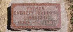
Floyd Lindberg
| Birth | : | 4 Jan 1901 Crawford County, Iowa, USA |
| Death | : | 24 Jul 1976 Arthur, Ida County, Iowa, USA |
| Burial | : | St. Stephen's Churchyard, Clanfield, West Oxfordshire District, England |
| Coordinate | : | 51.7174060, -1.5911740 |
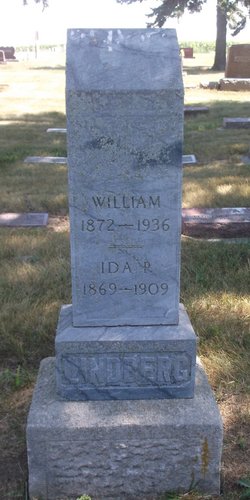
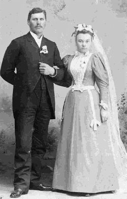
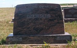
| Description | : | KIRON...Floyd N. Lindberg, the fifth child and the second son of William and Ida (Winquist) Lindberg, was born January 4, 1901 on his parents farm near Kiron, Iowa. Floyd had four brothers, Charles, Silas, Everett, and Harold and four sisters, Elsie (Mrs. Elmer Carlberg), Irene (Mrs. Elwood Larson), Florence (Mrs. Elmer Mauritz), and Evelyn, (Mrs. Niles Johnston). Florence of Kiron and Harold of Sun Prarie, Wisconsin are the only remaining members of Floyd's immediate family. Floyd grew to manhood in the Kiron area where his father was active in the affairs of the community and in the Baptist church in Kiron.... Read More |
frequently asked questions (FAQ):
-
Where is Floyd Lindberg's memorial?
Floyd Lindberg's memorial is located at: St. Stephen's Churchyard, Clanfield, West Oxfordshire District, England.
-
When did Floyd Lindberg death?
Floyd Lindberg death on 24 Jul 1976 in Arthur, Ida County, Iowa, USA
-
Where are the coordinates of the Floyd Lindberg's memorial?
Latitude: 51.7174060
Longitude: -1.5911740
Family Members:
Parent
Spouse
Siblings
Children
Flowers:
Nearby Cemetories:
1. St. Stephen's Churchyard
Clanfield, West Oxfordshire District, England
Coordinate: 51.7174060, -1.5911740
2. Saint Mary's Churchyard
Black Bourton, West Oxfordshire District, England
Coordinate: 51.7360520, -1.5864600
3. St. Peter's Churchyard
Alvescot, West Oxfordshire District, England
Coordinate: 51.7392910, -1.6046704
4. St. Mary the Virgin Churchyard
Bampton, West Oxfordshire District, England
Coordinate: 51.7278250, -1.5487270
5. Bampton Cemetery
Bampton, West Oxfordshire District, England
Coordinate: 51.7296400, -1.5490200
6. Saint Matthew's Churchyard
Langford, West Oxfordshire District, England
Coordinate: 51.7209390, -1.6405280
7. St Georges Churchyard
Kencot, West Oxfordshire District, England
Coordinate: 51.7407160, -1.6330900
8. Church of Saint Michael and All Angels
Eaton Hastings, Vale of White Horse District, England
Coordinate: 51.6852000, -1.6212000
9. St. George's Churchyard
Kelmscott, West Oxfordshire District, England
Coordinate: 51.6925550, -1.6408780
10. St Peter's Churchyard
Filkins, West Oxfordshire District, England
Coordinate: 51.7358700, -1.6578250
11. St. Britius Churchyard Extension
Brize Norton, West Oxfordshire District, England
Coordinate: 51.7660800, -1.5662600
12. St. Britius Churchyard
Brize Norton, West Oxfordshire District, England
Coordinate: 51.7662000, -1.5667000
13. St. Margaret's Churchyard
Little Faringdon, West Oxfordshire District, England
Coordinate: 51.7109400, -1.6739760
14. Littleworth Cemetery
Littleworth, Vale of White Horse District, England
Coordinate: 51.6722500, -1.5492500
15. St. James the Great Churchyard
Aston, West Oxfordshire District, England
Coordinate: 51.7252620, -1.5059510
16. Holy Trinity Church
Witney, West Oxfordshire District, England
Coordinate: 51.7726500, -1.6142050
17. Holy Rood Churchyard
Shilton, West Oxfordshire District, England
Coordinate: 51.7726519, -1.6142058
18. All Saints Churchyard
Faringdon, Vale of White Horse District, England
Coordinate: 51.6595730, -1.5839770
19. Faringdon Nonconformist Cemetery
Faringdon, Vale of White Horse District, England
Coordinate: 51.6576700, -1.5907200
20. Cote Baptist Chapel
Cote, West Oxfordshire District, England
Coordinate: 51.7254430, -1.4929510
21. Buscot Park
Faringdon, Vale of White Horse District, England
Coordinate: 51.6684973, -1.6518000
22. St. Mary's Churchyard
Buscot, Vale of White Horse District, England
Coordinate: 51.6815710, -1.6736770
23. St Mary Churchyard
Buckland, Vale of White Horse District, England
Coordinate: 51.6819730, -1.5060150
24. St George Roman Catholic Churchyard
Buckland, Vale of White Horse District, England
Coordinate: 51.6804300, -1.5068720


