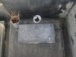
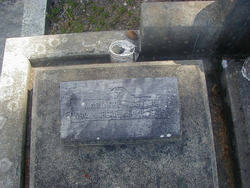
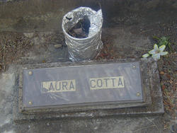
Frank Cotta
| Birth | : | 6 Jan 1891 Azores Region, Portugal |
| Death | : | 21 Aug 1952 Ferndale, Humboldt County, California, USA |
| Burial | : | St. Mary's Churchyard, Portchester, Fareham Borough, England |
| Coordinate | : | 50.8366280, -1.1134270 |
| Description | : | Frank Cotta, 62, died at his Ferndale home Thursday evening. A native of the Azores Islands, he had lived in Ferndale for 42 years. He had been a dairyman for many years, but lately had been working in lumber mills. He is survived by his wife, Maria Cotta , of Ferndale, two daughters, Mrs. Antone Luis, Ferndale, and Mrs. Lillian Giacomini of Rohnerville; one son, Frank Cotta, Jr. of Sacramento; four sisters, Mrs. Frank Luis, Mrs. Joe S. Sousa, Mrs. John Martin, all of Ferndale, and Mrs. Mike Santos of Fortuna; three brothers, Joseph and... Read More |
frequently asked questions (FAQ):
-
Where is Frank Cotta's memorial?
Frank Cotta's memorial is located at: St. Mary's Churchyard, Portchester, Fareham Borough, England.
-
When did Frank Cotta death?
Frank Cotta death on 21 Aug 1952 in Ferndale, Humboldt County, California, USA
-
Where are the coordinates of the Frank Cotta's memorial?
Latitude: 50.8366280
Longitude: -1.1134270
Family Members:
Spouse
Children
Flowers:
Nearby Cemetories:
1. St. Mary's Churchyard
Portchester, Fareham Borough, England
Coordinate: 50.8366280, -1.1134270
2. Roman Grove Cemetery
Portchester, Fareham Borough, England
Coordinate: 50.8384600, -1.1206200
3. Portchester Crematorium Gardens
Portchester, Fareham Borough, England
Coordinate: 50.8499680, -1.1382190
4. St Peter and St Paul Churchyard
Wymering, Portsmouth Unitary Authority, England
Coordinate: 50.8457490, -1.0777170
5. Mile End Cemetery
Portsea, Portsmouth Unitary Authority, England
Coordinate: 50.8108900, -1.0876400
6. St Thomas the Apostle Churchyard
Gosport, Gosport Borough, England
Coordinate: 50.8137570, -1.1484570
7. HMS Victory Ship
Portsmouth, Portsmouth Unitary Authority, England
Coordinate: 50.8017290, -1.1095590
8. St. James' Churchyard
Southwick, City of Winchester, England
Coordinate: 50.8739800, -1.1113800
9. HMS Victoria Monument
Portsmouth, Portsmouth Unitary Authority, England
Coordinate: 50.7997200, -1.0950800
10. St. Nicholas' Churchyard
Boarhunt, City of Winchester, England
Coordinate: 50.8709800, -1.1442000
11. St Mary Magdalene Churchyard
Widley, City of Winchester, England
Coordinate: 50.8623650, -1.0642640
12. St. Mary's Churchyard
Portsea, Portsmouth Unitary Authority, England
Coordinate: 50.8035350, -1.0763490
13. St John the Evangelist Churchyard
Gosport, Gosport Borough, England
Coordinate: 50.7995600, -1.1397800
14. St. Peter and St. Paul Churchyard
Fareham, Fareham Borough, England
Coordinate: 50.8556300, -1.1753200
15. Christ Church Portsdown Churchyard
Widley, City of Winchester, England
Coordinate: 50.8547300, -1.0507540
16. Holy Trinity Churchyard
Gosport, Gosport Borough, England
Coordinate: 50.7930600, -1.1207620
17. Kingston Cemetery
Portsmouth, Portsmouth Unitary Authority, England
Coordinate: 50.8031440, -1.0683260
18. St Mary the Virgin Churchyard
Gosport, Gosport Borough, England
Coordinate: 50.8112690, -1.1724800
19. Portsmouth Unitarian Church
Portsmouth, Portsmouth Unitary Authority, England
Coordinate: 50.7915640, -1.1011840
20. Ann's Hill Cemetery
Gosport, Gosport Borough, England
Coordinate: 50.7982670, -1.1549450
21. Portsmouth Cathedral Churchyard
Portsmouth, Portsmouth Unitary Authority, England
Coordinate: 50.7904650, -1.1043720
22. Holy Trinity Churchyard
Fareham, Fareham Borough, England
Coordinate: 50.8522480, -1.1834370
23. Royal Garrison Churchyard
Portsmouth, Portsmouth Unitary Authority, England
Coordinate: 50.7890180, -1.1040520
24. Royal Garrison Church Churchyard
Plymouth, Plymouth Unitary Authority, England
Coordinate: 50.7889690, -1.1039650


