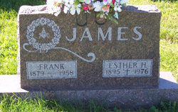
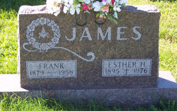
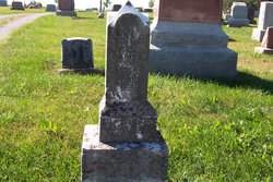
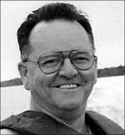
Franklin “Frank” James
| Birth | : | 16 Mar 1879 Franklin County, Indiana, USA |
| Death | : | 25 Jun 1958 Rushville, Rush County, Indiana, USA |
| Burial | : | Spring Grove Cemetery, Cincinnati, Hamilton County, USA |
| Coordinate | : | 39.1647900, -84.5231500 |
| Description | : | The following obituary was published in an Indiana newspaper on June 25, 1958: "Frank James, 79, Succumbs Today" Frank James, 79, of Andersonville, died at 12:30 this morning at the Rush Memorial Hospital. The husband of the former Esther Hannefey, to whom he was married October 17, 1931, Mr. James was a member of the Andersonville Christian Church, the Andersonville Masonic Lodge for 53 years and the Eagles Lodge at Connersville. A Franklin County resident most of his life and a retired carpenter, Mr. James had been in failing health for 15 years and had been serious for six weeks. He... Read More |
frequently asked questions (FAQ):
-
Where is Franklin “Frank” James's memorial?
Franklin “Frank” James's memorial is located at: Spring Grove Cemetery, Cincinnati, Hamilton County, USA.
-
When did Franklin “Frank” James death?
Franklin “Frank” James death on 25 Jun 1958 in Rushville, Rush County, Indiana, USA
-
Where are the coordinates of the Franklin “Frank” James's memorial?
Latitude: 39.1647900
Longitude: -84.5231500
Family Members:
Parent
Spouse
Siblings
Children
Flowers:
Nearby Cemetories:
1. Spring Grove Cemetery
Cincinnati, Hamilton County, USA
Coordinate: 39.1647900, -84.5231500
2. Saint John Cemetery
Saint Bernard, Hamilton County, USA
Coordinate: 39.1643982, -84.5053024
3. Vine Street Hill Cemetery
Cincinnati, Hamilton County, USA
Coordinate: 39.1516991, -84.5091019
4. Clifton United Jewish Cemetery
Cincinnati, Hamilton County, USA
Coordinate: 39.1470871, -84.5292816
5. Wesleyan Cemetery
Cincinnati, Hamilton County, USA
Coordinate: 39.1599998, -84.5468979
6. Third Quaker Cemetery (Defunct)
Cincinnati, Hamilton County, USA
Coordinate: 39.1542400, -84.5523720
7. Hillside Chapel Crematory and Columbarium
Cincinnati, Hamilton County, USA
Coordinate: 39.1393509, -84.5247192
8. Saint Mary Cemetery
Saint Bernard, Hamilton County, USA
Coordinate: 39.1664009, -84.4880981
9. Old Finneytown Cemetery
Finneytown, Hamilton County, USA
Coordinate: 39.1962220, -84.5206120
10. First German Protestant Cemetery
Avondale, Hamilton County, USA
Coordinate: 39.1492004, -84.4863968
11. Bishop Cemetery (Defunct)
College Hill, Hamilton County, USA
Coordinate: 39.1910210, -84.5489570
12. Methodist Protestant Cemetery (Defunct)
Cincinnati, Hamilton County, USA
Coordinate: 39.1324770, -84.4983160
13. Baltimore Pike Cemetery
Cincinnati, Hamilton County, USA
Coordinate: 39.1397018, -84.5681000
14. Convent of the Good Shepherd Cemetery (Defunct)
Carthage, Hamilton County, USA
Coordinate: 39.2055250, -84.5042780
15. Walnut Hills Cemetery
Cincinnati, Hamilton County, USA
Coordinate: 39.1355950, -84.4809040
16. Walnut Hills Jewish Cemetery
Evanston, Hamilton County, USA
Coordinate: 39.1403700, -84.4731300
17. Gard-Brown Cemetery
North Bend, Hamilton County, USA
Coordinate: 39.2035200, -84.5553300
18. Calvary Cemetery
Cincinnati, Hamilton County, USA
Coordinate: 39.1403008, -84.4697037
19. Longview Hospital Cemetery
Roselawn, Hamilton County, USA
Coordinate: 39.1887730, -84.4691660
20. Martini United Church of Christ Cemetery
Fairmount, Hamilton County, USA
Coordinate: 39.1296272, -84.5664902
21. Second Quaker Cemetery (Defunct)
Cincinnati, Hamilton County, USA
Coordinate: 39.1153090, -84.5305240
22. Christ Church Cemetery
Over-The-Rhine, Hamilton County, USA
Coordinate: 39.1126480, -84.5157623
23. Griffins Station Cemetery
Carthage, Hamilton County, USA
Coordinate: 39.2047000, -84.4770730
24. Jessup Cemetery
Mount Airy, Hamilton County, USA
Coordinate: 39.1970870, -84.5794270

