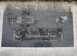
Gary Marshall Bolyard
| Birth | : | 29 Dec 1935 Wenatchee, Chelan County, Washington, USA |
| Death | : | 12 Jan 2006 Wenatchee, Chelan County, Washington, USA |
| Burial | : | Church of St Mary and All Saints, Willoughby-on-the-Wolds, Rushcliffe Borough, England |
| Coordinate | : | 52.8227780, -1.0608330 |
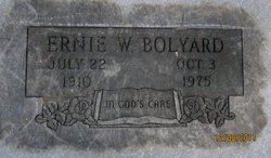
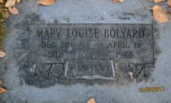
| Description | : | Wenatchee World - Jan 17, 2006 Gary M. Bolyard, 70, a lifetime Washington State resident, longtime Wenatchee resident and Banker, passed away at his home on Jan. 12, 2006, after four years of a courageous battle with pancreatic cancer. He was born on December 29, 1935, in Wenatchee to Ernie and Louise (Huddleston) Bolyard. He graduated from Upper Columbia Academy at Spangle, WA in 1954, and the following year entered the U.S. Army Medical Corps. Following his tour of duty with the 57th Field Hospital in France he was honorably discharged and returned to Wenatchee. He continued his education at Wenatchee... Read More |
frequently asked questions (FAQ):
-
Where is Gary Marshall Bolyard's memorial?
Gary Marshall Bolyard's memorial is located at: Church of St Mary and All Saints, Willoughby-on-the-Wolds, Rushcliffe Borough, England.
-
When did Gary Marshall Bolyard death?
Gary Marshall Bolyard death on 12 Jan 2006 in Wenatchee, Chelan County, Washington, USA
-
Where are the coordinates of the Gary Marshall Bolyard's memorial?
Latitude: 52.8227780
Longitude: -1.0608330
Family Members:
Parent
Flowers:
Nearby Cemetories:
1. Church of St Mary and All Saints
Willoughby-on-the-Wolds, Rushcliffe Borough, England
Coordinate: 52.8227780, -1.0608330
2. St Peter Churchyard
Widmerpool, Rushcliffe Borough, England
Coordinate: 52.8476890, -1.0679480
3. Holy Trinity Churchyard
Wysall, Rushcliffe Borough, England
Coordinate: 52.8383300, -1.1044200
4. St. Marys Churchyard
Wymeswold, Charnwood Borough, England
Coordinate: 52.8055010, -1.1067320
5. Wymeswold Rempstone Road Cemetery
Wymeswold, Charnwood Borough, England
Coordinate: 52.8084600, -1.1180480
6. Old Dalby Main Road Cemetery
Old Dalby, Melton Borough, England
Coordinate: 52.8084650, -1.0007670
7. St John the Baptist Churchyard
Old Dalby, Melton Borough, England
Coordinate: 52.8053510, -1.0017970
8. St Luke's Churchyard
Upper Broughton, Rushcliffe Borough, England
Coordinate: 52.8293700, -0.9870900
9. All Saints Churchyard
Stanton-on-the-Wolds, Rushcliffe Borough, England
Coordinate: 52.8693400, -1.0624900
10. Rempstone Anabaptist Burial Ground
Rempstone, Rushcliffe Borough, England
Coordinate: 52.8179800, -1.1426400
11. Burton-on-the-Wolds Burial Ground
Burton-on-the-Wolds, Charnwood Borough, England
Coordinate: 52.7864470, -1.1207120
12. All Saints Churchyard
Rempstone, Rushcliffe Borough, England
Coordinate: 52.8149800, -1.1477700
13. St Giles Churchyard
Costock, Rushcliffe Borough, England
Coordinate: 52.8326300, -1.1489100
14. All Saints Churchyard
Melton Mowbray, Melton Borough, England
Coordinate: 52.7728700, -1.0209400
15. All Saints Church
Melton Borough, England
Coordinate: 52.7728570, -1.0209240
16. St Mary the Virgin Churchyard
Nether Broughton, Melton Borough, England
Coordinate: 52.8289780, -0.9687040
17. St John the Baptist Churchyard
Grimston, Melton Borough, England
Coordinate: 52.7902720, -0.9850350
18. St Mary the Virgin Churchyard
Bunny, Rushcliffe Borough, England
Coordinate: 52.8606758, -1.1354220
19. Hoton Burial Ground
Hoton, Charnwood Borough, England
Coordinate: 52.7983472, -1.1500767
20. Rempstone, St Peter in the Rushes
Rempstone, Rushcliffe Borough, England
Coordinate: 52.8191600, -1.1614400
21. St Luke's Churchyard
Kinoulton, Rushcliffe Borough, England
Coordinate: 52.8697400, -0.9964300
22. St. Andrew's Churchyard
Prestwold, Charnwood Borough, England
Coordinate: 52.7875000, -1.1446400
23. St. Luke's Churchyard
Hickling, Rushcliffe Borough, England
Coordinate: 52.8564100, -0.9742800
24. St. Luke's Churchyard, Hickling
Melton Mowbray, Melton Borough, England
Coordinate: 52.8563758, -0.9738774


