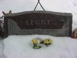
| Birth | : | 1879 |
| Death | : | 26 Dec 1954 Clearfield, Tripp County, South Dakota, USA |
| Burial | : | Pontarfynach Trisant Chapelyard, Wales |
| Coordinate | : | 52.3992800, -4.0038300 |
frequently asked questions (FAQ):
-
Where is George C Legge's memorial?
George C Legge's memorial is located at: Pontarfynach Trisant Chapelyard, Wales.
-
When did George C Legge death?
George C Legge death on 26 Dec 1954 in Clearfield, Tripp County, South Dakota, USA
-
Where are the coordinates of the George C Legge's memorial?
Latitude: 52.3992800
Longitude: -4.0038300
Family Members:
Parent
Spouse
Siblings
Children
Flowers:
Nearby Cemetories:
1. Pontarfynach Trisant Chapelyard
Wales
Coordinate: 52.3992800, -4.0038300
2. Aberffrwd Cemetery
Wales
Coordinate: 52.3916150, -3.9321050
3. Abertrinant
Wales
Coordinate: 52.6290830, -4.0111140
4. Wern Chapel
Wales
Coordinate: 52.2065510, -4.3272120
5. Eglwys Oen Duw Cemetery
Wales
Coordinate: 52.1566000, -3.5898000
6. Carmel Congregational Chapelyard
Wales
Coordinate: 52.2891200, -3.3881600
7. Llandingat Parish Church
Wales
Coordinate: 51.9914392, -3.8022458
8. St. Cynllo Cemetery
Wales
Coordinate: 52.0813422, -4.6277205
9. St Mary Churchyard
Bettws-y-Crwyn, Shropshire Unitary Authority, England
Coordinate: 52.4244990, -3.1692770
10. Maes y Bont
Wales
Coordinate: 51.8324324, -4.0821915
11. St. Michael the Archangel Churchyard
Chirbury with Brompton, Shropshire Unitary Authority, England
Coordinate: 52.5792757, -3.0914289
12. St George Churchyard
Clun, Shropshire Unitary Authority, England
Coordinate: 52.4184914, -3.0303540
13. Clun Cemetery
Clun, Shropshire Unitary Authority, England
Coordinate: 52.4215490, -3.0224990
14. St Michael and All Angels Churchyard
Knill, Herefordshire Unitary Authority, England
Coordinate: 52.2377070, -3.0396000
15. Holy Trinity Churchyard
Chirbury with Brompton, Shropshire Unitary Authority, England
Coordinate: 52.5873000, -3.0387300
16. St. John the Baptist Churchyard
Bishop's Castle, Shropshire Unitary Authority, England
Coordinate: 52.4898300, -2.9984000
17. St Mary Churchyard
Kington, Herefordshire Unitary Authority, England
Coordinate: 52.2044990, -3.0384990
18. Saint David's Churchyard
Wales
Coordinate: 51.8017440, -3.6967650
19. Kington Cemetery
Kington, Herefordshire Unitary Authority, England
Coordinate: 52.1936780, -3.0209970
20. Church of St. Mary
Cusop, Herefordshire Unitary Authority, England
Coordinate: 52.0670000, -3.1100000
21. St David Church Burial Ground
Wales
Coordinate: 51.7703100, -3.7884600
22. St Mary Churchyard
Bucknell, Shropshire Unitary Authority, England
Coordinate: 52.3592220, -2.9490030
23. St Mary's Churchyard
Hopton Castle, Shropshire Unitary Authority, England
Coordinate: 52.3985640, -2.9369870
24. St. Edward Churchyard
Hopton Castle, Shropshire Unitary Authority, England
Coordinate: 52.3985700, -2.9369700


