
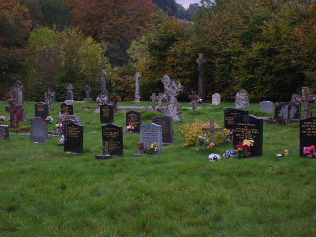
| Memorials | : | 2 |
| Location | : | Wales |
| Coordinate | : | 52.1566000, -3.5898000 |
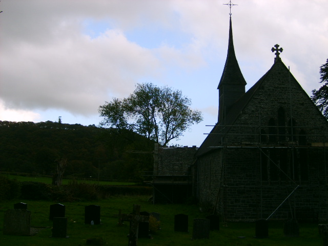
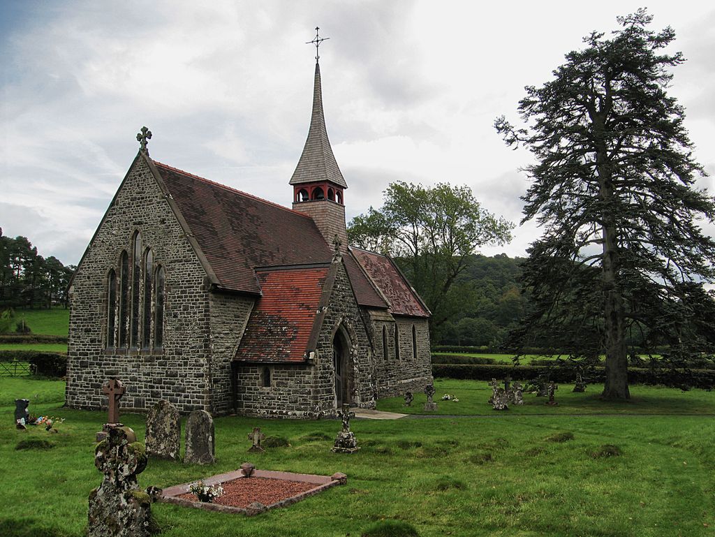
| Description | : | On the E side of a minor road between Beulah and Abergwesyn, approximately 1.2km NW of Beulah village Eglywys Oen Duw means ‘Church of the Lamb of God’ built in 1866 by John Norton. The churchyard surrounding the church is enclosed by hedgerows. Still in use. |
frequently asked questions (FAQ):
-
Where is Eglwys Oen Duw Cemetery?
Eglwys Oen Duw Cemetery is located at Beaulah Powys , LD5 4TYWales.
-
Eglwys Oen Duw Cemetery cemetery's updated grave count on graveviews.com?
2 memorials
-
Where are the coordinates of the Eglwys Oen Duw Cemetery?
Latitude: 52.1566000
Longitude: -3.5898000
Nearby Cemetories:
1. Carmel Congregational Chapelyard
Wales
Coordinate: 52.2891200, -3.3881600
2. Llandingat Parish Church
Wales
Coordinate: 51.9914392, -3.8022458
3. Church of St. Mary
Cusop, Herefordshire Unitary Authority, England
Coordinate: 52.0670000, -3.1100000
4. Aberffrwd Cemetery
Wales
Coordinate: 52.3916150, -3.9321050
5. St Mary Churchyard
Kington, Herefordshire Unitary Authority, England
Coordinate: 52.2044990, -3.0384990
6. St Michael and All Angels Churchyard
Knill, Herefordshire Unitary Authority, England
Coordinate: 52.2377070, -3.0396000
7. Kington Cemetery
Kington, Herefordshire Unitary Authority, England
Coordinate: 52.1936780, -3.0209970
8. Pontarfynach Trisant Chapelyard
Wales
Coordinate: 52.3992800, -4.0038300
9. St. Mary Magdalene Churchyard
Eardisley, Herefordshire Unitary Authority, England
Coordinate: 52.1366310, -3.0055730
10. Saint David's Churchyard
Wales
Coordinate: 51.8017440, -3.6967650
11. St Mary Churchyard
Bettws-y-Crwyn, Shropshire Unitary Authority, England
Coordinate: 52.4244990, -3.1692770
12. St. Mary's Churchyard
Almeley, Herefordshire Unitary Authority, England
Coordinate: 52.1576900, -2.9767400
13. St Andrew Churchyard
Bredwardine, Herefordshire Unitary Authority, England
Coordinate: 52.0948000, -2.9725000
14. St David Church Burial Ground
Wales
Coordinate: 51.7703100, -3.7884600
15. St. Leonard's Churchyard
Blakemere, Herefordshire Unitary Authority, England
Coordinate: 52.0646460, -2.9322980
16. St. Michael and All Angels Churchyard
Lingen, Herefordshire Unitary Authority, England
Coordinate: 52.2992480, -2.9317460
17. Godre'r Graig Independent Chapel Cemetery
Wales
Coordinate: 51.7474400, -3.8089300
18. St George Churchyard
Clun, Shropshire Unitary Authority, England
Coordinate: 52.4184914, -3.0303540
19. Clun Cemetery
Clun, Shropshire Unitary Authority, England
Coordinate: 52.4215490, -3.0224990
20. St Elli’s Churchyard
Wales
Coordinate: 51.8264420, -3.1154820
21. St Mary Churchyard
Bucknell, Shropshire Unitary Authority, England
Coordinate: 52.3592220, -2.9490030
22. Maes y Bont
Wales
Coordinate: 51.8324324, -4.0821915
23. St. Barnabas Churchyard
Brampton Bryan, Herefordshire Unitary Authority, England
Coordinate: 52.3470760, -2.9255360
24. Rhyd-Y-Fro Saron Congregational Old Chapelyard
Wales
Coordinate: 51.7379400, -3.8662700