
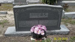
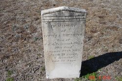
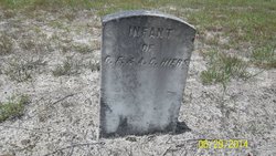
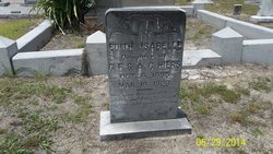
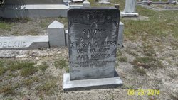
George Franklin “Frank” Hiers
| Birth | : | 11 Dec 1856 Barnwell County, South Carolina, USA |
| Death | : | 15 Mar 1933 Ehrhardt, Bamberg County, South Carolina, USA |
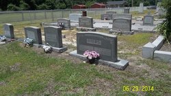
| Burial | : | St Mary the Virgin Churchyard, Hemingbrough, Selby District, England |
| Coordinate | : | 53.7672100, -0.9796300 |
frequently asked questions (FAQ):
-
Where is George Franklin “Frank” Hiers's memorial?
George Franklin “Frank” Hiers's memorial is located at: St Mary the Virgin Churchyard, Hemingbrough, Selby District, England.
-
When did George Franklin “Frank” Hiers death?
George Franklin “Frank” Hiers death on 15 Mar 1933 in Ehrhardt, Bamberg County, South Carolina, USA
-
Where are the coordinates of the George Franklin “Frank” Hiers's memorial?
Latitude: 53.7672100
Longitude: -0.9796300
Family Members:
Parent
Spouse

Siblings
Children
Flowers:


Nearby Cemetories:
1. St Mary the Virgin Churchyard
Hemingbrough, Selby District, England
Coordinate: 53.7672100, -0.9796300
2. St. Helen's Churchyard
Barmby on the Marsh, East Riding of Yorkshire Unitary Authority, England
Coordinate: 53.7476490, -0.9549090
3. Barmby on the Marsh Parish Burial Ground
Barmby on the Marsh, East Riding of Yorkshire Unitary Authority, England
Coordinate: 53.7472990, -0.9401910
4. St Peter and St Paul Churchyard
Drax, Selby District, England
Coordinate: 53.7293790, -0.9771560
5. Friends Burial Ground
Drax, Selby District, England
Coordinate: 53.7291640, -0.9771490
6. Drax Cemetery
Drax, Selby District, England
Coordinate: 53.7272540, -0.9875330
7. All Saints Churchyard
Barlby, Selby District, England
Coordinate: 53.7987840, -1.0415840
8. Selby Abbey
Selby, Selby District, England
Coordinate: 53.7840990, -1.0670270
9. Selby Cemetery
Selby, Selby District, England
Coordinate: 53.7766610, -1.0775960
10. Carlton Cemetery
Carlton, Selby District, England
Coordinate: 53.7129500, -1.0199200
11. St Mary Roman Catholic Church
Carlton, Selby District, England
Coordinate: 53.7111900, -1.0199300
12. All Saints Churchyard
Bubwith, East Riding of Yorkshire Unitary Authority, England
Coordinate: 53.8170680, -0.9200130
13. St. Wilfrid's Parish Churchyard
Brayton, Selby District, England
Coordinate: 53.7718060, -1.0849010
14. St Mary Churchyard
Carlton, Selby District, England
Coordinate: 53.7088060, -1.0209800
15. Howden Cemetery
Howden, East Riding of Yorkshire Unitary Authority, England
Coordinate: 53.7438890, -0.8770090
16. St David Churchyard
Airmyn, East Riding of Yorkshire Unitary Authority, England
Coordinate: 53.7178030, -0.9016700
17. Catholic Church of The Sacred Heart
Howden, East Riding of Yorkshire Unitary Authority, England
Coordinate: 53.7428360, -0.8709800
18. Howden Minster Churchyard
Howden, East Riding of Yorkshire Unitary Authority, England
Coordinate: 53.7449550, -0.8670300
19. St. Helen's Churchyard
Skipwith, Selby District, England
Coordinate: 53.8386300, -1.0022900
20. All Saints Churchyard
Aughton, East Riding of Yorkshire Unitary Authority, England
Coordinate: 53.8393490, -0.9352200
21. St. Mary's Churchyard
Riccall, Selby District, England
Coordinate: 53.8330620, -1.0601630
22. Holy Trinity Churchyard
East Cowick, East Riding of Yorkshire Unitary Authority, England
Coordinate: 53.6866220, -1.0000200
23. All Saints Churchyard
Wistow, Selby District, England
Coordinate: 53.8134750, -1.1014755
24. St Mary and St Lawrence Churchyard
Ellerton, East Riding of Yorkshire Unitary Authority, England
Coordinate: 53.8499000, -0.9347520