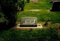
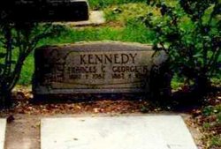
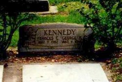
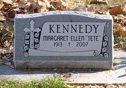
George Joseph “Bud” Kennedy
| Birth | : | 9 Sep 1915 Soldier, Jackson County, Kansas, USA |
| Death | : | 12 Oct 1993 De Beque, Mesa County, Colorado, USA |
| Burial | : | Olive Branch Cemetery, White Cloud, Doniphan County, USA |
| Coordinate | : | 39.9729400, -95.3129400 |
| Plot | : | Section 2, Row 10 |
| Description | : | A funeral mass for George "Bud" Kennedy will be celebrated at 10 a.m. Tuesday in St. Ann?s Catholic Church in Palisade with the Rev. James Plough officiating. Burial will be in Calvary Cemetery in Grand Junction. Visitation will be from noon to 7 p.m. Monday at Callahan-Edfast Mortuary. A rosary will be recited at 7 p.m. Monday at Callahan-Edfast Mortuary Chapel. Mr. Kennedy, 2148 Road 45-1/2, DeBeque, died of natural causes Tuesday at his home. He was 78. Mr. Kennedy was a rancher. He was a resident of DeBeque since 1937. He was born Sept. 9, 1915, to George A. and Frances C. Hurla... Read More |
frequently asked questions (FAQ):
-
Where is George Joseph “Bud” Kennedy's memorial?
George Joseph “Bud” Kennedy's memorial is located at: Olive Branch Cemetery, White Cloud, Doniphan County, USA.
-
When did George Joseph “Bud” Kennedy death?
George Joseph “Bud” Kennedy death on 12 Oct 1993 in De Beque, Mesa County, Colorado, USA
-
Where are the coordinates of the George Joseph “Bud” Kennedy's memorial?
Latitude: 39.9729400
Longitude: -95.3129400
Family Members:
Parent
Siblings
Flowers:
Nearby Cemetories:
1. Olive Branch Cemetery
White Cloud, Doniphan County, USA
Coordinate: 39.9729400, -95.3129400
2. Kelley Cemetery
White Cloud, Doniphan County, USA
Coordinate: 39.9797100, -95.3042800
3. Tesson Cemetery
Brown County, USA
Coordinate: 39.9763985, -95.3407974
4. Partlow Cemetery
Hiawatha, Brown County, USA
Coordinate: 39.9994011, -95.3602982
5. Collins Family Cemetery
White Cloud, Doniphan County, USA
Coordinate: 39.9221992, -95.2969284
6. Roy and Franklin Cemetery
Richardson County, USA
Coordinate: 40.0036011, -95.3878021
7. Franklin Cemetery
Rulo, Richardson County, USA
Coordinate: 40.0035000, -95.3884700
8. Campbell Cemetery
Reserve, Brown County, USA
Coordinate: 39.9905980, -95.3961750
9. Iowa Point Cemetery
Iowa Point, Doniphan County, USA
Coordinate: 39.9157982, -95.2275009
10. Kenyon Cemetery
Robinson, Brown County, USA
Coordinate: 39.9122000, -95.3964600
11. Walnut Grove Cemetery
Highland, Doniphan County, USA
Coordinate: 39.9000702, -95.2438736
12. Boyd Cemetery
Holt County, USA
Coordinate: 40.0466995, -95.2453003
13. Wilson Cemetery
Forest City, Holt County, USA
Coordinate: 40.0060997, -95.2027969
14. Tarkio Chapel Cemetery
Fortescue, Holt County, USA
Coordinate: 40.0659400, -95.3152200
15. Pleasant Hill Cemetery
Irving Township, Brown County, USA
Coordinate: 39.9435997, -95.4328232
16. Roderick Cemetery
Forest City, Holt County, USA
Coordinate: 40.0271988, -95.2071991
17. Union Cemetery
Forest City, Holt County, USA
Coordinate: 39.9872017, -95.1761017
18. Catron Cemetery
Fortescue, Holt County, USA
Coordinate: 40.0736300, -95.3629800
19. Laus Creek Cemetery
Reserve, Brown County, USA
Coordinate: 39.9754105, -95.4699936
20. Immaculate Conception Cemetery
Rulo, Richardson County, USA
Coordinate: 40.0480200, -95.4431800
21. Highland Cemetery
Highland, Doniphan County, USA
Coordinate: 39.8555984, -95.2514038
22. Sauer Cemetery
Bigelow, Holt County, USA
Coordinate: 40.1002100, -95.3339900
23. Benton Church Cemetery
Forest City, Holt County, USA
Coordinate: 40.0621430, -95.1918980
24. Rulo City Cemetery
Rulo, Richardson County, USA
Coordinate: 40.0561218, -95.4420471

