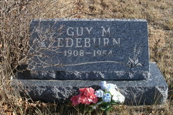
Guy Malin Edeburn
| Birth | : | 19 Jan 1908 Manly, Worth County, Iowa, USA |
| Death | : | 31 Jul 1954 Richland County, Montana, USA |
| Burial | : | Big Run Cemetery, Layland, Coshocton County, USA |
| Coordinate | : | 40.4338989, -82.0081024 |
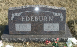
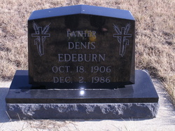
| Description | : | Parents: James William Edeburn and Ellen Rosina Foss Edeburn Siblings: Dale, Arthur, Dennis and Thelma Spouse: Myrtle Hollum married 9 Oct 1937 Sidney MT Children: Donald, Bennie, Monica and Lenora |
frequently asked questions (FAQ):
-
Where is Guy Malin Edeburn's memorial?
Guy Malin Edeburn's memorial is located at: Big Run Cemetery, Layland, Coshocton County, USA.
-
When did Guy Malin Edeburn death?
Guy Malin Edeburn death on 31 Jul 1954 in Richland County, Montana, USA
-
Where are the coordinates of the Guy Malin Edeburn's memorial?
Latitude: 40.4338989
Longitude: -82.0081024
Family Members:
Parent
Spouse
Siblings
Children
Flowers:
Nearby Cemetories:
1. Big Run Cemetery
Layland, Coshocton County, USA
Coordinate: 40.4338989, -82.0081024
2. Pleasant Hill Cemetery
Coshocton County, USA
Coordinate: 40.4225006, -82.0038986
3. Spring Mountain Cemetery
Spring Mountain, Coshocton County, USA
Coordinate: 40.4053800, -82.0439000
4. Monroe Cemetery
Coshocton County, USA
Coordinate: 40.4508018, -82.0580978
5. Salem Cemetery
Holmes County, USA
Coordinate: 40.4500008, -81.9480972
6. Blissfield Cemetery
Blissfield, Coshocton County, USA
Coordinate: 40.3927994, -81.9728012
7. Weatherwax Cemetery
Clark, Coshocton County, USA
Coordinate: 40.3839560, -81.9918080
8. Bucklew Cemetery
Metham, Coshocton County, USA
Coordinate: 40.3849983, -81.9858017
9. Saint Elizabeth Mission Cemetery
Spring Mountain, Coshocton County, USA
Coordinate: 40.3817900, -82.0108300
10. Harmony Cemetery
Coshocton County, USA
Coordinate: 40.4277992, -82.0819016
11. Wolf Creek Cemetery
Holmes County, USA
Coordinate: 40.4795410, -82.0522280
12. Fox Cemetery
Blissfield, Coshocton County, USA
Coordinate: 40.4035988, -81.9424973
13. Killbuck Cemetery
Killbuck, Holmes County, USA
Coordinate: 40.4958520, -81.9808390
14. Clark Township Baptist Church Cemetery
Clark, Coshocton County, USA
Coordinate: 40.4126680, -81.9229260
15. Stillwell Cemetery
Holmes County, USA
Coordinate: 40.4603430, -82.0951510
16. Dutch Meeting House Cemetery
Warsaw, Coshocton County, USA
Coordinate: 40.3796207, -81.9459337
17. Bethel Cemetery
Warsaw, Coshocton County, USA
Coordinate: 40.3615800, -82.0165150
18. Pleasant Grove Cemetery
Killbuck, Holmes County, USA
Coordinate: 40.4933900, -81.9495843
19. Austin Family Cemetery
Clark, Coshocton County, USA
Coordinate: 40.4422900, -81.9105570
20. Gwin Cemetery
Millersburg, Holmes County, USA
Coordinate: 40.4679600, -81.9203500
21. Shrimplin Cemetery
Killbuck, Holmes County, USA
Coordinate: 40.5086520, -81.9953000
22. Dutch Run Cemetery
Tiverton Township, Coshocton County, USA
Coordinate: 40.4021988, -82.1072006
23. Emerick Farm Cemetery
Killbuck, Holmes County, USA
Coordinate: 40.5157060, -81.9998380
24. Clark Cemetery
Clark, Coshocton County, USA
Coordinate: 40.4444008, -81.8968964

