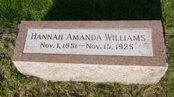
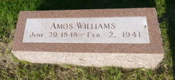
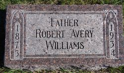
Hannah Amanda Buker Williams
| Birth | : | 1 Nov 1851 Iowa, USA |
| Death | : | 15 Nov 1925 Dunlap, Harrison County, Iowa, USA |
| Burial | : | Saint John the Baptist Churchyard, North Cheriton, South Somerset District, England |
| Coordinate | : | 51.0309000, -2.4474000 |
frequently asked questions (FAQ):
-
Where is Hannah Amanda Buker Williams's memorial?
Hannah Amanda Buker Williams's memorial is located at: Saint John the Baptist Churchyard, North Cheriton, South Somerset District, England.
-
When did Hannah Amanda Buker Williams death?
Hannah Amanda Buker Williams death on 15 Nov 1925 in Dunlap, Harrison County, Iowa, USA
-
Where are the coordinates of the Hannah Amanda Buker Williams's memorial?
Latitude: 51.0309000
Longitude: -2.4474000
Family Members:
Parent
Spouse
Siblings
Children
Flowers:
Nearby Cemetories:
1. Saint John the Baptist Churchyard
North Cheriton, South Somerset District, England
Coordinate: 51.0309000, -2.4474000
2. North Cheriton Cemetery
North Cheriton, South Somerset District, England
Coordinate: 51.0284840, -2.4389150
3. Saint Nicholas Churchyard
Holton, South Somerset District, England
Coordinate: 51.0401280, -2.4502641
4. St. Peter & St. Paul Churchyard
Maperton, South Somerset District, England
Coordinate: 51.0335993, -2.4686628
5. Saint John's Churchyard
Horsington, South Somerset District, England
Coordinate: 51.0126300, -2.4238400
6. St. Michael's Churchyard
Blackford, South Somerset District, England
Coordinate: 51.0336960, -2.4892290
7. Saint Peter & Saint Paul Churchyard
Charlton Horethorne, South Somerset District, England
Coordinate: 51.0060200, -2.4790100
8. St. Nicholas' Churchyard
Bratton Seymour, South Somerset District, England
Coordinate: 51.0679406, -2.4625400
9. Blessed Virgin Mary Churchyard
Compton Pauncefoot, South Somerset District, England
Coordinate: 51.0336770, -2.5089430
10. Saint Stephen Churchyard
Charlton Musgrove, South Somerset District, England
Coordinate: 51.0678630, -2.4008550
11. St Michael Churchyard
North Cadbury, South Somerset District, England
Coordinate: 51.0416670, -2.5213610
12. Corton Denham Cemetery
Corton Denham, South Somerset District, England
Coordinate: 51.0015810, -2.5202380
13. Saint Andrew Churchyard
Corton Denham, South Somerset District, England
Coordinate: 51.0015790, -2.5203100
14. All Saints Churchyard
Poyntington, West Dorset District, England
Coordinate: 50.9782070, -2.4997530
15. Civic Cemetery
Buckhorn Weston, North Dorset District, England
Coordinate: 51.0212440, -2.3484600
16. St Leonard Churchyard and Extension
Pitcombe, South Somerset District, England
Coordinate: 51.0925600, -2.4684600
17. St John The Baptist Churchyard
Buckhorn Weston, North Dorset District, England
Coordinate: 51.0212870, -2.3481780
18. St Lawrence Churchyard
Cucklington, South Somerset District, England
Coordinate: 51.0487190, -2.3507950
19. St Nicholas Churchyard
Henstridge, South Somerset District, England
Coordinate: 50.9762610, -2.3957980
20. Milborne Port Cemetery
Milborne Port, South Somerset District, England
Coordinate: 50.9662940, -2.4605880
21. Saint John's Churchyard
Charlton Musgrove, South Somerset District, England
Coordinate: 51.0840723, -2.3869787
22. Milborne Port Churchyard
Milborne Port, South Somerset District, England
Coordinate: 50.9653900, -2.4621550
23. St Peter Churchyard
Redlynch, South Somerset District, England
Coordinate: 51.0983279, -2.4299457
24. Castle Cary Cemetery
Castle Cary, South Somerset District, England
Coordinate: 51.0803800, -2.5223600


