
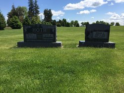
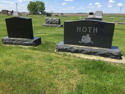
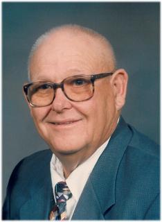
Harold John Hoth
| Birth | : | 20 Apr 1925 Clayton County, Iowa, USA |
| Death | : | 4 Aug 2012 Guttenberg, Clayton County, Iowa, USA |
| Burial | : | National Cemetery, National, Clayton County, USA |
| Coordinate | : | 42.9536018, -91.2902985 |
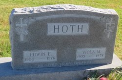
| Description | : | Parents: Edwin and Viola (Schloetzer) Hoth Spouse: Rachel M. Brownson Obituary: Dubuque Telegraph Herald August 7, 2012, p.C5 |
frequently asked questions (FAQ):
-
Where is Harold John Hoth's memorial?
Harold John Hoth's memorial is located at: National Cemetery, National, Clayton County, USA.
-
When did Harold John Hoth death?
Harold John Hoth death on 4 Aug 2012 in Guttenberg, Clayton County, Iowa, USA
-
Where are the coordinates of the Harold John Hoth's memorial?
Latitude: 42.9536018
Longitude: -91.2902985
Family Members:
Parent

Spouse

Siblings
Children
Flowers:


Nearby Cemetories:
1. National Cemetery
National, Clayton County, USA
Coordinate: 42.9536018, -91.2902985
2. Giard Cemetery
Farmersburg, Clayton County, USA
Coordinate: 42.9933014, -91.3080978
3. Bismark Cemetery
Farmersburg, Clayton County, USA
Coordinate: 42.9790000, -91.3500000
4. Farmersburg-Wagner Cemetery
Farmersburg, Clayton County, USA
Coordinate: 42.9481010, -91.3700027
5. Eastman Cemetery
McGregor, Clayton County, USA
Coordinate: 43.0010000, -91.2190000
6. Clayton Center Cemetery
Clayton Center, Clayton County, USA
Coordinate: 42.8841705, -91.3225021
7. Zion Lutheran Cemetery
Clayton Center, Clayton County, USA
Coordinate: 42.8841705, -91.3249969
8. County Home Cemetery
Clayton Center, Clayton County, USA
Coordinate: 42.8916702, -91.3499985
9. Railroad Employee Cemetery
Giard, Clayton County, USA
Coordinate: 43.0305395, -91.3140229
10. Norwegian Church Cemetery
McGregor, Clayton County, USA
Coordinate: 42.9644400, -91.1764100
11. First Evangelical Lutheran Church Cemetery
McGregor, Clayton County, USA
Coordinate: 42.9718000, -91.1760000
12. Colony Catholic Cemetery (Defunct)
Read Township, Clayton County, USA
Coordinate: 42.8830000, -91.3580000
13. Moody Cemetery
McGregor, Clayton County, USA
Coordinate: 43.0030594, -91.1886063
14. Buell Park Cemetery
Mendon Township, Clayton County, USA
Coordinate: 43.0168226, -91.1999590
15. Garnavillo Community Cemetery
Garnavillo, Clayton County, USA
Coordinate: 42.8656000, -91.2422100
16. Garnavillo Cemetery
Garnavillo, Clayton County, USA
Coordinate: 42.8660300, -91.2390100
17. Saint Joseph Cemetery
Garnavillo, Clayton County, USA
Coordinate: 42.8628006, -91.2502975
18. Walton Cemetery
McGregor, Clayton County, USA
Coordinate: 43.0216270, -91.1909350
19. Gooding Cemetery
Wagner Township, Clayton County, USA
Coordinate: 42.9869490, -91.4191570
20. Pleasant Grove Cemetery
McGregor, Clayton County, USA
Coordinate: 43.0266991, -91.1949997
21. Saint Marys Catholic Church Cemetery
McGregor, Clayton County, USA
Coordinate: 43.0213735, -91.1834632
22. Norway Lutheran Church Cemetery
Saint Olaf, Clayton County, USA
Coordinate: 42.9352798, -91.4302826
23. Clayton Cemetery
Clayton, Clayton County, USA
Coordinate: 42.9043999, -91.1641998
24. Saint Wenceslaus Cemetery
McGregor, Clayton County, USA
Coordinate: 43.0593987, -91.3142014