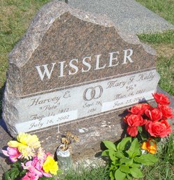
Harvey Edward “Pete” Wissler
| Birth | : | 11 Aug 1912 Du Bois, Pawnee County, Nebraska, USA |
| Death | : | 16 Jul 2002 Baldwin City, Douglas County, Kansas, USA |
| Burial | : | St. Mary's Churchyard, South Cowton, Hambleton District, England |
| Coordinate | : | 54.4187600, -1.5501800 |
| Description | : | Harvey "Pete" Edward Wissler, 89, Baldwin City, died Tuesday, July 16, 2002, at a Baldwin City care center. Mr. Wissler worked in Texas and Louisiana on the pipeline during World War II. He sold paint at various locations in Lawrence before he retired. He was born Aug. 11, 1912, in DuBois, Neb., the son of John H. and Alma Mae Caswell Wissler. He attended school in Whiting. He moved to Sabetha after World War II and then moved to Lawrence in 1956. He moved to Baldwin City in 1997. Mr. Wissler was a member of Annunciation Catholic Church in Baldwin City. He married Mary... Read More |
frequently asked questions (FAQ):
-
Where is Harvey Edward “Pete” Wissler's memorial?
Harvey Edward “Pete” Wissler's memorial is located at: St. Mary's Churchyard, South Cowton, Hambleton District, England.
-
When did Harvey Edward “Pete” Wissler death?
Harvey Edward “Pete” Wissler death on 16 Jul 2002 in Baldwin City, Douglas County, Kansas, USA
-
Where are the coordinates of the Harvey Edward “Pete” Wissler's memorial?
Latitude: 54.4187600
Longitude: -1.5501800
Family Members:
Parent
Spouse
Siblings
Children
Flowers:
Nearby Cemetories:
1. St. Mary's Churchyard
South Cowton, Hambleton District, England
Coordinate: 54.4187600, -1.5501800
2. St Mary Churchyard
East Cowton, Hambleton District, England
Coordinate: 54.4291100, -1.5370200
3. St. Peter's Churchyard
Birkby, Hambleton District, England
Coordinate: 54.4157560, -1.4901840
4. St. Lawrence Churchyard
Hutton Bonville, Hambleton District, England
Coordinate: 54.3958000, -1.4830000
5. Scorton & District Joint Cemetery
Scorton, Richmondshire District, England
Coordinate: 54.3914400, -1.6156200
6. St Mary Churchyard
Bolton-on-Swale, Richmondshire District, England
Coordinate: 54.3875300, -1.6127600
7. St Eloy Churchyard
Great Smeaton, Hambleton District, England
Coordinate: 54.4343000, -1.4647000
8. Danby Wiske Parish Churchyard
Danby Wiske, Hambleton District, England
Coordinate: 54.3793800, -1.4813060
9. St Michael and All Angels Churchyard
Middleton Tyas, Richmondshire District, England
Coordinate: 54.4451400, -1.6390500
10. St. Wilfrid Churchyard
Great Langton, Hambleton District, England
Coordinate: 54.3598870, -1.5367380
11. St Mary the Virgin Churchyard
Eryholme, Richmondshire District, England
Coordinate: 54.4754000, -1.5067000
12. St Anne Churchyard
Catterick, Richmondshire District, England
Coordinate: 54.3768500, -1.6319800
13. St Mary Churchyard
Kirkby Fleetham, Hambleton District, England
Coordinate: 54.3561750, -1.5691590
14. St Peter Churchyard
Croft-on-Tees, Richmondshire District, England
Coordinate: 54.4830000, -1.5556200
15. Catterick Cemetery
Catterick, Richmondshire District, England
Coordinate: 54.3774700, -1.6349100
16. All Saints Churchyard
Sockburn, Darlington Unitary Authority, England
Coordinate: 54.4582000, -1.4619000
17. All Saints Churchyard
Hurworth, Darlington Unitary Authority, England
Coordinate: 54.4869900, -1.5285200
18. Brompton-On-Swale Cemetery
Brompton on Swale, Richmondshire District, England
Coordinate: 54.3917400, -1.6608900
19. Neasham Priory
Sockburn, Darlington Unitary Authority, England
Coordinate: 54.4851000, -1.5035000
20. Middleton Lodge Chapel
Middleton Tyas, Richmondshire District, England
Coordinate: 54.4562000, -1.6567000
21. All Saints Churchyard
Girsby, Hambleton District, England
Coordinate: 54.4691000, -1.4554000
22. St Cuthbert and St Mary Churchyard
Barton, Richmondshire District, England
Coordinate: 54.4754490, -1.6458250
23. All Saints Churchyard
Deighton, Hambleton District, England
Coordinate: 54.4099130, -1.4141500
24. St Paulinus Roman Catholic Churchyard
Brough with St Giles, Richmondshire District, England
Coordinate: 54.3779100, -1.6698900


